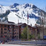
When looking at a mountain landscape, it’s easy to notice the long, elevated lines stretching between peaks. Some form narrow, rocky crests above deep valleys, while others appear as broad, forested highlands extending toward the horizon. Beyond them, still more mountains may rise in successive layers, forming an enormous region of elevated terrain.
These features are often described as mountain ridges and mountain ranges.
Although the terms are closely related and sometimes used interchangeably, they describe different aspects of mountain geography.
A mountain ridge is an elongated area of high ground, often forming a crest between slopes that descend in different directions. A mountain range is a larger geographical grouping of mountains, typically connected by their location, geological history, and surrounding landscape.
A ridge may connect several summits, extend along the side of a mountain, or form one of many elevated features within a mountain range. A range, meanwhile, can contain numerous ridges, peaks, valleys, passes, and smaller mountain groups.
The Appalachian Mountains provide an excellent example of this relationship. They form an enormous mountain system extending across eastern North America, while individual features such as Pennsylvania’s Kittatinny Ridge represent much smaller, more specific parts of the landscape.
The distinction is important for understanding topographic maps, geological formations, watersheds, hiking routes, and the organization of major mountain systems.
Here’s how mountain ridges and mountain ranges differ, how they form, and where to find examples of each around the world.
🏔️ What Is a Mountain Ridge?
A mountain ridge is a long, elevated landform with a crest that extends between or above surrounding slopes and valleys.
A ridge typically has higher ground along its central axis, with the terrain descending on either side. The crest may be narrow and sharply defined, or relatively broad and rounded.
According to the U.S. Geological Survey’s Geographic Names Information System, a ridge is an elevation with a narrow, elongated crest that can form part of a hill or mountain.
This definition emphasizes the ridge’s shape rather than its overall elevation.
A ridge does not have to reach a particular height above sea level. It may occur within a relatively low mountain system or extend across exceptionally high alpine terrain.
Some ridges connect several mountain summits, while others descend from a larger mountain toward a valley. A single mountain may have several ridges radiating outward from its summit.
The most recognizable ridges are long, continuous high points separating neighboring slopes. However, ridges can also be interrupted by saddles, passes, and other lower sections.
What Does a Mountain Ridge Look Like?
Imagine standing on a narrow trail with steep slopes descending on both sides.
The trail follows the highest part of an elongated mountain feature. Ahead, the crest rises toward a rocky summit before descending into a lower saddle and continuing toward another peak.
This is a classic mountain ridge.
In some regions, the crest may be extremely narrow, with exposed rock and dramatic drop-offs. In others, it may be broad enough to support forests, meadows, roads, or extensive hiking trails.
The Blue Ridge Mountains of the eastern United States contain many broad, forested ridges, while the high mountains of the Alps and Himalayas include sharp, rocky ridgelines shaped by glaciers.
Although these landscapes look different, their elongated elevated forms share the defining characteristics of ridges.
Can a Ridge Have Several Peaks?
Yes. A single ridge can contain multiple summits.
As the crest rises and falls, it may form a series of high points separated by lower saddles.
The summits may be individually named mountains, subsidiary peaks, or smaller topographic features.
A ridge therefore does not have to be perfectly level or uninterrupted.
Some ridgelines extend across several miles of rugged terrain, connecting prominent mountains through a sequence of rocky crests and high saddles.
In mountaineering, following these interconnected high points is commonly called a ridge traverse.
🌄 What Is a Mountain Range?
A mountain range is a geographical grouping of mountains that form a connected or associated system of elevated terrain.
Mountain ranges often extend across considerable distances and contain numerous summits, ridges, valleys, and passes.
The U.S. Geological Survey defines a range broadly as a single mass of hills or mountains or a complex, interconnected series of mountain ranges with a recognizable longitudinal trend.
Unlike a ridge, which emphasizes the shape of an individual elongated landform, a mountain range describes a larger mountainous region.
The Sierra Nevada in California, the Alps in Europe, the Karakoram in Asia, and the Great Smoky Mountains of the eastern United States are examples of named mountain ranges.
Each contains many individual landforms.
A range may include sharp mountain ridges, isolated-looking summits, deeply carved valleys, glaciers, plateaus, waterfalls, and extensive areas of lower terrain between its highest mountains.
Its boundaries are not always sharply defined.
Geographers may use geological structures, drainage basins, valleys, regional relief, and long-established place names to distinguish one mountain range from another.
Are Mountain Ranges Always Long Chains of Peaks?
Not necessarily.
Mountain ranges are often portrayed as continuous chains of mountains extending in one direction, but their actual geography can be considerably more complicated.
Some ranges are relatively narrow and linear, while others form broad regions containing several parallel ridges and smaller mountain groups.
The Sierra Nevada, for example, forms a prominent north-south mountain range along eastern California. Its landscape includes high crests, subsidiary ridges, deep river canyons, glacial valleys, and extensive forested slopes.
The Karakoram is much more complex, containing enormous peaks, interconnected ridges, glaciers, and deeply incised valleys.
Both are mountain ranges despite their different internal structures.
The important characteristic is that the mountains form a recognizable geographical grouping rather than one individual elongated crest.
📏 Mountain Ridge vs. Mountain Range: The Main Difference
The most important distinction between a mountain ridge and a mountain range is the type and scale of landform being described.
A ridge refers to an elongated elevated feature with a recognizable crest.
A range refers to a larger geographical grouping of mountains.
A ridge may be one component of a mountain range, while a mountain range may contain many ridges.
Imagine looking at a mountain landscape from a distant viewpoint.
You can see a long, rocky crest connecting several nearby peaks. That is a ridge.
Beyond it, numerous mountains, valleys, and parallel ridges extend across a much larger region. Together, they form a mountain range.
In this sense, the ridge is a particular landform within the broader mountainous landscape.
However, the distinction isn’t always a simple matter of size.
A ridge can extend for an enormous distance, while a relatively compact mountain range may contain several distinct peaks and valleys.
The terms describe different geographical concepts rather than fixed categories determined by length or elevation.
Is a Mountain Ridge Smaller Than a Mountain Range?
Usually, a named mountain ridge is more geographically specific than a named mountain range.
However, there is no universal minimum or maximum length that separates the two.
Pennsylvania’s Kittatinny Ridge, for example, extends approximately 185 miles according to the Pennsylvania Department of Conservation and Natural Resources.
Despite its considerable length, it is still described as a ridge because it forms a recognizable elongated feature within the larger Appalachian mountain landscape.
A mountain range may be shorter than this but contain several distinct mountains and interconnecting landforms.
The distinction therefore depends on shape, geographical organization, and naming conventions rather than distance alone.
Can a Mountain Ridge Be Part of More Than One Mountain Region?
Yes. A ridge may belong to a named mountain range, which may itself form part of a much larger mountain system.
For example, an individual ridge in the Great Smoky Mountains belongs to that named range, while the Great Smoky Mountains belong to the broader Appalachian mountain system.
This creates a geographical hierarchy.
A ridge is a particular elongated landform. A mountain range is a larger grouping of mountains. A mountain system may include multiple ranges and related uplands.
However, not every region follows a simple hierarchy.
Mountain names and boundaries have developed through geographical traditions, scientific classification, and local usage.
Some features called ridges are extensive mountain belts, while certain ranges have relatively compact geographical boundaries.
🪨 How Do Mountain Ridges Form?
Mountain ridges develop through several geological processes.
Some form where tectonic forces fold, fault, or uplift the Earth’s crust. Others emerge when erosion removes weaker material and leaves more resistant rock standing.
Glaciers can also sculpt existing mountain terrain into narrow, sharp ridges.
In most mountain regions, the modern landscape reflects a combination of geological structure and erosion operating over long periods.
The original mountain-building processes create elevated terrain, while rivers, glaciers, weathering, and gravity gradually modify its shape.
Ridges Formed by Folding
Folded rock layers can produce long, parallel ridges.
When tectonic forces compress sedimentary rocks, the layers may bend into anticlines and synclines.
These geological structures can later influence the landscape as erosion exposes and removes different formations.
Resistant layers, particularly some sandstones and quartzites, may remain standing as elevated ridges.
Weaker rock formations may erode into lower valleys.
The Appalachian Ridge and Valley province is one of the clearest examples of this process.
Its characteristic pattern of elongated ridges and valleys developed through the interaction of ancient folding, faulting, and differential erosion.
However, the relationship between the shape of a fold and the modern ridge is not always straightforward.
Erosion can remove the crest of an anticline or preserve resistant rocks in other structural positions, producing topographic patterns that differ from the original fold shapes.
Ridges Formed by Differential Erosion
Differential erosion occurs when rocks with different levels of resistance weather and erode at different rates.
A resistant rock formation may remain elevated while surrounding weaker materials are gradually removed.
Over time, this can produce a long ridge.
In sedimentary landscapes, the shape and inclination of rock layers strongly influence the resulting terrain.
A resistant layer tilted steeply upward may form a narrow ridge called a hogback. More gently inclined rock layers may produce an asymmetrical landform known as a cuesta.
These ridges can extend for considerable distances where the underlying formations remain continuous.
The process is especially important in regions with folded or tilted sedimentary rock layers.
Ridges Formed by Glacial Erosion
Glaciers can create some of the sharpest mountain ridges on Earth.
As glaciers move through mountainous terrain, they erode the rock beneath and beside them.
When glaciers occupy adjacent valleys, their erosion may steepen the intervening mountain crest.
Over time, the remaining ridge can become narrow and sharply defined.
This type of ridge is known as an arête.
The National Park Service describes arêtes as thin, jagged crests separating valleys that were occupied by glaciers.
These ridges are especially common in heavily glaciated mountain regions, including the Alps, the Rockies, the Alaska Range, and parts of the Himalayas.
Their sharp profiles create some of the most dramatic alpine scenery.
Ridges Associated with Faulting and Uplift
Tectonic activity can also contribute to ridge formation.
Faulting may uplift or tilt sections of the crust, creating elevated blocks that are subsequently modified by erosion.
In some regions, resistant rocks along the uplifted terrain remain as prominent ridges.
However, a fault scarp and a mountain ridge are not identical features.
A fault scarp is a steep slope produced by displacement along a fault, while a ridge is an elongated elevation with a crest.
The same landscape may contain both features, but they describe different aspects of its topography.
🌋 How Do Mountain Ranges Form?
Mountain ranges commonly develop through large-scale tectonic processes.
The movement of Earth’s lithospheric plates can cause rocks to fold, fracture, thicken, uplift, or undergo volcanic activity.
These processes create extensive belts of elevated terrain.
According to the National Park Service, many mountain ranges are associated with plate boundaries or volcanic hotspots.
The geological mechanisms vary considerably.
Some ranges form where continental plates collide.
Others develop above subduction zones, where one tectonic plate descends beneath another.
Still others form where Earth’s crust stretches and breaks into fault-bounded blocks.
Once mountains develop, erosion begins reshaping their surface.
Mountain Ranges Formed by Continental Collision
The Himalayas are a famous example of mountains formed through continental collision.
They developed as the Indian tectonic plate moved northward and collided with Eurasia.
The collision compressed and thickened enormous sections of Earth’s crust, producing a vast region of elevated mountains and plateaus.
The Himalayas contain numerous peaks and ridges, including Mount Everest and many other exceptionally high mountains.
The range continues evolving as tectonic forces and erosion interact.
The geological process responsible for creating the broader Himalayan mountain system differs from the more localized processes that shape individual ridges within it.
Mountain Ranges Formed by Faulting
Some mountain ranges form through faulting and the uplift or tilting of large crustal blocks.
This process is particularly important in the Basin and Range Province of the western United States.
The region contains numerous elongated mountain ranges separated by broad basins.
According to the National Park Service, the landscape developed largely through crustal extension, faulting, and the displacement of neighboring blocks.
The resulting mountains may form relatively narrow ranges with prominent slopes overlooking the surrounding valleys.
The Sierra Nevada also reflects major fault-related uplift and tilting, although its geological history differs from that of the typical Basin and Range mountain blocks.
Volcanic Mountain Ranges
Volcanic activity can produce extensive mountain ranges as well.
The Cascade Range of the Pacific Northwest contains numerous volcanic mountains associated with the Cascadia Subduction Zone.
Magma generated through processes related to subduction rises toward the surface, creating volcanoes over long periods.
These volcanoes form part of a larger mountain chain.
However, individual volcanic summits may have very different shapes from the narrow ridges produced by glacial erosion or resistant sedimentary rock layers.
This illustrates an important distinction.
A mountain range can contain many different types of mountains and ridges, even when its broader geological history is related to one dominant tectonic process.
🇺🇸 Kittatinny Ridge vs. the Appalachian Mountains
One of the clearest ways to understand the distinction between a mountain ridge and a mountain range is to compare Kittatinny Ridge with the Appalachian Mountains.
Kittatinny Ridge is a prominent elongated landform in Pennsylvania.
The Appalachian Mountains are a much larger system of mountain ranges, ridges, valleys, and highlands extending across eastern North America.
The two are related, but their geographical scale and organization are very different.
Kittatinny Ridge: An Individual Ridge
Kittatinny Ridge extends approximately 185 miles across Pennsylvania, according to the state’s Department of Conservation and Natural Resources.
The ridge is also associated with local names such as Blue Mountain, First Mountain, and North Mountain along different sections.
It forms an important boundary along the eastern side of Pennsylvania’s Appalachian Ridge and Valley region.
The landscape consists of a long, elevated belt of resistant rock overlooking neighboring valleys.
Its elongated shape makes it a recognizable ridge rather than a broad collection of separate mountain ranges.
The ridge is interrupted by water gaps, including places where major rivers cross through the surrounding high terrain.
These openings demonstrate how rivers interact with resistant rock formations.
Kittatinny Ridge is also ecologically important.
Pennsylvania’s Game Commission identifies it as a major migration corridor for hawks, eagles, falcons, and other birds.
Its long, continuous topography helps guide migrating birds across the landscape.
The Appalachian Mountains: A Mountain System
The Appalachian Mountains extend for roughly 2,000 miles across eastern North America, depending on the geographical boundaries used.
They include numerous named ranges, ridges, plateaus, and valleys.
The Blue Ridge Mountains, Great Smoky Mountains, White Mountains, Green Mountains, Allegheny Mountains, and Cumberland Mountains are among the better-known mountain groups associated with the Appalachian system.
Their geology is complicated, reflecting multiple mountain-building events and hundreds of millions of years of erosion.
Unlike Kittatinny Ridge, the Appalachian Mountains do not form one continuous elevated crest.
They occupy a broad region containing many different landforms.
This is the central difference.
Kittatinny Ridge is a particular elongated feature within the Appalachian landscape, while the Appalachian Mountains describe a much larger mountain system.
Our Appalachian Mountains Guide explores the geographical divisions and major ranges within this extensive region.
🧊 The Garden Wall: A Mountain Ridge in Glacier National Park
The Garden Wall in Montana’s Glacier National Park provides another excellent example of a mountain ridge.
Unlike the broad, forested Kittatinny Ridge, the Garden Wall is a dramatic alpine crest shaped by glacial erosion.
It forms part of the rugged mountain landscape of Glacier National Park, where ancient sedimentary rocks have been sculpted into steep peaks, narrow ridges, deep valleys, and glacial basins.
The Garden Wall is particularly recognizable because of its long, serrated rock crest.
The National Park Service identifies it as an outstanding example of an arête.
How Glaciers Created the Garden Wall
During periods of extensive glaciation, large glaciers eroded valleys on opposite sides of the developing ridge.
The moving ice removed rock from the valley walls, steepening the surrounding terrain.
As erosion continued, the crest between the glacial valleys became relatively narrow and sharp.
The resulting landform is the Garden Wall.
Its rugged appearance reflects the interaction of glacial erosion with the underlying geological structure.
The surrounding mountain landscape contains many additional ridges, peaks, and valleys.
The Garden Wall is therefore one distinctive feature within a much larger mountain region.
It illustrates how an individual ridge can have a recognizable geological identity without being considered a mountain range in its own right.
🏔️ Blue Ridge Mountains: Why Names Can Be Confusing
The Blue Ridge Mountains offer an important reminder that geographical names do not always describe landforms in a perfectly literal way.
Despite the word Ridge in the name, the Blue Ridge Mountains are not simply one long ridge.
They form a major mountain belt within the Appalachian system.
The region extends from the northern Appalachian highlands southwestward through Virginia and into the Southern Appalachians.
Its terrain includes extensive forested mountains, rounded summits, steep ridges, river valleys, and several distinct mountain groups.
In Virginia, the Blue Ridge often appears as a prominent, relatively narrow mountain belt.
Farther south, it expands into a much broader and more complicated mountainous region.
Why Are They Called the Blue Ridge?
The name refers partly to the distinctive bluish appearance of the mountains when viewed from a distance.
The haze results from atmospheric processes involving moisture, aerosols, and compounds released by vegetation.
The effect creates the familiar layers of blue mountains visible from scenic overlooks.
Although the name emphasizes the ridge-like appearance of the mountain belt, the geographical region includes far more than a single crest.
This distinction is useful when interpreting mountain names.
Some locations called ridges are relatively small landforms, while others represent extensive mountainous regions.
Local naming traditions, historical usage, and geographical conventions all influence these names.
Our Blue Ridge Mountains Guide explains the geography of this important Appalachian region in greater detail.
🇺🇸 Sierra Nevada: An Example of a Mountain Range
The Sierra Nevada provides a particularly useful example of a major mountain range.
It extends for approximately 400 miles along eastern California and into portions of western Nevada.
The range contains Mount Whitney, the highest summit in the contiguous United States, along with numerous other high mountains.
Its landscape includes rugged granite peaks, alpine ridges, glacial valleys, deep canyons, and extensive forests.
Although the Sierra Nevada has a recognizable high crest, it is not simply one narrow ridge.
It is an enormous mountain block containing many different topographic features.
Ridges Within the Sierra Nevada
The high country of the Sierra Nevada includes numerous ridgelines connecting prominent peaks.
In some areas, glacial erosion has created narrow rocky arêtes and sharply defined summits.
Elsewhere, the terrain consists of broad granite uplands, rounded ridges, and deeply eroded valleys.
A hiker following a high ridge in the Sierra Nevada is traveling along one particular landform within the much larger mountain range.
The Sierra Nevada itself encompasses an extensive region with varied geology, topography, and ecosystems.
The range’s eastern side is especially steep, rising dramatically above the adjacent basins.
Its western side generally descends more gradually toward California’s Central Valley.
These features demonstrate the geographical complexity of a mountain range compared with an individual ridge.
Our Sierra Nevada Guide explores the range’s geology, major summits, glaciers, and regional geography.
🌏 The Karakoram: A Complex Mountain Range of Ridges and Peaks
The Karakoram provides another striking example of the relationship between ridges and mountain ranges.
Located in the high mountains of Central and South Asia, the Karakoram contains K2 and several other peaks exceeding 8,000 meters.
Its landscape is among the most rugged and heavily glaciated on Earth.
Massive granite peaks rise above deep valleys, while long glacial systems separate interconnected ridges and mountain groups.
Unlike a simple chain of peaks along one crest, the Karakoram consists of numerous overlapping mountain structures.
Ridges Within the Karakoram
The Karakoram contains many dramatic high-altitude ridgelines.
Some connect major summits across narrow rock and snow crests.
Others separate enormous glacier valleys or extend outward from large mountain massifs.
These ridges can form major obstacles for mountaineers, with steep slopes, exposed rock, and difficult snow conditions.
Yet even the most impressive ridge represents only one component of the larger Karakoram landscape.
The mountain range includes entire networks of peaks, glaciers, valleys, passes, and subsidiary mountain groups.
This is why describing the Karakoram as a single ridge would fail to capture its geographical complexity.
Our Karakoram Guide explores the range’s major peaks, glaciers, mountain passes, and geological development.
🧭 Ridge, Ridgeline, Crest, and Summit: What’s the Difference?
Several geographical terms describe different parts of a mountain’s elevated terrain.
A ridge is the elongated high ground itself.
The ridgeline generally refers to the line following the uppermost part of that ridge.
The crest is its highest or most elevated portion along a particular section.
A summit is a prominent high point, often the top of an individual mountain.
These terms overlap in ordinary language, but they help describe different features of mountain topography.
A ridge may contain several summits, and its ridgeline may rise and fall between them.
A mountain can also have more than one ridge, particularly where several elevated spurs extend outward from the summit.
What Is a Mountain Spur?
A spur is a ridge or projecting area of elevated land extending outward from a larger mountain ridge or summit.
It often descends toward lower terrain between neighboring valleys.
Spurs are common in mountainous landscapes because rivers and glaciers carve valleys into the slopes, leaving elongated sections of higher ground between them.
A main ridge may therefore have numerous subsidiary spurs extending toward surrounding valleys.
The relationship can resemble branches extending from a central line.
This creates complex ridge networks within larger mountain systems.
What Is a Saddle?
A saddle is a relatively low point along a ridge between higher areas.
Imagine two summits connected by a mountain crest.
The lower section between them is the saddle.
Some saddles provide natural crossings between valleys and are known as mountain passes.
However, not every saddle is a major transportation route, and some occur in remote alpine terrain.
A ridge can therefore contain several summits separated by saddles without losing its identity as one elongated landform.
🗺️ How to Identify a Ridge and Range on a Topographic Map
Topographic maps provide one of the clearest ways to distinguish mountain ridges from mountain ranges.
They use contour lines to show elevation and the shape of the land.
Where the terrain is steep, the contour lines are close together. Where the landscape is gentler, they are more widely spaced.
A mountain ridge generally appears as an elongated area of high ground with contours descending toward valleys on either side.
The crest may connect several summits, producing a long elevated pattern across the map.
A mountain range, by contrast, usually occupies a much larger area.
It may contain numerous ridges, peaks, saddles, valleys, and other landforms extending across several map sheets.
Recognizing a Mountain Ridge
When examining a detailed topographic map, look for elongated high ground separating lower valleys.
The ridge may contain several contour-enclosed summits connected by a higher corridor.
Its crest follows the line of higher terrain between the slopes.
Some ridges are narrow and distinct, while others form broad uplands with several possible routes along their upper surface.
The contour pattern varies accordingly.
Recognizing a Mountain Range
To identify a mountain range, look at the broader geographical pattern.
A range may contain many parallel or intersecting ridges, separated by deep valleys and smaller basins.
Its boundaries may correspond with major lowlands, river systems, geological structures, or adjoining mountain regions.
On a shaded-relief map, a mountain range often appears as a recognizable belt or mass of elevated terrain.
The Appalachian Mountains provide a particularly useful example because the repeating pattern of long ridges and valleys is visible across a large area.
Our Map of the Appalachian Mountain Range shows how numerous ridges and mountain groups fit together within the broader system.
💧 Mountain Ridges, Watersheds, and River Drainage
Mountain ridges frequently influence the direction in which water flows.
Because a ridge consists of elevated terrain with slopes descending on either side, precipitation may drain toward different valleys.
In some cases, the ridgeline coincides with a watershed divide.
A watershed divide separates areas whose streams flow toward different river systems.
Rain falling on one side may enter one drainage basin, while water falling on the opposite side may flow toward another.
This relationship is especially important in mountainous regions.
However, not every ridge forms a major drainage divide.
Some separate tributaries that eventually join the same river.
Likewise, an important continental divide may cross saddles, plateaus, and other terrain rather than following one continuous narrow ridge.
Ridge Systems and River Valleys
Rivers help shape mountain ridges by eroding the surrounding terrain.
As neighboring valleys become deeper, the elevated land between them may become more pronounced.
Over time, the ridge can develop a sharper crest.
Where rivers cross resistant ridges, they may carve water gaps.
These are openings through elevated terrain that continue to carry flowing water.
If a river later abandons such an opening, the former passage may become a wind gap.
These relationships demonstrate how ridges, valleys, water gaps, and drainage systems develop together.
The shape of a ridge often reflects the combined influence of geological structure and long-term erosion.
🌳 Why Mountain Ridges Are Important for Wildlife
Mountain ridges can play an important role in wildlife movement and habitat distribution.
Some ridges form extensive corridors of relatively continuous habitat.
Others contain distinct vegetation communities because their slopes face different directions or occur at different elevations.
In forested mountain regions, ridges may support plant and animal species adapted to drier soils, stronger winds, or greater sunlight exposure.
Nearby valleys may have deeper soils, greater moisture, and different vegetation.
These contrasts contribute to the ecological diversity of mountain landscapes.
Kittatinny Ridge and Migrating Birds
Kittatinny Ridge provides a particularly interesting example.
The Pennsylvania Game Commission recognizes the ridge as an important migration corridor for birds of prey.
Hawks, eagles, falcons, and other raptors use the region during seasonal migration.
The ridge’s topography can contribute to favorable soaring conditions when winds interact with the mountain slopes.
Raptors can use rising air to conserve energy while traveling considerable distances.
The ridge is also associated with extensive forested habitat, including areas important for breeding and migrating birds.
Its ecological significance demonstrates that a ridge can influence environmental processes across a large region, even though it represents only part of a much larger mountain system.
🥾 Why Ridgelines Are Important for Hiking and Mountaineering
Ridgelines often attract hikers and mountaineers because they provide elevated routes with extensive views.
A trail following a broad forested ridge may offer relatively consistent terrain between several summits.
In some mountain ranges, ridgeline routes connect prominent peaks and provide access to high-country landscapes.
However, ridge hiking can also involve significant risks.
The difficulty depends on the ridge’s shape, elevation, exposure, surface conditions, and weather.
A broad Appalachian ridgeline may be accessible through a maintained hiking trail, while a narrow alpine arête can involve steep drops and technical climbing.
Ridge Traverses
A ridge traverse involves traveling along a mountain crest, sometimes crossing several summits in succession.
This type of route is common in mountaineering because it follows the natural connection between peaks.
Some traverses involve relatively straightforward hiking, while others require climbing equipment and advanced technical skills.
The route may pass over sharp rock crests, snow-covered saddles, or exposed sections where steep slopes descend on both sides.
The geological shape of the ridge strongly influences the difficulty.
Glacially sculpted arêtes are often especially narrow and exposed.
Ridge Trails vs. Valley Trails
Ridge trails and valley trails offer different experiences.
A ridge trail generally follows elevated ground and may provide extensive views across the surrounding mountains.
A valley trail follows lower terrain, often beside a stream or river.
Valley routes may be more sheltered, while high ridges can be exposed to wind, lightning, and rapidly changing weather.
However, neither type of trail is automatically safer or easier.
A valley may contain dangerous river crossings, steep terrain, or avalanche paths, while a broad ridge may provide a comfortable hiking route.
Understanding the landforms involved helps hikers interpret maps and choose routes appropriate to the conditions.
❓ Frequently Asked Questions About Mountain Ridges and Ranges
What Is the Difference Between a Mountain Ridge and a Mountain Range?
A mountain ridge is an elongated area of elevated terrain with a recognizable crest and slopes descending on either side. A mountain range is a larger geographical grouping of mountains, often containing many ridges, peaks, and valleys. A ridge may form one part of a range, while the range describes the broader mountainous region.
Is a Mountain Ridge a Mountain Range?
Not usually. A ridge is generally an individual landform, while a mountain range is a larger grouping of mountains. However, geographical naming conventions can be complicated, and some extensive mountain belts are historically called ridges even though they contain varied terrain.
Can a Mountain Range Contain Several Ridges?
Yes. Many mountain ranges contain numerous ridges extending between peaks, separating valleys, or branching from larger mountain masses. The Appalachian Mountains, Sierra Nevada, and Karakoram all contain extensive ridge networks within their broader mountainous landscapes.
What Is a Ridge in Simple Terms?
A ridge is a long area of elevated land with a crest running along its length. The land generally slopes downward from the crest on either side. Ridges occur in mountains, hills, and other landscapes, and their shapes range from broad and rounded to narrow and sharply defined.
How Is a Mountain Ridge Formed?
Mountain ridges develop through geological processes such as folding, faulting, uplift, differential erosion, and glacial erosion. Resistant rock formations may remain standing as weaker surrounding material erodes. Glaciers can also carve narrow ridges between adjacent valleys, forming sharp crests called arêtes.
How Is a Mountain Range Formed?
Mountain ranges commonly form through large-scale tectonic processes, including continental collision, subduction, faulting, and volcanic activity. These forces create extensive elevated regions that are subsequently shaped by rivers, glaciers, weathering, and erosion. Different ranges can have very different geological histories.
What Is the Difference Between a Ridge and a Peak?
A ridge is an elongated elevated feature that may connect several high points. A peak is an individual prominent summit or high point. A ridge can contain multiple peaks, while a mountain may have several ridges extending outward from its summit.
What Is the Difference Between a Ridge and a Ridgeline?
A ridge is the elevated landform itself. A ridgeline is the line following its crest or highest continuous route. The words are sometimes used interchangeably, particularly when describing hiking routes, but the ridge includes the surrounding slopes as well as the crest.
What Is a Mountain Crest?
A mountain crest is the highest part of a mountain or ridge. Along an elongated ridge, the crest may rise and fall between several peaks. A ridgeline generally follows this elevated axis through the landscape.
What Is the Difference Between a Ridge and a Spur?
A ridge is an elongated elevation, while a spur is a ridge-like projection extending from a larger ridge or mountain toward lower terrain. Spurs often occur between neighboring valleys and may form branches within a more extensive ridge network.
What Is an Arête?
An arête is a narrow, sharp mountain ridge shaped by glacial erosion. It commonly develops where glaciers erode adjacent valleys or cirques, leaving a thin rocky crest between them. The Garden Wall in Glacier National Park is a famous example.
What Is a Saddle Between Mountain Ridges?
A saddle is a relatively low point along a ridge between two higher areas. It may connect neighboring peaks and sometimes provides a natural crossing between valleys. When used as a route through higher terrain, such a feature may also be called a mountain pass.
Are the Blue Ridge Mountains One Ridge?
No. Despite their name, the Blue Ridge Mountains form a large mountain belt within the Appalachian system. They contain numerous ridges, peaks, valleys, and named mountain groups. The region is much broader and more geographically complex than one individual ridgeline.
Is the Appalachian Mountain Range One Continuous Ridge?
No. The Appalachian Mountains form an extensive mountain system containing numerous ranges, ridges, plateaus, and valleys. The landscape includes the Blue Ridge Mountains, Great Smoky Mountains, White Mountains, Allegheny Mountains, and many other regions.
Is the Sierra Nevada a Ridge or a Range?
The Sierra Nevada is a mountain range. It extends for approximately 400 miles through eastern California and into parts of western Nevada. The range includes many individual ridges, peaks, valleys, and glacial landscapes.
Do Mountain Ridges Form Watershed Divides?
Many do. Because ridges are elevated above surrounding valleys, they may separate areas draining toward different streams or river basins. However, not every ridge forms a major watershed divide, and drainage divides do not always follow one narrow crest.
How Can You Identify a Ridge on a Topographic Map?
Look for an elongated area of high terrain separating lower valleys. Contour lines generally show the slopes descending away from the crest. A ridge may connect several summits, while a mountain range usually appears as a much broader region containing multiple ridges and valleys.
🌄 Understanding Ridges and Mountain Ranges
Mountain ridges and mountain ranges are closely related, but they describe different parts of Earth’s elevated terrain.
A ridge is an elongated landform with a recognizable crest. It may connect peaks, separate valleys, or extend outward from a larger mountain.
A mountain range is a broader geographical grouping that commonly contains numerous ridges, summits, valleys, passes, and related landforms.
Their relationship is particularly clear in the Appalachian Mountains.
Kittatinny Ridge forms one long, distinctive elevated feature within the much larger Appalachian system. The Blue Ridge Mountains, despite their name, form an extensive mountainous region containing many individual ridges and smaller mountain groups.
The Sierra Nevada provides another excellent example. Its immense mountain landscape includes high crests, rugged granite summits, deep glacial valleys, and countless subsidiary ridges.
In the Karakoram, enormous peaks are connected by narrow rock and snow ridgelines, but together they belong to a mountain range encompassing extensive glacier systems and complex topography.
These examples demonstrate that size alone does not determine whether a landform is a ridge or a range.
The distinction depends on the geographical feature being described.
Understanding the relationship also helps explain how mountains develop.
Tectonic processes create broad regions of elevated terrain, while erosion, glaciers, rivers, and geological structure shape individual ridges and valleys within them.
Over time, these processes produce the complicated patterns visible on topographic maps and satellite images.
Mountain ridges also influence watersheds, ecosystems, wildlife migration, hiking routes, and the development of transportation corridors.
They are therefore important landforms in their own right, not simply smaller versions of mountain ranges.
The next time you look across a mountainous landscape, notice the different scales of the terrain.
A long crest connecting several peaks may be a ridge. The much larger collection of mountains and valleys surrounding it may form a mountain range.
Recognizing that distinction provides a clearer understanding of how Earth’s mountainous landscapes are organized—and how their individual features fit together within the great mountain systems of the world.
🔗 Related Reading
Explore more guides to mountains, ridges, mountain ranges, and related geographical landforms at Mountain Field Guide.
- Appalachian Mountains: Geography, Ranges & Highest Peaks
- Blue Ridge Mountains: Geography, Geology & Highest Peaks
- Map of the Appalachian Mountain Range
- Mountain Ranges in the U.S.
- Sierra Nevada: Geography, Mountains & Geology
- Karakoram: Geography, Highest Peaks & Glaciers
📚 Sources & Further Reading
- U.S. Geological Survey — Geographic Names Information System: Feature Classes
- U.S. Geological Survey — Geographic Names Information System: Frequently Asked Questions
- National Park Service — Geology and Physical Processes in Mountains
- National Park Service — Evidence of Plate Motions
- National Park Service — Tectonic Landforms and Mountain Building
- National Park Service — Nunataks, Arêtes, and Horns
- National Park Service — Glacial Landforms in Glacier National Park
- Pennsylvania Department of Conservation and Natural Resources — Kittatinny Ridge Conservation Landscape
- Pennsylvania Game Commission — Raptor Migration Through Pennsylvania