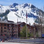
At first glance, the difference between a mountain and a hill may seem obvious. Mountains are taller, steeper, and more rugged, while hills are generally lower, rounder, and easier to climb.
In practice, however, the distinction is surprisingly difficult to define.
There is no universally accepted elevation, slope, or prominence at which a hill officially becomes a mountain. A landform described as a mountain in one region might be called a hill somewhere else. Traditional names, local geography, cultural history, and appearance can matter just as much as measured height.
The simplest explanation is that a mountain usually rises higher and more dramatically above its surroundings than a hill, but there is no single rule that applies everywhere.
🏔️ Mountain vs. Hill at a Glance
| Characteristic | Mountain | Hill |
|---|---|---|
| Typical height | Generally higher | Generally lower |
| Local relief | Usually substantial | Usually more modest |
| Slopes | Often steep or rugged | Commonly gentler or rounder |
| Summit | May be sharp, broad, rocky, or glaciated | Often rounded, although not always |
| Terrain | Frequently includes cliffs, ridges, and deep valleys | Commonly less rugged |
| Climate | May have distinct high-elevation conditions | Usually resembles the surrounding lowland climate |
| Geological origin | Tectonic uplift, volcanism, faulting, erosion, or several processes | The same processes can form hills |
| Official dividing line | None universally accepted | None universally accepted |
| Naming | Strongly influenced by local tradition | Strongly influenced by local tradition |
These are general tendencies rather than strict scientific rules. Some hills are steep and rocky, while some mountains have broad slopes and rounded summits.
⚡ Is There an Official Height for a Mountain?
There is no worldwide height requirement that separates a mountain from a hill.
In the United States, neither the U.S. Geological Survey nor the U.S. Board on Geographic Names maintains an official definition distinguishing a hill from a mountain. Both terms can describe prominent natural elevations, and their use is largely based on established names and local convention.
Historically, a difference of 1,000 feet of local relief was sometimes used in the United States. Under that approach, a landform rising at least 1,000 feet above the surrounding terrain might have been considered a mountain. The distinction was abandoned during the 1970s.
A historical British convention reportedly used an elevation of 1,000 feet, with higher landforms classified as mountains and lower ones as hills. That distinction was also abandoned.
Today, numbers such as 1,000 feet, 2,000 feet, or 600 meters sometimes appear in informal definitions, educational materials, hiking lists, and regional classification systems. None provides a universal boundary.
📏 Elevation Is Only Part of the Difference
Elevation is the height of a location above a reference level, normally mean sea level.
A summit at 10,000 feet has a higher elevation than one at 5,000 feet. That does not necessarily mean the 10,000-foot summit rises more dramatically from its surroundings.
Consider two hypothetical landforms:
- Summit A reaches 10,000 feet but rises only 500 feet above a high plateau.
- Summit B reaches 5,000 feet but rises 4,000 feet above a nearby valley.
Summit A has the greater elevation, but Summit B appears much larger and more imposing from below.
This is why elevation alone cannot reliably determine whether a landform feels like a mountain or a hill.
⛰️ Local Relief Often Matters More
Local relief is the difference between the highest and lowest elevations within a particular area.
It describes how dramatically the land rises above the terrain immediately around it.
A landform with substantial local relief may have:
- A steep and visually impressive profile
- Deep valleys around its base
- Long, sustained approaches
- Distinct climatic or ecological zones
- Extensive views from its summit
- Significant changes in temperature and vegetation
A lower summit rising abruptly from a coastal plain may look and feel more mountainous than a considerably higher summit located on an elevated plateau.
There is no single standard area over which local relief must be calculated. The result can vary depending on whether the surrounding terrain is measured within one mile, five miles, or an entire region.
📐 What About Topographic Prominence?
Topographic prominence measures how independently a summit rises in relation to higher terrain.
In simplified terms, it is the vertical distance between a summit and the lowest point a traveler would have to descend before climbing to a higher summit. That low point is known as the summit’s key col or key saddle.
Prominence helps distinguish an independent mountain from a minor high point on the side of a larger mountain.
For example:
- A high summit connected to a taller mountain by a shallow saddle may have little prominence.
- A lower but isolated summit may have considerable prominence.
- The highest summit on an island or landmass may have prominence nearly equal to its elevation.
Prominence is useful for creating objective mountain lists, but it does not officially determine whether a feature is a hill or mountain. Different climbing organizations and peak lists use different prominence thresholds.
A summit may have modest prominence and still carry “Mountain” in its official name. Another may be highly prominent while retaining a traditional name containing “Hill.”
🗻 Does Steepness Make a Mountain?
Steepness contributes to how people perceive a landform, but it is not a definitive test.
Mountains commonly have steep slopes, rocky faces, sharp ridges, or deeply cut valleys. Hills are more likely to have rounded profiles and gradual slopes.
There are many exceptions:
- Shield volcanoes can be enormous mountains with gentle average slopes.
- Small volcanic cones can be steep but remain relatively low.
- Glacial hills can have abrupt rock faces.
- Ancient mountains may become rounded after millions of years of erosion.
- Elevated plateaus can have steep edges but nearly level interiors.
The shape of a landform reflects its geology, rock type, age, climate, and erosional history—not merely whether it is called a mountain or hill.
🌎 Why the Surrounding Landscape Matters
Mountain and hill are relative terms.
A 2,000-foot summit rising from a coastal plain may dominate the surrounding landscape. The same elevation could be barely noticeable within a high mountain plateau.
This explains why relatively low landforms may be considered mountains in regions near sea level, while much higher features may be described as hills in already elevated terrain.
The distinction can also depend on the scale of the surrounding landscape. A landform may be an important mountain locally but appear as a small foothill when compared with a much larger range nearby.
A Mountain in One Region, a Hill in Another
Local expectations influence terminology.
In a region of generally low terrain, an isolated rocky summit may naturally be regarded as a mountain. In the Himalayas or Andes, a feature of the same elevation might be considered a minor hill, ridge, shoulder, or foothill.
The physical measurements have not changed. Only the geographical context has.
🗺️ Why Maps Do Not Settle the Question
Topographic maps show measurable characteristics such as:
- Elevation
- Contour lines
- Slope
- Ridges
- Valleys
- Saddles
- Cliffs
- Summit locations
They do not normally apply a universal formula to decide whether each landform is a hill or mountain.
The U.S. Geological Survey groups names including hill, mountain, mount, peak, knob, dome, cone, and volcano within a broad summit feature category. The words attached to individual features generally reflect their established geographical names rather than a precise physical classification.
Changing measurements also do not necessarily change a name. A feature that has traditionally been called a hill usually remains a hill even when improved surveying shows that it exceeds an informal mountain threshold.
🧭 Naming and Cultural Tradition
Many geographical names are far older than modern surveying methods.
People named mountains and hills based on:
- Their appearance
- Their importance as landmarks
- Traditional languages
- Local folklore
- Land ownership
- Religious significance
- Historical events
- Settlement patterns
- Established regional vocabulary
As a result, the word contained in a proper name may reveal little about the landform’s measurable dimensions.
A “hill” can be higher than a nearby “mountain.” A “mount” may be a relatively small local landmark. A feature called a “peak” may have a broad summit rather than a pointed one.
These names are not necessarily mistakes. They are part of the cultural geography of the landscape.
🪨 Are Mountains and Hills Formed Differently?
Not necessarily.
Mountains and hills can be created and shaped by many of the same geological processes.
Tectonic Uplift
Movement within Earth’s crust can raise broad regions, fold rock layers, or lift blocks of crust along faults. Large-scale uplift may produce mountain ranges, while smaller structures and eroded remnants may appear as hills.
Volcanism
Volcanic activity can create everything from enormous shield volcanoes to small cinder cones. Size varies according to the type of magma, eruption history, age, and rate of erosion.
Erosion
Rivers, glaciers, wind, weathering, and gravity gradually remove rock. Erosion can carve mountains into sharp peaks or reduce ancient ranges to rounded hills.
Glacial Deposition
Glaciers can leave behind hills made from deposited sediment. Drumlins, moraines, and other glacial landforms may have distinctive rounded or elongated shapes.
Resistant Rock
Hard rock may remain standing after softer surrounding material has eroded. This can produce an isolated hill, ridge, butte, or mountain.
The terms mountain and hill describe the resulting landform more than the exact process that created it.
🏔️ Can a Mountain Become a Hill?
Over geological time, a mountain can become lower and less rugged as weathering and erosion wear it down.
Rivers cut valleys into its slopes. Freeze-and-thaw cycles break exposed rock. Landslides move material downhill. Glaciers may carve the terrain, while wind and water carry sediment away.
Ancient mountain systems are often lower and rounder than geologically younger ranges because they have been exposed to erosion for much longer.
However, the name may remain unchanged. A feature can continue to be called a mountain even after its appearance becomes more hill-like.
Uplift and erosion can also occur simultaneously. A mountain range may continue rising tectonically while erosion removes material from its surface.
🏞️ Hill, Mountain, Peak, or Summit?
These terms describe related but slightly different ideas.
Hill
A hill is a natural elevation of the land, generally lower and less rugged than a mountain. It usually has a recognizable top and slopes descending toward the surrounding terrain.
Mountain
A mountain is a prominent natural elevation generally associated with substantial height, relief, steepness, or ruggedness. There is no universal minimum measurement.
Peak
A peak is a high point, especially one that forms a recognizable summit. It may be an independent mountain or a secondary summit belonging to a larger mountain.
“Peak” can also be part of a proper name, regardless of the summit’s precise shape.
Summit
A summit is the highest point of a hill, mountain, ridge, or other elevated feature.
The summit is a point or small area. The mountain or hill is the entire landform.
Knoll
A knoll is usually a small, rounded hill.
Ridge
A ridge is a long, narrow area of elevated ground. It may connect several hills or mountain summits.
Foothill
A foothill is a lower hill near the base of a mountain or mountain range. Foothills commonly form a transition between lowlands and higher mountain terrain.
Butte
A butte is an isolated, steep-sided landform with a relatively small, often flat summit. It is usually smaller than a mesa, although there is no absolute dividing line.
📊 Measurements Used to Describe Mountains and Hills
Because the name alone tells only part of the story, geographers and climbers use several measurements to describe elevated landforms.
| Measurement | What it describes |
|---|---|
| Elevation | Height of the summit above sea level |
| Local relief | Vertical difference between the summit and nearby low terrain |
| Prominence | Summit height above its key col |
| Isolation | Distance to the nearest point of equal or greater elevation |
| Slope | Steepness of the land |
| Ascent | Total elevation gained along a particular route |
| Summit area | Size and shape of the highest portion of the landform |
No single measurement fully captures how large or impressive a landform appears.
Elevation measures absolute height. Relief describes the rise above nearby land. Prominence measures independence. Isolation measures distance from higher terrain.
Together, these measurements provide a more useful description than the words mountain or hill alone.
🌐 How Scientists Define Mountainous Areas
Although there is no universal rule for naming individual hills and mountains, researchers sometimes need a consistent method for mapping mountainous regions around the world.
The United Nations Environment Programme World Conservation Monitoring Centre developed a classification using a combination of:
- Elevation above sea level
- Average slope
- Local elevation range
- Surrounding terrain
Under this system, areas at very high elevations qualify as mountainous based mainly on elevation. At lower elevations, the terrain must also have sufficient steepness or local relief.
This is useful for global environmental research, but it does not determine whether an individual named summit should be called a hill or mountain.
A global classification designed to study forests, biodiversity, or human populations serves a different purpose from a geographical naming system.
🥾 Does “Hill” Mean an Easier Hike?
No. The word hill does not guarantee an easy, short, or safe walk.
A hill can present:
- Extremely steep slopes
- Loose or unstable rock
- Exposed scrambling
- Thick vegetation
- Poorly marked trails
- Dangerous cliffs
- Rapidly changing weather
- Snow or ice
- Considerable cumulative ascent
- Long approaches
Likewise, some mountains can be reached by gradual, well-maintained trails.
The difficulty of a hike depends on the route rather than the feature’s name. Distance, elevation gain, trail condition, navigation, weather, exposure, altitude, and individual fitness all matter.
A route crossing several hills may require more total climbing than a direct route up one mountain.
🏔️ Field Guide Tip: Never judge a route solely by whether its destination is called a hill or mountain. Check the total distance, elevation gain, terrain, weather forecast, navigation requirements, and current trail conditions before setting out.
🌤️ Do Mountains Have Different Weather from Hills?
Large mountains are more likely to create noticeable differences in weather and climate because they extend farther into the atmosphere and can redirect moving air.
As air rises over a mountain, it cools. This can increase cloud formation and precipitation on the windward side. Drier conditions may occur on the leeward side in a rain shadow.
Higher mountains can also have:
- Lower temperatures
- Stronger winds
- Longer-lasting snow
- Alpine vegetation
- Greater exposure to storms
- Rapidly changing conditions
- Reduced oxygen at extreme elevations
Small hills can influence local wind, drainage, frost, and rainfall, but their effects are generally more limited.
Once again, there is no precise altitude at which “hill weather” becomes “mountain weather.”
💡 Why There Is No Perfect Definition
Any universal dividing line would create unusual results.
A rule based entirely on elevation might classify:
- A barely noticeable rise on a high plateau as a mountain
- A dramatic coastal summit as a hill
- Traditionally named mountains as hills
- Traditionally named hills as mountains
A rule based on prominence would identify independent summits but might exclude well-known mountain peaks connected to higher neighbors.
A rule based on slope would struggle with enormous shield volcanoes and broad uplifts.
A rule based on visual appearance would be subjective.
The absence of a universal definition is therefore not an oversight. It reflects the complexity of natural landscapes and the cultural history of geographical names.
❓ Frequently Asked Questions
What is the main difference between a mountain and a hill?
A mountain is generally higher, steeper, more rugged, and more prominent than a hill. There is no universally accepted measurement separating the two.
How high does a hill have to be before it becomes a mountain?
There is no universal height at which a hill becomes a mountain.
Thresholds such as 1,000 feet, 2,000 feet, or 600 meters have been used in certain historical, regional, or recreational contexts, but none applies worldwide.
Is anything over 1,000 feet a mountain?
No. The 1,000-foot figure was once associated with some classification systems, but it is not a current universal rule.
A feature over 1,000 feet may still be called a hill, while a lower feature may carry “Mountain” in its established name.
Is anything over 2,000 feet a mountain?
Not necessarily.
The 2,000-foot level is used in some British hiking and summit-list traditions, but it does not provide a global distinction between mountains and hills.
Can a hill be taller than a mountain?
Yes. Proper geographical names do not consistently follow elevation rules.
A feature called a hill may have a higher summit than another feature called a mountain.
What is the tallest hill in the world?
There is no definitive tallest hill because there is no universal boundary separating hills from mountains.
Any answer would depend on the classification system and local naming conventions being used.
What is the smallest mountain in the world?
There is no officially recognized smallest mountain.
Without a universal minimum height, relief, or prominence, no objective worldwide ranking can be created.
Does a mountain need a pointed summit?
No. Mountains can have sharp peaks, rounded tops, broad plateaus, volcanic craters, multiple summits, or long summit ridges.
Is a peak the same as a mountain?
Not exactly.
A mountain is the entire elevated landform. A peak is a high point or summit, which may belong to a larger mountain or ridge.
Is a hill geologically different from a mountain?
Not necessarily. Hills and mountains may be produced by the same tectonic, volcanic, glacial, and erosional processes.
Their differences are usually matters of scale, appearance, local relief, and naming.
Is topographic prominence the height of a mountain?
Prominence is one measure of a summit’s height, but it is not the same as elevation.
Elevation is measured above sea level. Prominence is measured from the summit down to the key col connecting it with higher terrain.
Are mountains always harder to climb than hills?
No. Route difficulty depends on distance, elevation gain, terrain, weather, exposure, navigation, and technical obstacles—not simply the landform’s name.
🔗 Related Mountain Guides
- Types of Mountains
- What Is Mountain Prominence?
- Mountain Elevation vs. Prominence
- Mountain Ranges
- Highest Mountains
- Highest Mountains by Continent
- Famous Mountains
- Mountains by Country
- Hiking & Climbing
Sources
- U.S. Geological Survey — What Is the Difference Between “Mountain,” “Hill,” and “Peak”? — Explains that the United States has no official definition separating hills, mountains, and peaks.
- U.S. Geological Survey — Mountain and Hill Classification History — Discusses abandoned historical distinctions based on elevation and local relief.
- U.S. Geological Survey — US Topo Cartographic Specifications: Geographic Names — Describes the broad summit feature category used for hills, mountains, peaks, knobs, domes, and related landforms.
- Food and Agriculture Organization of the United Nations — Defining Mountain Areas — Explains a global mountain classification based on elevation, slope, and local elevation range.
- U.S. Geological Survey — EarthWord: Prominence — Introduces topographic prominence as a measurement used to describe summits and mountain terrain.