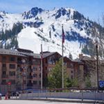
High in the mountains, surrounded by towering cliffs and rugged peaks, you may encounter a remarkable landscape feature resembling an enormous natural amphitheater. Steep rock walls curve around a broad, hollowed-out basin, sometimes enclosing a beautiful alpine lake. The surrounding cliffs may be covered in snow, while sharp ridges rise above the depression.
This distinctive mountain landform is known as a cirque.
Cirques are among the most recognizable features of landscapes shaped by glaciers. They occur in mountainous regions throughout the world, from the Rocky Mountains of North America to the European Alps, the Scottish Highlands, and the Himalayas.
Although these enormous basins may resemble natural bowls carved into mountainsides, their formation involves complex geological processes operating over thousands of years. Moving glaciers gradually erode the underlying rock, enlarging existing depressions and transforming them into dramatic, steep-walled hollows.
Some cirques still contain active glaciers. Others hold small mountain lakes, while many have been left completely free of ice, preserving evidence of glaciers that disappeared long ago.
Understanding how cirques form helps explain the distinctive shapes of glaciated mountain ranges, including their sharp ridges, pyramidal peaks, and spectacular alpine valleys.
🏔️ What Is a Cirque in Geography?
A cirque is a bowl-shaped or amphitheater-like depression carved into a mountain by glacial erosion. Cirques typically form near the heads of mountain valleys or along high mountain slopes where snow and ice accumulate over extended periods.
The landform generally has a steep, curved back wall called a headwall, with surrounding cliffs rising above a relatively broad basin. Its lower side is usually more open, allowing ice or meltwater to move downhill toward the valley below.
Many cirques have overdeepened floors, meaning glacial erosion has excavated part of the basin below the level of its outlet. A rock threshold or accumulated glacial debris may form a raised lip near the opening.
When a glacier retreats, water can collect within the depression, creating a small alpine lake known as a tarn.
Cirques vary considerably in size and appearance. Some are relatively small hollows beneath mountain summits, while others form enormous amphitheaters surrounded by cliffs hundreds of meters high.
The word cirque comes from French and ultimately derives from the Latin circus, referring to a circular space. The name reflects the curved, amphitheater-like shape of the landform.
In different mountainous regions, cirques are also known as corries in Scotland and cwms in Wales.
Despite these regional differences in terminology, the geological features are essentially the same.
❄️ How Do Cirques Form?
Cirques develop through a combination of snow accumulation, glacier formation, erosion, and weathering. The process generally begins in a natural depression on a mountainside where snow collects and remains for extended periods.
Over time, the accumulation of snow and the movement of glacier ice can transform a relatively modest hollow into an enormous rocky basin.
Snow Accumulates in a Mountainside Depression
Cirque formation often begins in a hollow where snow accumulates more readily than on the surrounding exposed slopes.
These depressions may already exist because of earlier erosion, geological structures, landslides, or other processes that have shaped the mountain.
Snow can remain in sheltered locations for long periods, particularly where low temperatures, limited sunlight, and favorable wind conditions reduce melting.
Repeated freezing and thawing, snowmelt, and weathering may gradually modify the hollow. These snow-associated processes are collectively known as nivation.
However, snow accumulation alone does not produce a fully developed glacial cirque. The formation of a classic cirque requires substantial erosion by glacier ice.
Snow Becomes Glacial Ice
When snowfall accumulates faster than it melts over successive years, the increasing weight compresses the underlying snow.
Individual snowflakes gradually lose their original structure, forming dense granular material called firn. Continued compression eventually transforms the firn into glacial ice.
As the ice becomes sufficiently thick, it begins to deform and move under the influence of gravity.
A small glacier occupying a mountainside hollow is called a cirque glacier.
Some cirque glaciers remain largely confined to their basins, while others grow and flow beyond the cirque into lower valleys.
Glacial Erosion Deepens the Basin
Once glacier ice begins moving, it can erode the bedrock beneath it.
Two especially important processes are abrasion and plucking, also known as quarrying.
Abrasion occurs when rock fragments embedded within the glacier scrape and grind against the underlying bedrock. The movement of these fragments gradually wears away the rock surface, sometimes producing polished rock and glacial scratches called striations.
Plucking occurs when glacier ice removes fractured pieces of bedrock. Water may enter cracks, freeze, and contribute to the weakening of rock, while ice movement and pressure changes help detach and transport rock fragments.
Together, these processes enlarge and deepen the mountainside hollow.
In some cirques, the movement of glacier ice contributes to an overdeepened basin, creating a floor that lies below the elevation of the outlet.
The precise amount of erosion depends on factors such as glacier thickness, ice movement, bedrock strength, meltwater conditions, and the length of time the glacier occupies the basin.
The Headwall Becomes Steeper
While glacier ice erodes the basin floor, weathering and erosion also modify the surrounding cliffs.
Freeze-thaw weathering can fracture exposed bedrock, particularly where temperatures repeatedly fluctuate around freezing.
Water entering cracks may freeze and expand, helping loosen rock fragments. Rockfalls and other slope movements then remove some of this fractured material.
Glacial quarrying near the base of the headwall can also contribute to its retreat.
Over long periods, these processes may cause the headwall to become higher and steeper as the cirque expands farther into the mountain.
The result is the distinctive curved rock wall that gives many cirques their amphitheater-like appearance.
The Glacier Retreats and Leaves the Cirque Behind
When climatic conditions become less favorable for glacier growth, the glacier may begin to lose more ice than it gains through snowfall.
Over time, the glacier can shrink and retreat, eventually disappearing from the cirque.
The enormous hollow remains as evidence of its former presence.
Some abandoned cirques contain rocky floors covered with loose debris. Others develop alpine meadows, small streams, or lakes.
Where the basin retains water, a tarn may form.
The glaciers responsible for creating many cirques in today’s temperate mountain regions were associated with colder periods during the Pleistocene Epoch, although some cirques have experienced multiple episodes of glaciation and others remain occupied by glaciers today.
🪨 What Are the Main Features of a Cirque?
Although cirques vary in size, shape, and geological setting, several features commonly distinguish them from other mountain landforms.
The Headwall
The headwall forms the steep back of the cirque, rising above the basin floor.
It may consist of exposed bedrock, fractured cliffs, or slopes partly covered by scree. In some locations, the headwall rises hundreds of meters above the cirque floor.
The headwall is often the most visually dramatic part of the landform.
The Cirque Floor
The floor is the lower interior portion of the cirque.
It may be relatively flat, gently sloping, or deeply excavated by former glacier ice. Some floors contain exposed bedrock, while others are covered with glacial sediments, boulders, or accumulated slope debris.
Where glacial erosion has created a sufficiently deep basin, water may collect to form a lake.
The Cirque Lip
Many cirques possess a raised threshold or lip at their downhill opening.
This threshold may consist of bedrock that was eroded less deeply than the interior of the basin. In other cases, accumulated glacial sediment can contribute to a barrier near the outlet.
The lip helps distinguish an overdeepened cirque basin from a simple depression on a mountain slope.
A glacier can flow across a bedrock lip even when the underlying surface slopes upward, provided the glacier’s ice surface continues to slope downward in the direction of flow.
The Surrounding Ridges
Cirques frequently occur beneath sharp mountain ridges and peaks.
Where neighboring glaciers erode opposite sides of a mountain ridge, they may leave behind a narrow, steep-sided crest known as an arête.
If several glaciers erode a mountain from different directions, the remaining summit may develop into a sharp, pyramidal peak called a horn.
These associated landforms contribute to the rugged appearance of heavily glaciated mountain landscapes.
💧 What Is the Difference Between a Cirque and a Tarn?
Cirques and tarns are closely related geological features, but they are not the same thing.
A cirque is the glacially carved basin, while a tarn is a lake occupying a mountain depression, commonly a cirque left behind by a retreating glacier.
During glaciation, a cirque may contain a substantial body of moving ice. After the glacier retreats, meltwater, precipitation, and runoff can collect within the basin.
If the basin has a sufficiently effective natural barrier and receives enough water, a lake can develop.
These lakes are often relatively small compared with those occupying major glacial valleys, although their size and depth vary considerably.
Some tarns appear strikingly blue or turquoise because fine glacial sediment suspended in the water scatters sunlight. Others are dark and clear, reflecting the surrounding cliffs and mountain peaks.
Not every cirque contains a tarn. Some basins drain readily, remain dry, or contain only temporary pools.
Likewise, not every alpine lake occupies a cirque. Mountain lakes can form through several geological processes, including glacial damming, landslides, and other forms of natural basin development.
The important distinction is that a cirque describes a landform created by erosion, while a tarn describes the water body that may occupy it.
⛰️ How Do Cirques Create Arêtes and Horns?
Cirques are closely associated with the formation of some of the sharpest and most dramatic features in glaciated mountain ranges.
As glaciers enlarge neighboring cirques, they gradually erode the mountains from different directions.
Where two cirques expand toward one another from opposite sides of a ridge, the intervening rock may become progressively narrower.
Eventually, a steep, knife-edged ridge called an arête can remain.
Where three or more cirques erode different sides of a mountain summit, they may produce a sharply pointed peak known as a glacial horn.
The Matterhorn in the European Alps is one of the world’s most famous examples of a pyramidal mountain peak shaped by glacial erosion.
These relationships explain why many formerly glaciated mountains have rugged summits, narrow ridges, and steep rock walls.
The surrounding cirques record the areas where glaciers removed rock, while arêtes and horns represent portions of the original mountain that survived between the eroded basins.
🌍 Where Are Cirques Found?
Cirques occur in mountain regions that currently support glaciers or experienced sufficient glaciation in the past.
They are particularly common in high mountains and in upland regions that were extensively glaciated during colder climatic periods.
Some of the best-known examples occur in North America and Europe.
Cirque de Gavarnie, French Pyrenees
The Cirque de Gavarnie is one of Europe’s most spectacular examples of an enormous natural amphitheater.
Located in the French Pyrenees near the border with Spain, it forms part of the Pyrénées–Mont Perdu UNESCO World Heritage Site.
The landscape is distinguished by towering curved rock walls, steep cliffs, and dramatic waterfalls.
Gavarnie and neighboring cirques reveal the combined influence of mountain geology, glacial erosion, and subsequent weathering.
The extraordinary scale of the surrounding cliffs demonstrates how dramatic these mountain basins can become.
Iceberg Lake Cirque, Glacier National Park, Montana
Glacier National Park contains numerous examples of glacial cirques and related alpine landforms.
One particularly striking example surrounds Iceberg Lake, a mountain lake situated within a steep-walled cirque.
The lake occupies a glacially carved basin surrounded by imposing cliffs and rugged mountain scenery.
The landscape provides a clear illustration of how glacier erosion produces a dramatic amphitheater that may later become occupied by water.
Glacier National Park also contains arêtes, horns, hanging valleys, and broad U-shaped valleys, making it an important location for studying glacial geography.
Cwm Cau, Wales
The mountains of Eryri, also known as Snowdonia, contain numerous cirques formed during earlier periods of glaciation.
Cwm Cau, beneath Cadair Idris in Wales, is a well-known example of a glacial cirque.
Its steep enclosing mountain slopes and basin illustrate the characteristic form of a cirque that no longer contains an active glacier.
The region’s glacial landforms provide valuable evidence of former ice accumulation and the changing climatic conditions experienced by the British uplands.
Coire an t-Sneachda, Scottish Highlands
The Cairngorm Mountains of Scotland contain several impressive cirques, locally called corries.
Coire an t-Sneachda, whose name translates as Corrie of the Snow, is surrounded by steep rocky slopes and cliffs.
It is a prominent example of the glacial landscapes preserved in the Scottish Highlands.
The shape of the corrie demonstrates how mountain glaciers can excavate sheltered basins beneath high ridges and leave behind distinctive landforms after retreating.
🧊 What Is the Difference Between a Cirque and a Glacial Valley?
Both cirques and glacial valleys form through erosion by moving ice, but they differ in their position, scale, and overall shape.
A cirque is generally a relatively compact, bowl-shaped depression located near the head of a valley or on a mountainside.
A glacial valley is usually a much longer feature, extending through a mountain range or across a substantial part of the landscape.
As a valley glacier moves downhill, it can widen and deepen a preexisting river valley.
River erosion commonly produces V-shaped valleys, while glaciers often transform these into broad U-shaped valleys with steep sides and relatively wide floors.
Cirques may form the uppermost portions of glacial valley systems.
A glacier can begin within a cirque, grow beyond the limits of its basin, and descend into an existing valley. As it expands, it may erode the valley into a glacial trough.
When the ice retreats, the cirque and U-shaped valley remain as connected features of the same glacial landscape.
This relationship helps explain why many glaciated mountain ranges contain a combination of bowl-shaped hollows, sharp ridges, steep cliffs, and long valleys.
🌨️ Why Do Some Cirques Face North or East?
The direction a cirque faces can provide clues about the conditions under which its glaciers developed.
In the Northern Hemisphere, slopes facing north generally receive less direct solar radiation than comparable south-facing slopes.
This can help snow persist for longer periods, creating favorable conditions for glacier development.
Wind direction also influences snow accumulation.
Prevailing winds may transport snow across exposed ridges and deposit it on sheltered slopes. Depending on local wind patterns, these locations may favor the development of glaciers facing particular directions.
Research on the glacial cirques of Snowdonia has identified a strong tendency for cirques to face north or east, reflecting the combined influence of solar radiation and snow redistribution by wind.
However, cirque orientation is not uniform worldwide.
In the Southern Hemisphere, slopes facing south may receive less direct sunlight, while local topography, regional weather, and geological conditions can influence glacier development in either hemisphere.
Consequently, the direction of a cirque must be interpreted within its geographical and climatic setting.
🔬 Why Are Cirques Important to Geologists?
Cirques are valuable geological features because they preserve evidence of former glaciers and the environments in which those glaciers developed.
In mountain regions where glaciers have completely disappeared, abandoned cirques may help scientists reconstruct the extent and distribution of ancient ice.
Their elevation, dimensions, orientation, and relationship to neighboring valleys can provide information about former glacial conditions.
For example, the elevation of cirque floors and associated glacial deposits may help researchers investigate the approximate climatic conditions required for glaciers to exist in a particular mountain range.
Cirque orientation can also reveal patterns of snow accumulation related to sunlight exposure and prevailing winds.
However, cirques are not exact records of a single climatic period. Many have been modified by multiple episodes of glaciation, weathering, and subsequent erosion.
Geologists therefore examine cirques alongside other evidence, including moraines, glacial sediments, striations, and the shapes of surrounding valleys.
Together, these features help reconstruct the history of mountain glaciation and long-term environmental change.
❓ Frequently Asked Questions About Cirques
What Is a Cirque in Simple Terms?
A cirque is a large, bowl-shaped hollow carved into a mountainside by glacier ice. It usually has steep rock walls surrounding a basin that opens downhill. After the glacier melts, the hollow may contain a small mountain lake called a tarn.
Are Cirques Formed by Erosion or Deposition?
Cirques are primarily erosional landforms.
They develop as glaciers remove bedrock through abrasion and plucking, while weathering and rockfalls can contribute to the retreat of surrounding cliffs.
Although glaciers may deposit sediment within or near a cirque, the defining basin is principally the result of erosion.
Can a Cirque Form Without a Glacier?
A classic glacial cirque requires erosion by glacier ice.
Snow accumulation and associated weathering can enlarge an existing hollow, but these processes alone do not generally produce the deeply excavated basin and characteristic headwall of a fully developed glacial cirque.
However, a cirque does not need to contain a glacier today.
Many cirques remain visible thousands of years after the ice responsible for shaping them has disappeared.
What Is Another Name for a Cirque?
A cirque is commonly called a corrie or coire in Scotland and a cwm in Wales.
The term kar is also used in German-speaking regions.
These names describe closely related mountain landforms produced by glacial erosion.
Where Do Cirques Usually Form?
Cirques typically form near the heads of mountain valleys or on high mountain slopes where snow can accumulate and eventually develop into glacial ice.
They are particularly common in regions that experienced alpine glaciation, including the Rockies, Alps, Pyrenees, Himalayas, Scottish Highlands, and mountains of Wales.
🌄 Understanding Cirques and Glacial Mountain Landscapes
Cirques are among the clearest examples of the extraordinary power of glacial erosion.
What may begin as a relatively small hollow on a mountainside can gradually become a vast natural amphitheater through the accumulation and movement of glacier ice.
As glaciers deepen their basins and erosion modifies the surrounding cliffs, cirques develop the distinctive steep headwalls, broad floors, and open downhill sides that characterize these landforms.
In areas where neighboring cirques expand toward one another, the remaining mountain ridges may become narrow arêtes or sharply pointed horns.
Elsewhere, glaciers flowing out of cirques carve broad U-shaped valleys through the mountains.
Once the ice retreats, the resulting landscape may contain tarns, exposed rock basins, alpine vegetation, and dramatic cliffs.
From the towering walls of the Cirque de Gavarnie in France to the glacier-carved mountains of Montana and the ancient corries of Scotland, cirques preserve a remarkable record of the processes that have shaped Earth’s mountainous regions.
The next time you encounter a steep-walled hollow high in the mountains, especially one enclosing a small lake beneath rugged cliffs, you may be looking at a cirque—a lasting reminder of the immense glaciers that once occupied the landscape.
🔗 Related Reading
- What Is a Mountain Pass? Geography, Formation & Famous Examples
- Mountain Ridge vs. Mountain Range: What’s the Difference?
- What Is an Escarpment? Geography and Examples
📚 Sources & Further Reading
- U.S. National Park Service — Cirques
- U.S. Geological Survey — Geology of Glacier National Park
- U.S. National Park Service — Glacial Geology of Glacier National Park
- AntarcticGlaciers.org — Cirques
- UNESCO World Heritage Centre — Pyrénées–Mont Perdu
- U.S. National Park Service — Tarns