Mount Hajdukovich

🏔️ Overview
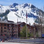
Mount Hajdukovich is a remote, glacier-bound mountain in the Delta Mountains of Alaska’s eastern Alaska Range. Rising to approximately 9,600 feet (2,926 meters) at its highest summit, the mountain stands among a rugged collection of seldom-visited peaks, glaciers, steep ridges, and broad wilderness east of the Richardson Highway.
Although Mount Hajdukovich is considerably lower than Alaska Range giants such as Mount Hayes and Denali, its isolation and glaciated surroundings make it a serious mountaineering objective. There is no maintained hiking trail to the summit, and historical climbing parties have relied on skis, crampons, glacier travel, and lengthy approaches through some exceptionally wild country.
Mount Hajdukovich is particularly interesting because it has two closely spaced summits. The northern summit was first climbed in March 1970, but the climbers discovered from its top that the summit roughly half a mile to the southwest was slightly higher. That main southern summit remained unclimbed for nearly another 22 years.
The mountain is named for John Hajdukovich (1878–1965), a well-known Alaska trapper, prospector, hunter, guide, and longtime contributor to the Alaska Game Commission.
⚡ Fast Facts
| Fact | Details |
|---|---|
| Continent | North America |
| Country | United States |
| State/Province | Alaska |
| County/Region | Southeast Fairbanks Census Area |
| Mountain Range | Delta Mountains / Alaska Range |
| Parent Peak | Tusac |
| Elevation | Approximately 9,600 ft / 2,926 m at the main summit |
| Prominence | Approximately 1,600 ft / 488 m |
| Isolation | Approximately 7.1 mi / 11.5 km |
| Nearest Higher Neighbor (NHN) | Old Snowy |
| Coordinates | Approximately 63.5407° N, 145.2118° W |
| USGS Quadrangle | Mount Hayes C-3 |
| Mountain Type | Remote glaciated alpine mountain |
| First Ascent of North Summit | March 1970 |
| First Ascent of Main South Summit | March 16, 1992 |
| Named For | John Hajdukovich (1878–1965) |
A note on elevation: Published figures for Mount Hajdukovich differ. Peakbagger and the American Alpine Journal use approximately 9,600 feet (2,926 meters) for the main summit, while a GNIS-derived listing gives 9,399 feet and ListsOfJohn gives approximately 9,650 feet. These differences are not unusual for remote Alaskan summits where older mapping and modern elevation datasets may produce slightly different results.
📍 Location
Mount Hajdukovich lies in the Delta Mountains, an eastern subdivision of the Alaska Range in Interior Alaska. It is approximately 36 miles northeast of Paxson, around 9 miles southeast of Saint Anthony Pass, and several miles east of Gerstle Glacier.
The mountain sits in the Southeast Fairbanks Census Area, amid one of the most rugged concentrations of mountains in the eastern Alaska Range.
Nearby peaks include:
- Old Snowy
- Tusac
- Black Cap
- Snow White
- White Princess
- Little Princess
- Mount Kimball
Gerstle Glacier is approximately 3.5 miles west of Mount Hajdukovich, while several smaller glaciers and icefields drain the basins immediately surrounding the mountain.
Despite the proximity of major Alaska transportation corridors on a regional scale, the peak itself is thoroughly backcountry terrain. There is no road reaching its base and no maintained trail providing straightforward summit access.
📏 Elevation & Prominence
The highest summit of Mount Hajdukovich is generally listed at approximately 9,600 feet (2,926 meters).
Its topographic prominence is approximately 1,600 feet (488 meters) according to Peakbagger, while ListsOfJohn calculates roughly 1,700 feet of rise. Its isolation is about 7.1 miles (11.5 kilometers).
The nearest higher mountain is Old Snowy, which rises to approximately 9,700 feet and lies south-southeast of Hajdukovich.
Mount Hajdukovich is not among the highest mountains of the Delta Range. Mount Kimball reaches roughly 10,300 feet, while Tusac, Mount Gakona, Black Cap, White Princess, Old Snowy, and Little Princess also rank among the range’s higher named summits.
However, elevation alone gives a poor impression of Mount Hajdukovich’s difficulty. Extensive glaciers, steep snow, crevasses, avalanche terrain, isolation, and severe Interior Alaska weather can make reaching this sub-10,000-foot summit a genuine expedition.
🪨 Geology
Mount Hajdukovich belongs to the eastern Alaska Range, a mountain system shaped by a long and complicated history of terrane collision, crustal deformation, faulting, uplift, and erosion.
Geological studies of the eastern and central Alaska Range show that the region developed through interactions between crustal blocks that were gradually added to the North American margin. These collisions created a complicated zone of sedimentary rocks, metamorphic rocks, faults, intrusive bodies, and deformed terrain.
Uplift continued through the Cenozoic, while glaciers profoundly reshaped the landscape.
Around Mount Hajdukovich, glacial erosion is one of the most obvious landscape-forming forces. Moving ice has excavated deep valleys and basins, sharpened ridges, transported enormous amounts of debris, and left moraines along lower glacier margins.
Freeze-thaw weathering also continually breaks exposed mountain rock apart. Water enters fractures, freezes, expands, and gradually loosens rock from cliffs and ridges. Combined with steep slopes and glacial erosion, this produces the rugged terrain characteristic of much of the Delta Mountains.
Detailed bedrock descriptions specifically for Mount Hajdukovich are limited, so broad descriptions of Alaska Range geology should not automatically be assumed to represent every exposed rock on the mountain.
🌿 Flora & Fauna
The upper slopes of Mount Hajdukovich are too high, cold, rocky, and heavily glaciated to support much vegetation.
Near the summit, the environment is dominated by:
- Snow
- Glacier ice
- Exposed rock
- Talus
- Wind-scoured ridges
At progressively lower elevations, alpine tundra begins to replace the barren high mountain environment. Hardy grasses, sedges, mosses, lichens, dwarf shrubs, and low-growing flowering plants are capable of surviving short growing seasons, persistent winds, and cold temperatures.
Eventually, the mountain valleys transition toward the boreal environments typical of Interior Alaska.
Wildlife is far more abundant in these lower valleys and tundra landscapes than on the summit itself. The broader eastern Alaska Range supports animals such as Dall sheep, caribou, moose, brown bears, wolves, wolverines, Arctic ground squirrels, ptarmigan, and golden eagles.
Anyone approaching Mount Hajdukovich overland must therefore consider both mountain hazards and ordinary Alaska wilderness concerns, including wildlife encounters.
🥾 Hiking & Climbing Routes
Mount Hajdukovich is not a hiking summit in the conventional sense.
There is no established trail to the top, and an ascent involves remote glacier mountaineering. Historical expeditions reached the mountain by traveling up the Little Gerstle River or approaching via Gerstle Glacier.
North-Side Route
The route used during the first ascent of the northern summit began with a lengthy approach along the Little Gerstle River.
The 1970 party traveled roughly 16 miles up the river before reaching the glacier flowing northeast from Mount Hajdukovich. They established a camp around 5,600 feet.
From there, climbers traveled up the glacier between ridges extending from Hajdukovich’s twin summits.
They reached the more easterly summit on March 21 and discovered that the summit approximately half a mile southwest was about 30–50 feet higher.
South-Side Route
The main summit was finally climbed in March 1992.
One party approached from Gerstle Glacier and climbed through the glaciated basin south of Hajdukovich. After navigating crevassed ice, the climbers reached an approximately 8,200-foot col and followed the south ridge toward the summit.
At nearly the same time, another team approached from the north, repeated the historical route to the north summit, and then traversed across to the higher southern summit.
The two groups unexpectedly converged near the top, completing the first documented ascent of Mount Hajdukovich’s true high point.
Mountaineering Hazards
Potential hazards include:
- Crevasses
- Weak snow bridges
- Avalanches
- Cornices
- Steep snow and ice
- Glacier icefalls
- Rockfall
- Extreme cold
- High winds
- Whiteout conditions
- Difficult route-finding
- Long-distance wilderness travel
- Limited opportunities for emergency assistance
🏔️ Field Guide Tip: Mount Hajdukovich should be considered a remote Alaska mountaineering objective, not a conventional hiking peak. Glacier travel, crevasse rescue, avalanche assessment, navigation, winter camping, and self-rescue skills may all be necessary depending on the chosen route and season.
🧗 Mountaineering History
Mount Hajdukovich has a particularly fascinating climbing history because its first climbers initially reached the wrong summit.
In March 1970, Douglas Bingham, Don Wallace, and Sid Whaley climbed the mountain from the Little Gerstle River side.
After a strenuous approach involving river ice, skis, willows, moraines, and glacier travel, the climbers headed for what appeared to be the easier of the mountain’s twin summits.
They reached the top in bitterly cold conditions only to discover that the southwestern summit was visibly higher.
The true summit remained unclimbed.
Almost exactly 22 years later, climbers returned in March 1992.
Two independent groups attacked the mountain from opposite directions. One traveled through the Little Gerstle drainage while another approached through Gerstle Glacier.
On March 16, climbers reached the higher southern summit, establishing the first ascent of Mount Hajdukovich’s true high point.
The American Alpine Journal later described the unusual coincidence of the two groups arriving on the mountain almost simultaneously.
The expedition also included Hank, a 70-pound Siberian husky, who traveled roped with one group and survived two crevasse falls thanks to a specially designed canine harness.
🧑 Who Was John Hajdukovich?
Mount Hajdukovich commemorates John Hajdukovich (1878–1965).
Hajdukovich was born in Montenegro and later became a notable figure in Interior Alaska. He worked in the region as a guide, trapper, hunter, prospector, and pioneer.
He also devoted years of service to the Alaska Game Commission, helping connect detailed firsthand knowledge of Alaska’s wilderness and wildlife with early conservation and game-management efforts.
His long association with Alaska’s Interior eventually led to the mountain bearing his name.
During the 1992 ascent of the main summit, climbers included a member connected by marriage to the Hajdukovich family. A Yugoslav flag was carried to the summit and later presented to Hajdukovich’s family in Fairbanks.
🌤️ Best Time to Visit
There is no simple hiking season for Mount Hajdukovich because visiting the mountain usually means undertaking a backcountry mountaineering expedition.
Historically, late winter and spring have been important climbing periods in the Delta Mountains.
Cold conditions can make frozen rivers and snow-covered glaciers easier to cross on skis, while snow bridges may cover otherwise complicated crevasse systems.
The first ascent of the north summit occurred in March 1970, and the first ascent of the main summit also took place in March, in 1992.
However, spring travel can bring serious avalanche hazards, bitter nighttime temperatures, storms, high winds, and rapidly changing snow conditions.
Summer removes some of the extreme winter cold but introduces other problems. Crevasses become increasingly exposed, glacial streams grow, moraines can be unstable, and travel across bare ice may become more complicated.
Any expedition should be planned around current weather, snowpack, glacier conditions, river levels, aviation considerations, and avalanche conditions, rather than simply choosing a particular month.
🧭 Nearby Mountains & Attractions
Old Snowy
Old Snowy reaches approximately 9,700 feet and is Mount Hajdukovich’s nearest higher neighbor. It forms part of the same spectacular cluster of glaciated Delta Mountains.
Tusac
Tusac rises to approximately 9,860 feet and is one of the more prominent mountains in the eastern Delta Range. Peak databases identify it in Mount Hajdukovich’s parent lineage.
Mount Kimball
At approximately 10,300 feet, Mount Kimball is the highest point of the Delta Mountains and one of the most geographically significant mountains in this portion of Alaska.
Black Cap
Black Cap is another high, glaciated peak of the Delta Mountains and stands within the same remarkable mountain complex.
Gerstle Glacier
Gerstle Glacier lies only a few miles west of Mount Hajdukovich and played an important role in the successful 1992 ascent. Its tributaries and surrounding icefields dominate much of the landscape west and south of the mountain.
Richardson Highway
Although Mount Hajdukovich itself is remote, the Richardson Highway provides access to the western side of the Delta Mountains and offers striking views of the Alaska Range.
💡 Fun Facts
- Mount Hajdukovich has two major summits separated by roughly half a mile.
- Climbers reached the northern summit in March 1970 before realizing the southwestern summit was slightly higher.
- The true summit remained unclimbed for almost another 22 years.
- The main summit was first reached in March 1992.
- Two separate climbing groups approached the mountain from different directions during that historic ascent.
- A 70-pound Siberian husky named Hank accompanied one of the 1992 climbing parties.
- Hank fell into crevasses twice but was saved by his climbing harness and rope.
- Mount Hajdukovich is named for Alaska pioneer John Hajdukovich.
- Hajdukovich was born in Montenegro and became a trapper, hunter, prospector, guide, and game commissioner in Alaska.
- Gerstle Glacier lies only a few miles west of the mountain.
- The mountain’s published elevation varies depending on the mapping or elevation dataset being used.
- Despite standing below 10,000 feet, Mount Hajdukovich requires genuine expedition-style Alaska mountaineering.
❓ Frequently Asked Questions
How high is Mount Hajdukovich?
The main summit is commonly listed at approximately 9,600 feet (2,926 meters). Other databases provide somewhat different elevations, including approximately 9,399 and 9,650 feet.
Where is Mount Hajdukovich?
Mount Hajdukovich lies in the Delta Mountains of the eastern Alaska Range, within Alaska’s Southeast Fairbanks Census Area. It is approximately 36 miles northeast of Paxson.
What is Mount Hajdukovich’s nearest higher mountain?
Old Snowy, at approximately 9,700 feet, is the nearest higher neighbor.
What is Mount Hajdukovich’s prominence?
Peakbagger lists approximately 1,600 feet (488 meters) of topographic prominence. Other elevation datasets produce slightly different figures.
Can you hike Mount Hajdukovich?
Not by an established hiking trail. Reaching the summit requires remote backcountry and glacier travel and should be considered a mountaineering expedition.
When was Mount Hajdukovich first climbed?
The northern summit was first climbed in March 1970. The climbers discovered that the southwestern summit was slightly higher. That true summit was first climbed in March 1992.
Who is Mount Hajdukovich named after?
The mountain honors John Hajdukovich (1878–1965), an Alaska trapper, prospector, hunter, guide, pioneer, and longtime contributor to the Alaska Game Commission.
Is Mount Hajdukovich part of the Alaska Range?
Yes. It belongs to the Delta Mountains, which form part of the eastern Alaska Range.
🔗 Related Articles
- Alaska Range
- Old Snowy (Alaska)
- Tusac
- Mount Kimball
- Black Cap (Fairbanks, Alaska)
- Mountains in the United States
📚 Sources
- Peakbagger — Delta Range — elevation and regional peak data.
- ListsOfJohn — Mount Hajdukovich — coordinates, elevation, prominence, isolation, and parent information.
- Alaska Guide — Mount Hajdukovich — location, GNIS elevation, nearby features, and naming history.
- U.S. Geological Survey — Geographic Names Information System — official geographic-name record.
- American Alpine Journal — Mount Hajdukovich, 1971 — account of the first ascent of the north summit.
- American Alpine Journal — Mount Hajdukovich, 1993 — account of the first ascent of the higher south summit and new routes.
- Alaska Alpine Club — Club History — historical record of the March 1970 north-summit ascent.
- U.S. Geological Survey — Mesozoic and Cenozoic Tectonics of the Eastern and Central Alaska Range — geological history of the eastern Alaska Range.