🏔️ Overview
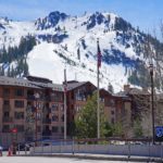
The Sawtooth Range is one of the most recognizable mountain landscapes in the American West. Rising above the valleys of central Idaho, the range is defined by sharp granite summits, glacially carved basins, clear alpine lakes, and steep ridges that give the mountains their distinctive saw-blade appearance.
The Sawtooths form part of the broader Rocky Mountains and occupy a rugged section of central Idaho west of the Sawtooth Valley. Much of the highest terrain is protected within the Sawtooth Wilderness, which lies inside the Sawtooth National Recreation Area and Sawtooth National Forest.
Unlike the much higher mountain ranges of neighboring Wyoming and Colorado, the Sawtooths do not contain any 12,000- or 13,000-foot summits. Their highest point, Thompson Peak, rises to only about 10,760 feet. Yet the steep relief, exposed granite, narrow ridges, and deep glacial valleys give the range a far more dramatic appearance than its absolute elevations might suggest.
The Sawtooth Range is particularly famous among hikers and backpackers. Trails lead through forests and alpine basins to destinations such as Sawtooth Lake, Alice Lake, Toxaway Lake, and the country surrounding Redfish Lake.
⚡ Fast Facts
| Fact | Details |
|---|---|
| Continent | North America |
| Country | United States |
| State | Idaho |
| Counties | Custer, Boise, Blaine, and Elmore |
| Mountain System | Rocky Mountains |
| Highest Point | Thompson Peak |
| Highest Point Elevation | About 10,759.5 ft / 3,279.5 m using modern LiDAR data |
| Traditional Thompson Peak Elevation | 10,751 ft / 3,277 m |
| Thompson Peak Prominence | Approximately 2,440 ft / 744 m |
| Thompson Peak Isolation | Approximately 17.8 mi / 28.6 km |
| Nearest Higher Neighbor of Thompson Peak | White Cloud Peak #7 |
| Approximate Range Area | 678 sq mi / 1,756 sq km |
| Protected Areas | Sawtooth Wilderness, Sawtooth National Recreation Area, Sawtooth National Forest |
| Major Rock Types | Granite and granodiorite |
| Notable Lakes | Redfish Lake, Sawtooth Lake, Alice Lake, Toxaway Lake, Pettit Lake |
| Nearby Community | Stanley, Idaho |
The often-published elevation of 10,751 feet for Thompson Peak comes from traditional topographic mapping. Modern Peakbagger data derived from LiDAR places the summit slightly higher at approximately 10,759.5 feet. Small differences like this are increasingly common as high-resolution elevation data improves older mountain measurements.
📍 Location
The Sawtooth Range lies in central Idaho, primarily west and southwest of the small mountain town of Stanley.
The mountains form the western wall of the Sawtooth Valley, a broad high-elevation valley drained by the upper Salmon River. Across the valley to the east rise the White Cloud Mountains, another exceptionally rugged central Idaho range.
The Sawtooths extend through portions of:
- Custer County
- Boise County
- Blaine County
- Elmore County
Idaho State Highway 75 follows the eastern side of the mountains through the Sawtooth Valley, providing access to many of the best-known trailheads and recreation areas.
The landscape is remarkably undeveloped. Stanley is the principal community near the northern portion of the range, while Ketchum and Sun Valley lie farther south beyond the main Sawtooth peaks.
The Sawtooths are one of many important ranges within the vast Rocky Mountain system. For a broader look at ranges across the country, see Mountain Ranges in the U.S..
📏 Elevation & Prominence
The Sawtooths are not Idaho’s highest mountain range, but they contain an unusually dense concentration of rugged summits.
Thompson Peak
Thompson Peak is the highest mountain in the range.
Modern LiDAR-based data used by Peakbagger places its summit at approximately:
10,759.5 feet / 3,279.5 meters
Traditional USGS-based references commonly list:
10,751 feet / 3,277 meters
Its topographic prominence is approximately 2,440 feet, while its isolation is about 17.8 miles.
Peakbagger identifies White Cloud Peak #7, east of the Sawtooth Valley in the White Cloud Mountains, as the nearest higher summit in its database.
Other Major Sawtooth Peaks
Several additional peaks rise above 10,000 feet, including:
- Mount Cramer
- Decker Peak
- Snowyside Peak
- Williams Peak
- Mount Carter
- Mickey’s Spire
- Horstmann Peak
- Mount Limbert
- Braxon Peak
- Mount Iowa
- Merritt Peak
- Baron Peak
The Sawtooths consequently contain dozens of 10,000-foot summits even though their highest mountain barely exceeds that mark.
Their ruggedness comes less from absolute elevation than from the rapid rise of steep granite walls above deep valleys and lake basins.

🪨 Geology
The spectacular shape of the Sawtooth Range reflects both ancient intrusive geology and much younger erosion.
Much of the range consists of granitic rock associated with the Idaho Batholith and Sawtooth Batholith.
The Idaho Batholith represents an enormous body of intrusive igneous rock emplaced deep within Earth’s crust during the Late Cretaceous. Magma slowly cooled beneath the surface, producing extensive masses of granite and granodiorite.
Younger intrusive rocks associated with the Sawtooth Batholith were emplaced during the Eocene.
Later uplift exposed these resistant rocks at the surface.
The Sawtooth Range developed as an uplifted mountain block, but the sharp skyline visible today was created largely through erosion.
Ice Age Glaciers
Glaciers played an especially important role.
During repeated cold periods of the Pleistocene, alpine glaciers occupied the high valleys of the Sawtooths.
Moving ice excavated and enlarged:
- Cirques
- U-shaped valleys
- Hanging valleys
- Lake basins
- Steep headwalls
- Sharp ridges
- Jagged summit towers
Many of the range’s famous lakes occupy basins originally carved or modified by glaciers.
Weathering continued after the glaciers retreated. Water entering cracks in the granite freezes and expands during cold weather, gradually breaking rock apart.
Repeated frost action contributes to the talus slopes, cliffs, pinnacles, and broken ridges that characterize the modern Sawtooths.
💧 Lakes, Rivers & Glacial Valleys
Water is one of the defining features of the Sawtooth landscape.
Hundreds of lakes occur throughout the larger Sawtooth National Recreation Area, with many concentrated in glacial basins beneath the high peaks.
Among the best known are:
Redfish Lake — One of the largest and most recognizable lakes beneath the Sawtooths. It provides access to trails penetrating deep into the wilderness.
Sawtooth Lake — A spectacular alpine lake northwest of Stanley reached from the Iron Creek area.
Alice Lake — A popular backpacking destination surrounded by granite peaks.
Toxaway Lake — A major stop on the Alice-Toxaway backpacking circuit.
Pettit Lake — An important trail-access area along the eastern edge of the range.
Glacial erosion produced many of these basins as moving ice scoured depressions from the underlying bedrock.
The range also forms part of an important watershed divide.
Water flowing from different sides of the mountains ultimately enters major river systems including the Salmon, Payette, and Boise rivers.
The headwaters of the Salmon River occur within the broader Sawtooth National Recreation Area. The river eventually travels hundreds of miles before joining the Snake River.
🌿 Flora & Fauna
Elevation creates several distinct ecological zones across the Sawtooth Range.
Lower and middle slopes support extensive conifer forests.
Common trees include:
- Lodgepole pine
- Douglas-fir
- Engelmann spruce
- Subalpine fir
- Whitebark pine
- Ponderosa pine in some lower western areas
As elevation increases, forests become increasingly open.
Subalpine fir and whitebark pine survive near the upper limits of tree growth, where long winters, strong winds, and short summers make conditions increasingly severe.
Above timberline, vegetation becomes sparse. Alpine grasses, wildflowers, lichens, and other cold-adapted plants occupy sheltered areas between large expanses of granite and talus.
Wildlife within Sawtooth National Forest includes:
- Elk
- Mule deer
- Black bears
- Mountain goats
- Coyotes
- Smaller alpine mammals
- Numerous birds and raptors
Black bears occur throughout the forest, making proper food storage and campsite management particularly important for backpackers.
The high country also contains sensitive whitebark pine habitat. Whitebark pine is especially important in western mountain ecosystems because its seeds provide food for wildlife and its presence helps stabilize high-elevation soils.
🥾 Hiking & Climbing Routes
The Sawtooth Range offers everything from relatively accessible lake hikes to demanding cross-country scrambles and technical rock climbing.
Alice-Toxaway Loop
The Alice-Toxaway Loop is one of the best-known backpacking routes in the Sawtooths.
Access begins near Pettit Lake.
The route connects several spectacular alpine destinations, including:
- Alice Lake
- Twin Lakes
- Toxaway Lake
- Farley Lake
The surrounding landscape includes granite peaks, high passes, forests, meadows, and glacial basins.
Because of heavy recreational use and fragile alpine environments, visitors should carefully review current Sawtooth Wilderness regulations before beginning a trip.
Sawtooth Lake
Sawtooth Lake is another popular destination.
The Iron Creek area southwest of Stanley provides access toward Sawtooth Lake and neighboring Alpine Lake.
The route provides an excellent introduction to Sawtooth scenery without requiring a technical climb.
Redfish Lake Backcountry
Redfish Lake provides access to some of the most dramatic terrain in the range.
Trails extending beyond the lake lead beneath major peaks and into remote wilderness basins.
The lake area also provides approaches toward mountains including Mount Heyburn, Grand Mogul, Decker Peak, and the Thompson Peak region.
Thompson Peak
Reaching Thompson Peak is considerably more demanding than ordinary Sawtooth hiking.
Although the summit can be reached without highly technical mountaineering on its easiest route, the ascent requires substantial off-trail travel and exposed Class 3 scrambling.
Loose rock, steep terrain, route-finding difficulties, lingering snow, and sudden weather changes increase the seriousness of the climb.
It should not be treated as a normal maintained-trail hike.
🏔️ Field Guide Tip: Sawtooth trails can lead quickly from developed recreation areas into remote wilderness. Carry navigation, extra layers, food, water treatment, emergency shelter, and other essential equipment even on seemingly straightforward day hikes. Check official Forest Service alerts, fire restrictions, wilderness regulations, and trail conditions immediately before departure.

🎟️ Sawtooth Wilderness Permits & Regulations
Much of the central Sawtooth high country lies inside the approximately 217,000-acre Sawtooth Wilderness.
Anyone entering the Sawtooth Wilderness currently needs a wilderness permit, including day hikers.
For smaller groups, permits can generally be self-issued at wilderness access points. Different requirements apply to larger groups.
Additional wilderness regulations address:
- Group size
- Campfires
- Camping locations
- Waste disposal
- Motorized travel
- Bicycles
- Protection of lakes and vegetation
Campfires are prohibited in several sensitive lake basins and are subject to additional seasonal and location-based restrictions.
Regulations and temporary fire restrictions can change, particularly during dry summers, so visitors should always consult the current U.S. Forest Service information rather than relying on an older trail description.
🌤️ Best Time to Visit
For most hikers and backpackers, the primary Sawtooth hiking season extends from July through September.
June
Early summer can still bring substantial snow to high passes and shaded basins.
Creeks may also run high during snowmelt.
July
By July, many lower trails become accessible, although snow can persist in high country.
Wildflowers become increasingly abundant.
August
August generally offers some of the most reliable access to high trails.
However, wildfire smoke, temporary fire restrictions, dry conditions, and afternoon storms can occasionally affect travel.
September
September can be one of the most beautiful times to explore the Sawtooths.
Crowds often decrease and nights become colder. Early-season snow is possible at higher elevations.
Winter
Winter transforms the range into deep snow country.
Backcountry travel may require skis, snowshoes, avalanche knowledge, winter navigation skills, and cold-weather survival equipment.
Many summer roads and recreation facilities become inaccessible or operate differently during winter.
🧭 Nearby Mountains & Attractions
The Sawtooth Range is part of a much larger concentration of wild mountain country in central Idaho.
White Cloud Mountains
Across the Sawtooth Valley to the east are the White Cloud Mountains.
Their highest summit, Castle Peak, reaches approximately 11,815 feet—more than 1,000 feet higher than Thompson Peak.
The contrasting ranges create one of Idaho’s most impressive mountain panoramas.
Stanley and the Sawtooth Valley
The community of Stanley sits near the northern end of the Sawtooth Valley and serves as the primary gateway for many visitors.
From the valley, travelers can see the jagged Sawtooth skyline rising abruptly to the west.
Redfish Lake, Stanley Lake, trailheads, campgrounds, and numerous recreation facilities are distributed throughout the surrounding area.

💡 Fun Facts
- The range’s name comes from its jagged skyline, which resembles the teeth of a saw.
- Thompson Peak is the highest point in the Sawtooth Range.
- The range is part of the much larger Rocky Mountains.
- Dozens of Sawtooth summits exceed 10,000 feet.
- Modern LiDAR measurements place Thompson Peak slightly higher than the traditional elevation printed on older topographic maps.
- The mountains contain extensive granitic rock associated with both the Idaho and Sawtooth batholiths.
- Ice Age glaciers carved many of the range’s lakes, cirques, and steep valleys.
- Much of the high country lies inside federally designated wilderness.
- Redfish Lake is one of the most recognizable landmarks along the eastern base of the range.
- The White Cloud Mountains directly across the Sawtooth Valley contain higher summits than the Sawtooths.
- The mountains contribute water to several major Idaho river systems.
- Despite their rugged appearance, no Sawtooth summit reaches 11,000 feet.
❓ Frequently Asked Questions
Where is the Sawtooth Range?
The Sawtooth Range is located in central Idaho, primarily west and southwest of Stanley.
It forms part of the Rocky Mountain system and rises along the western side of the Sawtooth Valley.
What is the highest mountain in the Sawtooth Range?
Thompson Peak is the highest summit.
Traditional topographic maps list an elevation of 10,751 feet, while modern LiDAR-based Peakbagger data places the summit at approximately 10,759.5 feet.
Are the Sawtooth Mountains part of the Rocky Mountains?
Yes.
The Sawtooth Range is generally classified within the broader Rocky Mountain system.
Learn more in The Rocky Mountains.
Why are they called the Sawtooth Mountains?
The name refers to the serrated skyline created by numerous sharp summits, spires, ridges, and granite pinnacles.
Viewed from the Sawtooth Valley, the profile resembles the teeth along the edge of a saw blade.
How high are the Sawtooth Mountains?
Most major Sawtooth summits rise between approximately 9,000 and 10,760 feet.
Thompson Peak is the highest.
Are there glaciers in the Sawtooth Range?
The range does not contain major modern valley glaciers comparable with those found in Alaska or the North Cascades.
However, large glaciers repeatedly occupied the Sawtooths during the Ice Age and were responsible for much of the scenery visible today.
How were the Sawtooth Mountains formed?
The range consists largely of resistant granitic rock associated with major intrusive bodies including the Idaho and Sawtooth batholiths.
Tectonic uplift raised the mountain block, while erosion—especially Pleistocene glaciation—carved the jagged peaks, cirques, and deep valleys visible today.
What are the best hikes in the Sawtooths?
Popular destinations include the Alice-Toxaway Loop, Sawtooth Lake, trails around Redfish Lake, and numerous wilderness lake routes.
Difficulty ranges from ordinary maintained trails to demanding off-trail scrambling.
Do you need a permit to hike in the Sawtooth Wilderness?
Yes.
Current Forest Service rules require anyone entering the Sawtooth Wilderness, including day hikers, to have an appropriate wilderness permit.
Visitors should verify regulations before each trip because requirements can change.
Can you climb Thompson Peak?
Yes, but the standard ascent is not an ordinary hiking trail.
The easiest route involves off-trail navigation and Class 3 scrambling over steep mountain terrain. Experience with scrambling, route finding, and remote mountain travel is strongly recommended.
What town is closest to the Sawtooth Mountains?
Stanley is the principal community beside the northern Sawtooth Range and serves as a gateway to Redfish Lake, Stanley Lake, wilderness trailheads, and the Sawtooth National Recreation Area.
🔗 Related Articles
- The Rocky Mountains
- Mountain Ranges in the U.S.
- Bitterroot Range
- Wasatch Range
- What Is a Parent Peak?
📚 Sources
- U.S. Forest Service — Sawtooth National Recreation Area
- U.S. Forest Service — Sawtooth Wilderness
- U.S. Forest Service — Animals and Plants
- U.S. Geological Survey — Geology of the Sawtooth Area, Idaho
- Peakbagger — Thompson Peak, Idaho