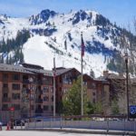
The Snowy Mountains, often called the Snowies, form the highest section of Australia’s Great Dividing Range. Located primarily in southern New South Wales, this alpine region contains the highest summits on the Australian mainland, including the 2,228-meter (7,310-foot) Mount Kosciuszko.
Although their rounded summits are modest compared with the Himalayas, Andes, or European Alps, the Snowy Mountains possess a distinctive alpine landscape of granite outcrops, glacial lakes, windswept ridges, snow gum forests, wildflower meadows, and broad high-country plateaus.
The region is also important culturally and historically. Its mountains have been gathering places for Aboriginal peoples for thousands of years, while more recent chapters include gold mining, the development of Australian skiing, and construction of the enormous Snowy Mountains Hydro-electric Scheme.
🏔️ Overview
The Snowy Mountains are part of the Australian Alps, which form the highest southern section of the much larger Great Dividing Range. Most of the range lies within Kosciuszko National Park, the largest national park in New South Wales.
Rather than sharp, recently uplifted peaks, the Snowies are characterized by weathered summits, rolling tablelands, steep river valleys, and exposed rocky ridges. Their highest section, known as the Main Range, contains all of mainland Australia’s highest mountains.
Snow commonly covers the upper slopes during winter, supporting major ski areas such as Thredbo, Perisher, Charlotte Pass, and Selwyn. Once the snow melts, the region becomes one of Australia’s premier destinations for hiking, mountain biking, fishing, camping, and wildlife watching.
⚡ Snowy Mountains at a Glance
| Feature | Details |
|---|---|
| Continent | Australia/Oceania |
| Country | Australia |
| State | New South Wales |
| Larger mountain region | Australian Alps |
| Mountain system | Great Dividing Range |
| Highest peak | Mount Kosciuszko |
| Highest elevation | 2,228 m (7,310 ft) |
| Principal high section | Main Range |
| Major protected area | Kosciuszko National Park |
| Important rivers | Snowy, Murray, Murrumbidgee, Tumut and Geehi |
| Major gateway towns | Jindabyne, Cooma, Tumut and Khancoban |
| Popular activities | Hiking, skiing, snowboarding, mountain biking, camping and fishing |
| Common nickname | The Snowies |
📍 Where Are the Snowy Mountains?
The Snowy Mountains are located in southeastern New South Wales, close to the borders of Victoria and the Australian Capital Territory. They rise southwest of Canberra and west of Australia’s southeastern coastline.
The region is generally reached through several gateway communities:
- Jindabyne provides access to Thredbo, Perisher, Charlotte Pass and the Main Range.
- Cooma is the largest regional service center and an important base for exploring the southern Snowies.
- Tumut provides access to the northern part of Kosciuszko National Park.
- Khancoban lies near the steep western side of the mountains.
- Adaminaby is close to Lake Eucumbene and several areas associated with the Snowy Mountains Scheme.
The term Snowy Mountains may be used in slightly different ways. Geographically, it usually refers to the high mountains of southern New South Wales. In tourism, the name is sometimes applied more broadly to surrounding valleys, lakes, ski villages, national park areas, and high-country communities.
🏔️ Highest Peaks of the Snowy Mountains
The Snowy Mountains contain the highest peaks of the Great Dividing Range and all ten of the highest recognized mountain points on the Australian mainland.
| Rank | Mountain or high point | Elevation |
|---|---|---|
| 1 | Mount Kosciuszko | 2,228 m (7,310 ft) |
| 2 | Mount Townsend | 2,209 m (7,247 ft) |
| 3 | Mount Twynam | 2,195 m (7,201 ft) |
| 4 | Rams Head | 2,190 m (7,185 ft) |
| 5 | Unnamed peak on Etheridge Ridge | 2,180 m (7,152 ft) |
| 6 | Rams Head North | 2,177 m (7,142 ft) |
| 7 | Alice Rawson Peak | 2,160 m (7,087 ft) |
| 8 | Unnamed peak southwest of Abbott Peak | 2,159 m (7,083 ft) |
| 9 | Abbott Peak and Carruthers Peak | 2,145 m (7,037 ft) |
| 10 | Mount Northcote | 2,131 m (6,991 ft) |
Mountain rankings can vary because some high points are unnamed or may be classified as subsidiary summits rather than independent mountains. Nevertheless, the table illustrates how closely grouped Australia’s highest elevations are around the Main Range.
Mount Kosciuszko
Mount Kosciuszko is the tallest mountain on the Australian mainland and the best-known summit in the range. Its broad, rounded summit can be reached by maintained walking tracks during snow-free conditions.
The mountain is included on the traditional Bass version of the Seven Summits, although the alternative Messner list uses Puncak Jaya as the highest mountain in the wider Oceania region.
Mount Townsend
At 2,209 meters, Mount Townsend is Australia’s second-highest mainland mountain. It has a rockier and more rugged appearance than nearby Mount Kosciuszko and is often considered one of the most visually striking peaks in the Main Range.
Mount Twynam
Mount Twynam rises to 2,195 meters near the headwaters of the Snowy River. Its broad upper slopes overlook Blue Lake and several of the range’s best-preserved glacial landforms.
🪨 Geology and Glacial Landforms
The Snowy Mountains are ancient highlands rather than a young, rapidly rising mountain chain. Much of their present landscape developed through long periods of crustal uplift, faulting, weathering, and erosion.
Granite is prominent around Mount Kosciuszko and the Main Range, although the region also contains metamorphic and sedimentary rocks. Differences in rock type, resistance to erosion, and faulting have helped create the area’s plateaus, valleys, ridges, and rocky tors.
During colder stages of the Pleistocene Epoch, small glaciers formed around the highest summits. These glaciers were far smaller than those of New Zealand or the European Alps, but they left recognizable features, including:
- Glacial cirques
- Moraines
- Boulder deposits
- U-shaped hollows
- Alpine lakes and tarns
- Smoothed or weathered rock surfaces
Blue Lake, Club Lake, Lake Albina, and Hedley Tarn occupy or are associated with glacier-carved terrain. Blue Lake is especially significant as a rare Australian alpine lake and internationally recognized wetland.
The mountains do not contain permanent glaciers today. Snowfields may remain well into spring, and occasional sheltered snow patches can last longer, but the region’s snow cover is seasonal.
🌊 Rivers, Lakes and the Snowy Mountains Scheme
The Snowy Mountains form one of southeastern Australia’s most important water catchments. Snowmelt and rainfall feed rivers that flow toward both the coast and the inland plains.
The Snowy River rises near Mount Kosciuszko before flowing southeast toward the Tasman Sea. Other waterways originating in or near the mountains eventually contribute to the Murray and Murrumbidgee river systems.
The natural drainage of the region was substantially altered by the Snowy Mountains Hydro-electric Scheme, one of the largest engineering projects in Australian history. Construction began in 1949 and was completed in 1974.
The original scheme included:
- 16 major dams
- Seven power stations
- One pumping station
- Approximately 145 kilometers of interconnected tunnels
- Around 80 kilometers of aqueducts
Water is collected in mountain reservoirs and transferred through tunnels and power stations before being released into the Murray and Murrumbidgee systems. The scheme produces hydroelectric power while also supplying water for inland irrigation.
Major reservoirs include Lake Eucumbene, Lake Jindabyne, Tantangara Reservoir, Talbingo Reservoir, and Geehi Reservoir.
More than 100,000 people from over 30 countries worked on the project. The workforce included many migrants who arrived in Australia following the Second World War, making the scheme an important part of the country’s social as well as engineering history.
🌿 Flora and Fauna
Elevation strongly influences vegetation in the Snowy Mountains. Lower slopes support eucalyptus forests and woodlands, while snow gum woodland dominates much of the subalpine zone.
Above the natural treeline, the landscape opens into alpine grasslands, herbfields, heathlands, bogs, fens, and rocky feldmark communities. Plants must survive strong winds, freezing temperatures, snow cover, intense sunlight, and an extremely short growing season.
Characteristic plants include:
- Snow gums
- Snow daisies
- Billy buttons
- Alpine grevilleas
- Mountain celery
- Alpine buttercups
- Sphagnum moss
- Hardy tussock grasses
Summer brings a brief but colorful wildflower season, particularly from December through February.
The Snowies also shelter several rare and cold-adapted animals. Among the best known is the mountain pygmy-possum, a small alpine marsupial that shelters among high-elevation boulder fields and hibernates through winter.
Other notable animals include:
- Southern corroboree frog
- Broad-toothed rat
- Alpine she-oak skink
- Snowy Mountains rock skink
- Wombat
- Eastern grey kangaroo
- Wallaby
- Echidna
- Wedge-tailed eagle
Bogong moths traditionally migrate into alpine areas during the warmer months. They are an important food source for several native species, including the mountain pygmy-possum.
Climate change, invasive weeds, feral animals, altered fire patterns, erosion, and recreational pressure all present challenges for the region’s sensitive alpine ecosystems.

🧑🤝🧑 Aboriginal Heritage
The Snowy Mountains form part of the traditional Country of several Aboriginal peoples, including the Monaro Ngarigo, Wolgalu, Wiradjuri, and Ngunnawal peoples.
For thousands of years, people travelled into the mountains for ceremonies, trade, social gatherings, and seasonal food collection. Archaeological evidence demonstrates more than 9,000 years of Aboriginal connection with the area.
More than 1,000 Aboriginal archaeological sites have been recorded within Kosciuszko National Park. These include stone arrangements, scarred trees, axe-grinding grooves, and ceremonial places.
Seasonal gatherings associated with Bogong moth migrations were particularly important. The mountains continue to hold deep cultural meaning, and Aboriginal communities remain involved in caring for Country and managing cultural heritage.
📜 European Settlement and Mountain History
European pastoralists began using parts of the Snowy Mountains during the 19th century. Summer grazing became common on the high plains, and stockmen built huts that provided shelter in the remote landscape.
Gold was discovered near Kiandra in 1859, briefly transforming the mountain settlement into a busy mining town. The area also became one of Australia’s earliest skiing centers during the 1860s, when miners and residents used long wooden skis—then commonly called snowshoes—to travel and race over the snow.
Scientific interest, tourism, and concern over grazing damage eventually led to greater protection of the mountains. An early reserve surrounding Mount Kosciuszko was established in 1906. The protected area was subsequently expanded and eventually became Kosciuszko National Park.
Historic huts remain scattered across the high country. Although some were built by graziers, miners, surveyors, skiers, or Snowy Scheme workers, they are now protected heritage structures rather than guaranteed emergency accommodation.
🥾 Hiking and Outdoor Adventures
The Snowy Mountains offer everything from short viewpoint walks to demanding multi-day journeys.
Mount Kosciuszko Walk from Thredbo
The most accessible approach to Mount Kosciuszko begins at Thredbo. A chairlift carries visitors to the upper slopes, from which a raised walking track crosses alpine terrain toward Rawson Pass and the summit.
Although this is not a technical climb in summer, hikers remain exposed to strong winds, cold temperatures, storms, and rapidly changing weather.
Mount Kosciuszko Summit Walk from Charlotte Pass
A longer approach begins at Charlotte Pass and follows a broad track toward Seaman’s Hut, Rawson Pass, and Mount Kosciuszko. The route offers expansive views across the Main Range and passes several historic and natural landmarks.
Main Range Walk
The Main Range Walk is one of Australia’s finest alpine day hikes. The approximately 22-kilometer loop visits the Blue Lake area, Carruthers Peak, high ridges, glacial landscapes, and Mount Kosciuszko.
It is a long and exposed route requiring suitable fitness, navigation awareness, adequate water, and protection from sudden weather changes.
Snowies Alpine Walk
The Snowies Alpine Walk is a 56-kilometer multi-day route through the Thredbo–Perisher section of Kosciuszko National Park. It connects Guthega, Charlotte Pass, Perisher Valley, and Bullocks Flat while incorporating the Main Range and Mount Kosciuszko.
The route passes alpine wildflower meadows, snow gum forests, glacial lakes, historic huts, rivers, and high mountain viewpoints.
Other Activities
Beyond hiking, visitors can enjoy:
- Downhill and cross-country skiing
- Snowboarding
- Snowshoeing
- Backcountry ski touring
- Mountain biking
- Trout fishing
- Camping
- Horse riding in permitted areas
- Caving at Yarrangobilly
- Scenic driving
- Wildlife and wildflower photography
🏔️ Field Guide Tip: Even during summer, carry warm and waterproof layers when hiking above the treeline. Clear conditions can quickly change to strong wind, rain, hail, fog, or freezing temperatures. Check national park alerts before entering the high country and consider carrying a personal locator beacon on remote walks.

🌤️ Best Time to Visit
| Season | Best for | Typical conditions |
|---|---|---|
| Summer: December–February | Summit hiking, wildflowers, camping and mountain biking | Mildest alpine weather, although storms and cold changes remain possible |
| Autumn: March–May | Quieter trails, photography and lower-elevation walks | Cooler days, cold nights and occasional early snow |
| Winter: June–August | Skiing, snowboarding and snowshoeing | Regular snow at higher elevations, icy roads and severe alpine weather |
| Spring: September–November | Late-season snow, snowmelt and wildflowers | Highly variable conditions with snow remaining on upper routes |
For most hikers, the best period is generally December through March. Snow may continue to obstruct high routes during November, while cold conditions can arrive at any time.
Winter travel requires additional preparation. Roads may be icy, snow chains may be required, and many walking tracks become suitable only for people with winter navigation and backcountry experience.
🧭 Towns, Resorts and Nearby Attractions
Jindabyne
Jindabyne is the principal gateway to the southern Snowy Mountains. The town sits beside Lake Jindabyne and offers accommodation, restaurants, equipment rental, visitor information, and access to nearby mountain roads.
Thredbo
Thredbo is a year-round alpine village offering skiing and snowboarding in winter. During warmer months, it serves as a center for hiking, mountain biking, and trips to Mount Kosciuszko.
Perisher
Perisher Valley forms part of an extensive ski area that includes Perisher, Blue Cow, Smiggin Holes, and Guthega. In summer, the surrounding trails become much quieter and provide access to snow gum woodlands and alpine walking routes.
Charlotte Pass
Charlotte Pass is Australia’s highest permanent village. It provides access to the Main Range, Mount Kosciuszko, Blue Lake, and several major walking routes.
Yarrangobilly Caves
Located in the northern part of Kosciuszko National Park, Yarrangobilly contains limestone caves, walking tracks, historic buildings, and a naturally heated thermal pool.
Kiandra
The former gold-mining settlement of Kiandra preserves traces of the region’s mining and skiing history. Weather, bushfires, and time have removed many original structures, but the landscape remains an important heritage area.
💡 Fun Facts
- The Snowy Mountains contain every one of mainland Australia’s ten highest mountain points.
- Mount Kosciuszko is almost exactly one kilometer lower than Mount Fuji in Japan.
- Australia’s highest summits are clustered within a relatively small section of the Main Range.
- Blue Lake occupies a basin shaped by Pleistocene glaciation.
- The region contains mainland Australia’s most extensive alpine environment.
- Kiandra became an early center of recreational skiing during the 1860s.
- Construction of the Snowy Mountains Scheme employed more than 100,000 people.
- Australia has seasonal snowfields but no surviving permanent glaciers.
- The mountains divide rivers flowing toward the Tasman Sea from those draining toward Australia’s interior.
- The summit of Mount Kosciuszko can be reached on foot without technical climbing during suitable snow-free conditions.
❓ Frequently Asked Questions
Are the Snowy Mountains part of the Great Dividing Range?
Yes. The Snowy Mountains are the highest section of the Great Dividing Range and form part of the Australian Alps.
What is the highest mountain in the Snowy Mountains?
Mount Kosciuszko is the highest mountain in the range and on the Australian mainland. It reaches 2,228 meters (7,310 feet).
Are the Snowy Mountains actually snowy?
Yes, but snow cover is seasonal. The upper mountains usually receive substantial winter snow, while lower elevations may receive less consistent coverage. The region does not contain permanent glaciers.
Can beginners climb Mount Kosciuszko?
During snow-free conditions, beginners with reasonable fitness can usually reach the summit using one of the maintained tracks. Nevertheless, the route enters an exposed alpine environment where sudden cold, storms, fog, and strong wind are possible.
Are the Snowy Mountains volcanic?
No. The Snowy Mountains are not an active or recently formed volcanic chain. Their landscape consists largely of ancient igneous, metamorphic, and sedimentary rocks shaped by uplift, weathering, erosion, and limited Pleistocene glaciation.
What is the best base for visiting the Snowy Mountains?
Jindabyne is the most convenient base for Mount Kosciuszko, Thredbo, Perisher, and the southern section of the national park. Cooma, Tumut, Khancoban, and Adaminaby are useful for reaching other parts of the region.
Can you visit the Snowy Mountains outside winter?
Yes. Summer and early autumn are the main hiking seasons, with opportunities for mountain biking, camping, fishing, wildflower viewing, and scenic drives. The Snowies are a year-round destination rather than solely a ski region.
🔗 Related Articles
- Mount Kosciuszko
- The Great Dividing Range
- Highest Peaks of the Great Dividing Range
- Mountain Ranges
- The World’s Top 100 Mountain Ranges
- Highest Mountains by Continent
- Seven Summits: Climbing the Highest Peak on Every Continent
📚 Sources
- Geoscience Australia — Highest Mountains
- NSW National Parks — Snowy Mountains
- NSW National Parks — Snowies Alpine Walk
- NSW National Parks — Kosciuszko National Park 80th Anniversary
- Australian Government — Australian Alps
- Snowy Hydro — History of the Snowy Scheme