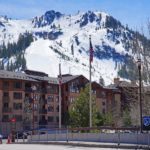
Punta Maquignaz

Punta Maquignaz, also known in French as Pointe Maquignaz, is a 3,801-meter (12,470-foot) alpine summit on the border between Italy and Switzerland. It rises along the dramatic east ridge of Dent d’Hérens in the Pennine Alps, only a few kilometers west of the Matterhorn.
Rather than being an isolated mountain, Punta Maquignaz forms part of a complicated chain of rocky towers and subsidiary summits along the Dent d’Hérens ridge. The Swiss Alpine Club describes it as a twin summit with the slightly higher Punta Carrel, which rises immediately beside it to approximately 3,840 meters.
That makes Punta Carrel the nearest higher summit to Punta Maquignaz.
Despite its relatively low topographic independence, Punta Maquignaz is an important landmark on one of the more demanding high-alpine ridges in this part of the Alps and has a climbing history stretching back to the late 19th century.
⚡ Fast Facts
| Fact | Details |
|---|---|
| Mountain | Punta Maquignaz / Pointe Maquignaz |
| Countries | Italy and Switzerland |
| Italian Region | Aosta Valley |
| Swiss Canton | Valais |
| Mountain Range | Pennine Alps |
| Mountain Group | Matterhorn–Dent d’Hérens area |
| Parent Mountain | Dent d’Hérens |
| Elevation | 12,470 feet / 3,801 meters |
| Approximate Coordinates | 45.9713° N, 7.6170° E |
| Nearest Higher Neighbor (NHN) | Punta Carrel |
| Punta Carrel Elevation | Approximately 3,840 meters / 12,598 feet |
| Summit Type | Subsidiary rocky summit / ridge tower |
| First Recorded Ascent | August 29–30, 1894 |
| First-Ascent Party | Evan Mackenzie, Louis Carrel, Antoine Maquignaz, André Pellissier |
| Main Climbing Context | East Ridge of Dent d’Hérens |
| SAC Route Grade | D |
| Common Base | Bivacco Giorgio e Renzo Novella |
| Hiking Trail to Summit | None |
📍 Where Is Punta Maquignaz?
Punta Maquignaz lies directly on the Italian-Swiss border, with Italy’s Aosta Valley on its southern side and Switzerland’s canton of Valais to the north.
The peak forms part of the main Alpine watershed running through this section of the Pennine Alps.
It sits on the long east ridge of Dent d’Hérens, a major 4,000-meter mountain that rises immediately west of the better-known Matterhorn.
The ridge contains a remarkable succession of high points, including:
- Punta Bianca
- Punta Carrel
- Punta Maquignaz
- Punta Maria Cristina
Rather than standing alone above a broad valley, Punta Maquignaz is embedded within this complicated high ridge.
That setting explains both its dramatic appearance and its relatively limited topographic independence.
📏 How High Is Punta Maquignaz?
Punta Maquignaz reaches 3,801 meters (12,470 feet) above sea level.
That places it well below the 4,000-meter threshold traditionally used to identify the highest major Alpine summits, but it remains an exceptionally high mountain feature.
Its immediate neighbor, Punta Carrel, reaches approximately 3,840 meters, making it about 39 meters higher.
Farther west, Dent d’Hérens rises to approximately 4,173 meters, while the Matterhorn reaches 4,478 meters to the east.
Punta Maquignaz therefore occupies an unusually dramatic location between some of the highest and most recognizable mountains of the Pennine Alps.
🏔️ Nearest Higher Neighbor
Punta Maquignaz’s Nearest Higher Neighbor is Punta Carrel.
The two summits stand immediately beside one another and are described by the Swiss Alpine Club as a twin summit formation.
Punta Carrel rises to approximately 3,840 meters, compared with Punta Maquignaz at 3,801 meters.
Neither peak is considered highly independent in a topographic sense. Instead, both form major rocky elevations along the east ridge of Dent d’Hérens.
Punta Carrel itself is named after celebrated Valtournenche guide Jean-Antoine Carrel, one of the central figures in the early climbing history of the Matterhorn.
Interestingly, Punta Maquignaz also serves as the Nearest Higher Neighbor of nearby Punta Maria Cristina, creating a useful sequence of progressively higher points along the ridge.
🧗 Is Punta Maquignaz an Independent Mountain?
Not really.
Although Punta Maquignaz has its own recognized name and summit, the Swiss Alpine Club specifically notes that it does not have the character of an independent mountain.
Instead, it is one of several significant elevations along the east ridge of Dent d’Hérens.
This distinction is important.
Mountain names do not necessarily correspond with topographic independence. In heavily dissected high-mountain terrain such as the Alps, even relatively minor ridge towers can acquire official names because of their climbing importance, visibility, history, or distinctive shape.
Punta Maquignaz is a good example.
Its importance comes less from prominence and more from its position on a technically demanding ridge and its connection with the history of Alpine guiding.
🧭 Who Was Jean-Joseph Maquignaz?
Punta Maquignaz was named for Jean-Joseph Maquignaz, one of the notable mountain guides associated with Valtournenche in the Aosta Valley.
Maquignaz belonged to a celebrated local tradition of Alpine guides who played an important role during the development of mountaineering in the western Alps.
He is particularly remembered for his pioneering climbing activities in the Matterhorn and Mont Blanc regions.
Among his achievements was participation in the first ascent of the Punta Sella summit of the Dent du Géant in 1882.
Maquignaz disappeared in 1890 in the Mont Blanc region.
The later naming of Punta Maquignaz preserved his association with the mountains surrounding Valtournenche and Cervinia.
The area’s climbing history is filled with similar commemorative names honoring pioneering guides and alpinists.
🧭 First Ascent
The first recorded ascent of Punta Maquignaz occurred in late August 1894.
The successful party consisted of:
- Evan Mackenzie
- Louis Carrel
- Antoine Maquignaz
- André Pellissier
There is a small historical discrepancy over the exact date.
The Swiss Alpine Club gives the ascent as August 30, 1894, while a contemporary 1894 publication of the Italian Alpine Club reported the first ascent of Punta Maquignaz and Punta Carrel on August 29.
For that reason, the most accurate way to describe the event is as an August 29–30, 1894 first ascent.
The party climbed the mountain while exploring the east ridge of Dent d’Hérens.
Their ascent also included neighboring Punta Carrel, linking the climbing histories of the twin summits from the beginning.
🧗 The East Ridge of Dent d’Hérens
Today, Punta Maquignaz is most often encountered during an ascent or traverse of the East Ridge of Dent d’Hérens.
This is a serious alpine route rather than an ordinary summit hike.
The Swiss Alpine Club grades the route D, or Difficile, indicating sustained technical mountaineering terrain requiring significant experience.
Climbers encounter combinations of:
- Exposed rock climbing
- Narrow ridges
- Snow
- Ice
- Mixed terrain
- Route-finding
- Significant exposure
The ridge passes across several subsidiary summits before eventually reaching the much higher summit of Dent d’Hérens.
Punta Maquignaz is therefore often crossed as part of a larger alpine objective rather than climbed as an isolated destination.
🛖 Bivacco Giorgio e Renzo Novella
An important staging point for climbing in this area is the Bivacco Giorgio e Renzo Novella.
The small high-altitude bivouac stands at approximately 3,695 meters near Punta Maria Cristina.
Its exceptionally high location places climbers directly among the rocky towers and ridges east of Dent d’Hérens.
From the bivouac, mountaineers can access the east ridge and continue toward Punta Maquignaz, Punta Carrel, Punta Bianca, and ultimately Dent d’Hérens.
The bivouac is an emergency-style alpine shelter rather than a full-service mountain hut.
Reaching it is itself a serious high-mountain undertaking.
⚠️ Can You Hike Punta Maquignaz?
Punta Maquignaz should not be considered a hiking summit.
There is no maintained walking trail leading to the top.
Although trails and mountain paths extend into the surrounding valleys, reaching Punta Maquignaz requires genuine alpinism.
Climbers need skills in:
- Rock climbing
- Rope work
- Alpine route-finding
- Snow and ice travel
- Glacier travel
- Exposure management
- High-altitude weather assessment
The Dent d’Hérens East Ridge is graded D, placing it firmly beyond ordinary hiking or scrambling terrain.
This is an objective for experienced mountaineers.
🧊 Glaciers Around Punta Maquignaz
Glaciers remain an important part of the landscape surrounding Punta Maquignaz.
On the Swiss side, the high ridges descend toward the glacier systems associated with the upper Zmutt Valley and Tiefmattengletscher.
Punta Carrel’s northern side falls particularly steeply toward the Tiefmatten Glacier.
On the Italian side, snowfields and glacier-carved valleys descend toward the upper Valtournenche and Cervinia region.
Repeated glaciation helped carve the steep relief that distinguishes this part of the Pennine Alps.
Today, climbers may encounter glacier travel and snow-covered terrain depending on their chosen approach and route.
🪨 Geology and Alpine Formation
Punta Maquignaz forms part of the immense Alpine mountain system created by the long collision between the African and Eurasian tectonic plates.
Compression, folding, faulting, and uplift raised enormous masses of rock to create the Alps.
Glacial erosion then profoundly reshaped the rising mountains.
Ice carved deep valleys around resistant ridges, while frost and weathering continued breaking exposed rock apart.
The resulting landscape around Dent d’Hérens is exceptionally rugged.
Sharp ridges, isolated rock towers, couloirs, steep faces, and glaciated basins dominate the terrain.
Punta Maquignaz itself represents one of the rocky high points left standing along the great east ridge.
🌤️ Weather and Climbing Conditions
Weather can change rapidly at 3,800 meters.
Even during the normal summer climbing season, Punta Maquignaz may experience:
- Snow
- Strong winds
- Freezing temperatures
- Thick cloud
- Ice-covered rock
- Afternoon thunderstorms
- Rapid deterioration in visibility
Conditions along narrow ridges can become particularly dangerous when rock is covered by verglas or fresh snow.
Because Punta Maquignaz is generally climbed as part of a much longer ridge route, weather forecasting is especially important.
A sudden storm does not simply make the summit uncomfortable—it can make retreat from exposed terrain extremely difficult.
🌿 Plants and Wildlife
The summit of Punta Maquignaz is far too high and exposed to support the rich plant communities found in the lower Alpine valleys.
Its upper slopes are dominated by rock, snow, and ice.
Vegetation becomes progressively more limited with increasing altitude, and the summit environment supports very little plant life.
Lower elevations around Valtournenche and the surrounding valleys support much richer Alpine ecosystems, including meadows, dwarf shrubs, and conifer forests.
Wildlife found in the broader Pennine Alps includes ibex, chamois, marmots, mountain hares, golden eagles, and alpine birds.
Those species belong primarily to the broader mountain environment rather than the exposed summit ridge of Punta Maquignaz itself.
🏔️ Nearby Mountains
Punta Maquignaz lies amid one of Europe’s most famous concentrations of high mountains.
Punta Carrel
Punta Carrel rises immediately beside Punta Maquignaz to approximately 3,840 meters.
It is Punta Maquignaz’s Nearest Higher Neighbor and forms its closely associated twin summit.
Punta Maria Cristina
Punta Maria Cristina lies farther east along the same general ridge system.
At approximately 3,706 meters, it is lower than Punta Maquignaz, which serves as its Nearest Higher Neighbor.
Dent d’Hérens
Dent d’Hérens reaches approximately 4,173 meters and forms the dominant mountain from which Punta Maquignaz’s ridge ultimately descends.
Punta Maquignaz is best understood as a subsidiary summit of this much larger mountain.
Matterhorn
The unmistakable Matterhorn rises only a few kilometers east.
At 4,478 meters, it dominates much of the surrounding landscape and shares the Italy-Switzerland border.
Monte Rosa
Farther east, the Monte Rosa massif contains some of the highest summits in the Alps, including the 4,634-meter Dufourspitze.
Together, these mountains form one of the world’s classic mountaineering regions.
💡 Interesting Facts About Punta Maquignaz
- Punta Maquignaz reaches 3,801 meters (12,470 feet).
- It lies directly on the Italy-Switzerland border.
- The peak is part of the Pennine Alps.
- It forms part of the east ridge of Dent d’Hérens.
- Punta Maquignaz forms a twin summit with Punta Carrel.
- Its Nearest Higher Neighbor is Punta Carrel.
- The Swiss Alpine Club does not regard Punta Maquignaz as a strongly independent mountain.
- It is named after Valtournenche guide Jean-Joseph Maquignaz.
- Maquignaz disappeared in the Mont Blanc region in 1890.
- The first recorded ascent took place in August 1894.
- Historical sources disagree by one day on the precise first-ascent date.
- Punta Maquignaz is normally encountered as part of the challenging East Ridge of Dent d’Hérens.
- The East Ridge is graded D by the Swiss Alpine Club.
- There is no maintained hiking trail to the summit.
- Nearby Punta Maria Cristina has Punta Maquignaz as its Nearest Higher Neighbor.
❓ Frequently Asked Questions
How high is Punta Maquignaz?
Punta Maquignaz reaches 3,801 meters (12,470 feet) above sea level.
Where is Punta Maquignaz?
It lies on the border between Italy’s Aosta Valley and Switzerland’s canton of Valais in the Pennine Alps.
What is Punta Maquignaz’s Nearest Higher Neighbor?
The Nearest Higher Neighbor is Punta Carrel, which rises immediately beside it to approximately 3,840 meters.
Is Punta Maquignaz an independent mountain?
It has an officially recognized name and summit, but the Swiss Alpine Club describes it as a subsidiary elevation without strong independent mountain character. It forms part of the east ridge of Dent d’Hérens.
Who was Punta Maquignaz named after?
The summit honors Jean-Joseph Maquignaz, a celebrated mountain guide from Valtournenche who disappeared in the Mont Blanc region in 1890.
Who first climbed Punta Maquignaz?
Evan Mackenzie, Louis Carrel, Antoine Maquignaz, and André Pellissier made the first recorded ascent in late August 1894.
Why are two first-ascent dates sometimes given?
The Swiss Alpine Club lists August 30, 1894, while a contemporary publication of the Italian Alpine Club reported the first ascent on August 29, 1894.
Can you hike Punta Maquignaz?
No. There is no maintained hiking trail to the summit. Reaching Punta Maquignaz requires technical alpine climbing.
What is the main climbing route?
Punta Maquignaz is most commonly crossed during the East Ridge of Dent d’Hérens, a serious alpine route graded D.
🔗 Related Articles
📚 Sources
- Swiss Alpine Club — Pointe Maquignaz
- Swiss Alpine Club — Punta Carrel / Pointe Carrel
- Club Alpino Italiano — Rivista Mensile del CAI, 1894
- Treccani — Jean-Antoine Carrel
- Swiss Alpine Club — Pointe Maquignaz Route Information
- Wikimedia Commons — Punta Carrel and Punta Maquignaz