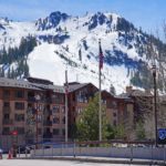
Eggstock

🏔️ Overview
Eggstock is a high, glaciated mountain in the Uri Alps of Switzerland, rising to 3,554 meters (11,660 feet) along the border between the cantons of Uri and Valais. It forms the northern end of the great Dammastock chain, a rugged line of snow-covered summits surrounded by some of the most impressive glaciers in the central Swiss Alps.
Although Eggstock is overshadowed by neighboring Dammastock and Schneestock, its geographical position makes it unusually interesting. The mountain stands above the Rhône Glacier to the west and the high glacial terrain draining toward Göscheneralp to the east. The meeting point of the cantons of Bern, Uri, and Valais lies only about 600 meters west of the summit.
Eggstock is also associated with one of Switzerland’s more unusual geographic distinctions: the country’s calculated volumetric center lies on the mountain’s glaciated northern flank. Unlike the better-known geographical center of Switzerland, this point takes the country’s three-dimensional terrain into account.
For mountaineers, Eggstock is a genuine high-alpine objective rather than a hiking summit. The standard ascent crosses glaciers, and conditions can involve crevasses, snow, ice, unstable rock, and rapidly changing weather.
⚡ Fast Facts
| Fact | Details |
|---|---|
| Continent | Europe |
| Country | Switzerland |
| State/Province | Cantons of Uri and Valais |
| County/Region | Göschenen, Uri / Obergoms, Valais |
| Range | Urner Alps, part of the Alps |
| Mountain Group | Dammastock chain / Winterberg massif |
| Parent Peak | Dammastock |
| Elevation | 3,554 m / 11,660 ft |
| Prominence | Approximately 14 m / 46 ft using traditional Swiss topographic figures |
| Isolation | Approximately 0.6 km / 0.4 mi to higher terrain |
| Nearest Higher Neighbor (NHN) | Schneestock |
| Key Col | Approximately 3,540 m / 11,614 ft |
| Coordinates | Approximately 46.6524° N, 8.4177° E |
| Normal Route | From the west via the Rhône Glacier |
| Alpine Grade | Approximately PD− under favorable conditions |
| Main Hazards | Crevasses, glacier travel, rockfall, snow and ice, changing weather |
| Notable Feature | Switzerland’s volumetric center lies on Eggstock’s northern flank |
📍 Location
Eggstock stands in south-central Switzerland on the boundary between the canton of Uri to the east and the canton of Valais to the west.
The mountain forms part of the Dammastock chain, sometimes called the Dammakette, which contains several of the highest peaks in the Urner Alps. Eggstock lies immediately north of Schneestock and Dammastock and marks the northern corner of the long snowy ridge surrounding the upper Eggfirn.
To the west, ice and snow descend toward the Rhône Glacier and the upper Rhône Valley. To the east, much steeper terrain falls toward the Göscheneralp region.
Eggstock also stands very close to the junction of three Swiss cantons. The Bern–Uri–Valais tripoint is located roughly 600 meters west of the summit at an elevation of about 3,500 meters.
This location places Eggstock on an important Alpine watershed. Water flowing toward Valais ultimately joins the Rhône system, while drainage on the Uri side feeds tributaries of the Reuss and eventually the Rhine.
📏 Elevation & Prominence
The Swiss Alpine Club lists Eggstock at 3,554 meters (11,660 feet) above sea level. This is the traditional elevation used on Swiss topographic maps and is the figure used throughout this guide.
Eggstock has very little topographic prominence because it is closely connected to the much higher Schneestock and Dammastock. Traditional mapping places its key saddle at approximately 3,540 meters, giving the mountain only about 14 meters (46 feet) of prominence.
Its limited prominence does not make it visually insignificant. Eggstock forms an important corner of the Dammastock ridge and rises dramatically above the surrounding glaciers and the steep eastern slopes facing Göscheneralp.
Why do some databases give Eggstock a different elevation?
There is an unusual naming issue in this part of the Dammastock chain. Some modern peak databases apply the name Eggstock to a nearby point of approximately 3,583 meters, while the Swiss Alpine Club and traditional Swiss mapping use 3,554 meters for Eggstock.
A separate unnamed point of approximately 3,583 meters appears along the ridge between Eggstock and the higher summits.
For consistency, Mountain Field Guide follows the Swiss Alpine Club and Swiss topographic convention and uses 3,554 meters for Eggstock.
🪨 Geology
Eggstock lies within the Aar Massif, one of the great exposed crystalline basement massifs of the Swiss Alps.
The rocks of this region have a much longer history than the modern Alps themselves. Much of the Aar Massif consists of ancient gneisses, schists, amphibolites, granites, and granodiorites. Some of the granitic magmas crystallized approximately 300 million years ago during the late stages of the Variscan mountain-building period.
Tens of millions of years later, the collision processes that created the Alps compressed, buried, fractured, metamorphosed, and uplifted this older European crust.
The present mountain landscape is therefore the result of several distinct geological chapters. Ancient crystalline rocks form the foundation, Alpine tectonic forces raised them, and glaciers subsequently carved the sharp ridges and deep valleys visible today.
Ice has been especially important in shaping Eggstock. Repeated glaciations ground down the mountain’s flanks, excavated surrounding basins, transported enormous quantities of rock, and helped create the dramatic relief between the high Dammastock ridge and the valleys below.
Modern glacier retreat continues to change the mountain. As ice disappears, previously supported rock faces can become unstable, increasing the danger of rockfall on certain routes.
🌿 Flora & Fauna
Very little vegetation survives near Eggstock’s summit. At more than 3,500 meters, the environment is dominated by snow, glacier ice, bare rock, frost, and extreme seasonal temperature changes.
Small lichens and other exceptionally hardy organisms may colonize exposed rock where conditions permit, but substantial plant communities occur much farther down the mountain.
Below the glacier zone, the landscape gradually changes to moraine, rocky alpine grassland, and eventually richer mountain meadows.
Wildlife in the wider Urner Alps can include:
- Alpine ibex
- Chamois
- Alpine marmots
- Mountain hares
- Snow voles
- Golden eagles
- Alpine choughs
- Rock ptarmigan
Many animals remain well below Eggstock’s summit while using surrounding ridges, valleys, and alpine meadows for feeding and shelter.
The retreat of glaciers is creating new habitat throughout the region. Newly exposed ground is gradually colonized by microorganisms, lichens, mosses, grasses, and other pioneer species, beginning a slow ecological succession on terrain that may have been covered by ice for centuries.
🥾 Hiking & Climbing Routes
There is no ordinary hiking trail to the summit of Eggstock. Reaching the mountain requires genuine alpine mountaineering skills.
Rhône Glacier Normal Route
The standard route approaches Eggstock from the west by crossing the Rhône Glacier.
The Swiss Alpine Club grades the normal route approximately PD− and gives an ascent time of roughly 4½ to 5 hours, with around 1,400 meters of elevation gain depending on the starting point and current access.
The climb involves prolonged glacier travel followed by snow or firn slopes leading toward the summit.
Although PD− is relatively modest within the Alpine grading system, this should never be confused with an ordinary hike. Crevasses, snow bridges, exposed glacier ice, route-finding problems, and sudden weather changes can all create serious hazards.
Approach from the Trift Side
Eggstock may also be approached from the north and northwest through the high glacial country associated with the Trift Glacier and Trift Hut.
Historically, this side formed part of long mountaineering traverses through the Dammastock group. Modern conditions can vary dramatically because of glacier retreat, so current route information is essential.
Eastern Side
Eggstock’s eastern slopes fall steeply toward Göscheneralp.
The Swiss Alpine Club warns that routes on this side have become increasingly dangerous as snow and ice coverage decreases. The exposed walls contain steep and brittle rock, and traditional lines are now affected by objective rockfall hazards.
For that reason, some historic routes are rarely or no longer repeated.
Ski Mountaineering
Eggstock can also be reached during suitable spring snow conditions as part of ski-mountaineering tours through the Dammastock massif.
The long glaciated terrain is well suited to skis when sufficient snow covers crevasses and rough glacier surfaces, but the route remains a serious alpine undertaking requiring avalanche assessment, glacier skills, navigation ability, and suitable equipment.
🏔️ Field Guide Tip: Eggstock’s relatively low prominence and moderate Alpine grade can make the mountain sound easier than it really is. Every normal summit approach involves high-altitude glacier terrain. A rope, crampons, ice axe, glacier-rescue equipment, and the skills to use them are essential.
🌤️ Best Time to Visit
The best season for Eggstock depends on the activity and on conditions in the surrounding glaciers.
Late spring and early summer can provide good ski-mountaineering conditions when a deep snowpack still covers irregular glacier surfaces. Snow bridges may be stronger during cooler periods, although avalanche conditions require careful assessment.
July through early September is generally the main period for summer mountaineering. Longer daylight hours and comparatively stable weather make high routes more practical.
Later in summer, however, glacier travel can become more complicated. Crevasses widen, snow bridges weaken, and bare ice becomes more extensive. Melting snow and ice may also increase rockfall from exposed faces.
Autumn can bring clear mountain weather, but days become shorter and new snow may arrive surprisingly early.
Whatever the season, climbers should check current conditions shortly before attempting Eggstock. Historical route descriptions cannot reliably predict the state of rapidly changing Alpine glaciers.
🧭 Nearby Mountains & Attractions
Dammastock
Dammastock rises to 3,630 meters immediately south of Eggstock and is the dominant mountain of the massif.
It is the highest summit of the Urner Alps and the highest point in the canton of Uri. Eggstock effectively forms the northern pillar of the same high mountain chain.
Schneestock
Schneestock rises between Eggstock and Dammastock and reaches approximately 3,608 meters.
Because Schneestock is so close and substantially higher, it is Eggstock’s nearest higher neighbor.
Rhône Glacier
The Rhône Glacier spreads across the western side of the Dammastock massif and forms the headwaters of one of Europe’s great rivers.
Its ice once extended much farther down the upper Rhône Valley. Rapid retreat has dramatically altered the landscape during the modern era.
Furka Pass
Furka Pass crosses the high mountains south of the Dammastock group and connects the upper Rhône Valley with the Andermatt region.
The seasonal road is famous for its Alpine scenery and provides access to viewpoints overlooking the Rhône Glacier.
Göscheneralp
On the eastern side of Eggstock, the remote Göscheneralp valley offers a very different perspective on the Dammastock massif.
The landscape includes steep granite walls, alpine pastures, mountain streams, reservoirs, glaciers, and several important mountaineering routes.
💡 Fun Facts
- Eggstock reaches 3,554 meters, making it one of the higher summits of the Urner Alps.
- The mountain stands directly on the border between Uri and Valais.
- The three-canton boundary of Bern, Uri, and Valais lies only about 600 meters from the summit.
- Eggstock forms the northern end of the high Dammastock chain.
- Its nearest higher neighbor is Schneestock.
- The mountain has relatively little topographic prominence despite its considerable elevation.
- The Rhône and Rhine drainage systems meet within the surrounding high mountain landscape.
- Switzerland’s calculated volumetric center lies on Eggstock’s glaciated northern flank.
- Swisstopo calculated the volumetric center by dividing Switzerland into three-dimensional volume elements referenced to sea level.
- The volumetric center is extremely remote and is considered practically accessible only to mountaineers.
- Eggstock should not be confused with the Eggstöcke near Braunwald, a completely different mountain group in the Schwyzer/Glarus Alps.
❓ Frequently Asked Questions
How high is Eggstock?
Eggstock reaches 3,554 meters (11,660 feet) above sea level according to the Swiss Alpine Club and traditional Swiss topographic mapping.
Where is Eggstock located?
Eggstock lies in the Urner Alps of Switzerland on the border between the cantons of Uri and Valais.
What is Eggstock’s parent peak?
Eggstock’s parent mountain is Dammastock, the 3,630-meter high point of the Urner Alps.
What is Eggstock’s nearest higher mountain?
The nearest higher neighbor is Schneestock, which rises to approximately 3,608 meters immediately toward the south.
Can you hike to the summit of Eggstock?
No ordinary hiking route reaches the summit. Eggstock is a high-alpine mountaineering peak involving glacier travel.
What is the easiest route up Eggstock?
The usual route approaches from the west across the Rhône Glacier. The Swiss Alpine Club grades it approximately PD− under favorable conditions.
Do you need glacier equipment to climb Eggstock?
Yes. Standard routes involve crevassed glacier terrain. Appropriate equipment typically includes a rope, harness, crampons, ice axe, glacier-rescue equipment, helmet, and navigation tools.
Is Eggstock suitable for beginners?
It is not suitable for inexperienced hikers attempting the mountain independently. A physically fit beginner learning mountaineering may be able to attempt an appropriate route with a qualified guide and suitable conditions.
Is Eggstock the same mountain as the Eggstöcke above Braunwald?
No. This is an important distinction.
The Eggstock described here is a 3,554-meter mountain in the Uri Alps beside Dammastock.
Another mountain group called the Eggstöcke rises above Braunwald on the border between the cantons of Glarus and Schwyz. Its highest summit is only about 2,455 meters and is famous for via ferrata climbing.
They are completely separate mountains.
Why is Eggstock important to Swiss geography?
The calculated volumetric center of Switzerland lies on Eggstock’s northern flank. This point was determined by considering Switzerland as a three-dimensional volume rather than simply calculating the center of its two-dimensional outline.
Is Switzerland’s volumetric center on the Eggstock summit?
No. The calculated point lies on the glaciated northern flank of Eggstock rather than directly on its summit.
When is the best time to climb Eggstock?
July through early September is generally the main summer mountaineering season. Spring and early summer may provide suitable ski-mountaineering conditions. Exact timing depends heavily on snow, glacier, weather, and access conditions.
🔗 Related Articles
📚 Sources
- Swiss Alpine Club — Eggstock
- Swiss Alpine Club — Eggstock Alpinism
- Swiss Alpine Club — Eggstock Normal Route via the Rhône Glacier
- Swiss Alpine Club — Eggstock Ski Touring
- Peakbagger — Eggstock
- Wikipedia — Eggstock (Uri Alps)