🏔️ Overview
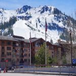
The Green Mountains form the mountainous backbone of Vermont, running north–south through much of the state and creating one of the defining landscapes of New England. Forested summits, narrow mountain passes, clear streams, ski areas, and long-distance hiking trails make the range central to Vermont’s geography and outdoor culture.
The Green Mountains are part of the broader Appalachian mountain system. They are one of several major ranges within the Northern Appalachians, alongside the White Mountains of New Hampshire and mountainous regions farther north in Maine and Canada.
The highest point in the Green Mountains is Mount Mansfield, which reaches approximately 4,395 feet (1,340 meters) above sea level. Although modest in elevation compared with the great ranges of western North America, the Green Mountains can be surprisingly rugged. Steep trails, rocky ridges, extensive forests, heavy winter snowfall, and rapidly changing weather give them a distinctly mountainous character.
For a broader view of how the range fits into eastern North America, see the Map of the Appalachian Mountain Range.
⚡ Fast Facts
| Feature | Details |
|---|---|
| Continent | North America |
| Country | United States; related mountain terrain continues into Canada |
| Primary State | Vermont |
| Parent Mountain System | Appalachian Mountains |
| General Orientation | North–south |
| Highest Peak | Mount Mansfield |
| Highest Elevation | About 4,395 feet / 1,340 meters |
| Mount Mansfield Prominence | About 3,635 feet / 1,108 meters |
| Mount Mansfield Isolation | About 51.95 miles / 83.61 kilometers |
| Major Long-Distance Trail | Long Trail |
| Long Trail Length | 272 miles |
| Major Protected Area | Green Mountain National Forest |
📍 Where Are the Green Mountains?
The Green Mountains extend along the central portion of Vermont, forming a north–south chain between the Massachusetts state line and the Canadian border.
Rather than forming a single uninterrupted ridge, the range consists of numerous peaks, ridges, passes, valleys, and subsidiary mountain groups. The mountains divide many of Vermont’s river systems and strongly influence the state’s topography.
To the west are the Champlain Valley and the Taconic Mountains, while the terrain generally descends eastward toward the Connecticut River Valley.
Mountainous terrain continues beyond Vermont. To the south, related Appalachian highlands include the Berkshire Hills of Massachusetts and Connecticut. North of the international border, the Green Mountain geological and topographic belt continues into southern Quebec, where the Sutton Mountains are associated with the same broader mountain region.
The Green Mountains are an important component of the larger collection of Mountain Ranges in the U.S..
📏 Elevation and Highest Peaks
The Green Mountains do not reach the elevations found in the Rocky Mountains, Sierra Nevada, or Cascade Range, but several Vermont summits rise above 4,000 feet.
Vermont has five generally recognized 4,000-foot mountains:
- Mount Mansfield
- Killington Peak
- Mount Ellen
- Camel’s Hump
- Mount Abraham
Mount Mansfield is the highest.
Modern LiDAR measurements and traditional published elevations sometimes differ by several feet, so exact figures can vary among maps, trail guides, and peak databases.
Mount Mansfield
Mount Mansfield reaches approximately 4,395 feet and is both the highest summit in the Green Mountains and the highest point in Vermont.
Peakbagger calculates the mountain’s prominence at approximately 3,635 feet and its isolation at nearly 52 miles, making Mansfield an unusually prominent summit for the northeastern United States.
Its elongated summit ridge is famous for resembling the profile of a human face when seen from certain directions. Features along the ridge have consequently acquired names such as the Forehead, Nose, Lips, Chin, and Adam’s Apple.
The highest point is the Chin.
Killington Peak
Killington Peak is one of southern Vermont’s dominant mountains and is generally considered the state’s second-highest summit.
The mountain is especially well known because of Killington Resort, one of New England’s major ski destinations.
Camel’s Hump
Camel’s Hump is one of Vermont’s most recognizable mountains. Its distinctive profile and largely undeveloped upper slopes make it one of the iconic natural landmarks of the state.
The Long Trail crosses the mountain close to its summit.
Mount Ellen and Mount Abraham
Mount Ellen and Mount Abraham rise along the high ridge of the central Green Mountains. Both are crossed by the Long Trail and are popular destinations for hikers exploring Vermont’s 4,000-foot peaks.

🪨 Geology of the Green Mountains
The Green Mountains contain an exceptionally long and complicated geological record.
Some of the rocks exposed within the mountain core are Precambrian gneisses more than a billion years old. These ancient basement rocks are represented in geological units such as the Mount Holly Complex.
Around and above these ancient rocks are younger metamorphosed sedimentary and volcanic formations that accumulated during later chapters in the geological development of eastern North America.
Schist, gneiss, quartzite, amphibolite, marble, and other metamorphic rocks occur within different parts of the Green Mountains.
The region was repeatedly deformed and metamorphosed as ancient landmasses and volcanic arcs collided during the formation of the Appalachian Mountains. These mountain-building episodes folded, faulted, buried, heated, and altered the rocks that now make up Vermont’s mountainous interior.
Erosion subsequently removed enormous quantities of material from the ancestral Appalachians.
Today’s Green Mountains are therefore not simply the remains of one mountain-building event. Their rocks preserve evidence from extremely ancient continental crust as well as later tectonic events associated with the development of the Appalachian mountain system.
🌲 Forests and Plant Life
Forests dominate the Green Mountains and are responsible for much of their characteristic appearance.
At lower and middle elevations, northern hardwood forests are common. Typical trees include:
- Sugar maple
- American beech
- Yellow birch
At higher elevations and in colder locations, coniferous species become increasingly important. Red spruce and balsam fir are characteristic of many high-elevation forests.
Some of the highest and most exposed areas support specialized mountain vegetation adapted to cold temperatures, strong winds, thin soils, and short growing seasons.
These fragile summit environments are one reason hikers are encouraged to remain on established paths, particularly around heavily visited mountains such as Mount Mansfield and Camel’s Hump.
🦌 Wildlife
The extensive forests of the Green Mountains provide habitat for a wide range of northeastern wildlife.
Animals found within the broader mountain region include:
- American black bears
- White-tailed deer
- Moose
- Beavers
- Wild turkeys
- Numerous small mammals
- Forest birds
- Amphibians associated with mountain streams and wetlands
Streams, ponds, forests, wetlands, and elevation changes create a variety of habitats within a relatively compact region.
Wildlife sightings are never guaranteed, and visitors should avoid approaching or feeding wild animals.
🥾 The Long Trail
No hiking route is more closely associated with the Green Mountains than Vermont’s Long Trail.
The Long Trail follows the main ridge of the Green Mountains for approximately 272 miles, traveling from the Massachusetts–Vermont border north to the Canadian border.
Construction began after the Green Mountain Club was established in 1910, and the trail was built between 1910 and 1930. It is recognized as the oldest long-distance hiking trail in the United States.
The route crosses or approaches many of Vermont’s best-known peaks, including:
- Mount Mansfield
- Camel’s Hump
- Mount Abraham
- Mount Ellen
- Killington Peak
- Stratton Mountain
- Bromley Mountain
The trail is not an easy walk simply because the elevations are relatively low. Many sections are steep, rocky, root-covered, wet, muddy, and remote.
Thru-hikers attempting the entire route experience an exceptionally varied cross-section of the Green Mountains.
🥾 The Appalachian Trail in the Green Mountains
The Appalachian Trail also passes through Vermont.
For approximately 100 miles in southern Vermont, the Appalachian Trail and Long Trail use the same footpath.
They enter Vermont together from Massachusetts and travel north through the southern Green Mountains, crossing mountains including Stratton and Bromley.
Near Killington, the routes separate. The Appalachian Trail turns generally eastward toward New Hampshire while the Long Trail continues northward along the Green Mountains toward Canada.
This section connects the Green Mountains directly with the enormous Appalachian hiking corridor stretching from Georgia to Maine.
🌲 Green Mountain National Forest
Much of the southern and central Green Mountains is protected within Green Mountain National Forest.
The national forest contains hundreds of miles of trails as well as streams, ponds, mountain ridges, recreation areas, and designated wilderness.
Its protected wilderness areas include:
- Aiken Wilderness
- Big Branch Wilderness
- Breadloaf Wilderness
- Bristol Cliffs Wilderness
- Glastenbury Wilderness
- Joseph Battell Wilderness
- Lye Brook Wilderness
- Peru Peak Wilderness
The U.S. Forest Service manages the area for multiple purposes that include recreation, wildlife habitat, watershed protection, conservation, forestry, and other public uses.
The forest also contains portions of the Long Trail, Appalachian Trail, and other recreational trail systems.
🏔️ Notable Mountains of the Green Mountains
Beyond Vermont’s five 4,000-foot summits, numerous mountains contribute to the character of the range.
Jay Peak
Jay Peak rises in northern Vermont close to the Canadian border. Its location exposes it to substantial winter snowfall, and the mountain has become particularly well known for skiing.
Stratton Mountain
Stratton Mountain is an important summit in the southern Green Mountains and is crossed by the combined Appalachian Trail and Long Trail.
The mountain is also historically associated with the early development of the Long Trail and Appalachian Trail concepts.
Bromley Mountain
Bromley Mountain rises in southern Vermont and is crossed by the Appalachian Trail/Long Trail corridor.
It is also home to a major ski area.
Pico Peak
Pico Peak stands near Killington Peak and is one of the prominent mountains of central Vermont.
Glastenbury Mountain
Glastenbury Mountain rises within the heavily forested Glastenbury Wilderness of southern Vermont. Its surrounding landscape is considerably more remote than many of the ski-oriented areas elsewhere in the range.
🌤️ Weather and Climate
The Green Mountains strongly influence Vermont’s weather.
Elevation generally brings cooler temperatures, stronger winds, increased snowfall, and more rapidly changing conditions than nearby valleys.
Winters can be long and snowy, particularly at higher elevations. These conditions have helped make the Green Mountains one of the important skiing regions of the northeastern United States.
Summer conditions are usually milder, but thunderstorms, heavy rain, fog, and sudden temperature changes are possible.
Autumn is famous for colorful hardwood foliage, while spring can bring one of the most difficult hiking periods of the year.
Snowmelt and rainfall frequently saturate mountain soils during Vermont’s spring mud season. Heavy trail use during this period can damage trails and surrounding vegetation.
🍁 Best Time to Visit the Green Mountains
The best time depends on the activity.
Summer
Summer is one of the most popular seasons for hiking, backpacking, camping, and exploring mountain towns.
Higher elevations are generally cooler than surrounding valleys, although hikers should still be prepared for heat, thunderstorms, rain, and rapidly changing conditions.
Autumn
Late September and early October frequently bring brilliant fall foliage to Vermont, although peak color varies from year to year and by elevation.
Autumn is consequently one of the busiest and most scenic periods in the Green Mountains.
Winter
The Green Mountains become a major skiing, snowboarding, snowshoeing, and winter recreation destination.
Mountain conditions can nevertheless become severe. Snow, ice, high winds, low temperatures, and limited daylight require appropriate winter preparation.
Spring
Spring is often the least favorable period for hiking.
The Green Mountain Club encourages hikers to avoid vulnerable high-elevation trails during mud season when saturated soils can be easily damaged.
🎿 Skiing in the Green Mountains
The combination of mountainous terrain and snowy winters has made skiing an important part of the Green Mountains’ recreational identity.
Major ski areas are associated with mountains and ridges throughout Vermont, including areas near:
- Stowe
- Killington
- Sugarbush
- Jay Peak
- Stratton
- Bromley
Ski development occupies only selected portions of the range. Large areas remain forested, roadless, protected, or primarily used for backcountry recreation.
🧭 Mountain Passes and Notches
Roads crossing the Green Mountains frequently use lower passes and narrow gaps through the range.
One of the best known is Smugglers’ Notch, a narrow mountain passage between Mount Mansfield and the Sterling Range.
Other mountain gaps have historically influenced transportation, settlement, recreation, and communication across Vermont.
Because the range runs approximately north–south, east–west transportation often requires crossing these higher ridges or following river valleys through them.

📜 Why Are They Called the Green Mountains?
The history of the name is more complicated than a frequently repeated story suggesting that French explorer Samuel de Champlain named the mountains les Monts Verts.
Quebec’s Commission de toponymie notes that evidence does not support Champlain as the originator of the name.
Written use of Green Mountain is associated with the eighteenth century, and the name was connected with the Green Mountain Boys during the years preceding the American Revolution.
The name Vermont itself derives from French words meaning approximately “green mountain,” but historical evidence suggests that the relationship between the English and French mountain names developed later than the popular Champlain story implies.
The mountains eventually became so strongly identified with Vermont that the state is widely known as the Green Mountain State.
🥾 Hiking the Green Mountains
Hiking opportunities range from short woodland walks to strenuous summit ascents and multiweek backpacking trips.
Popular objectives include Mount Mansfield, Camel’s Hump, Killington Peak, Mount Abraham, Stratton Mountain, and numerous sections of the Long Trail.
Trail conditions can vary dramatically.
Hikers may encounter:
- Wet rocks
- Exposed roots
- Mud
- Steep ascents
- Stream crossings
- Snow and ice
- Strong summit winds
- Fog and poor visibility
Mileage alone is therefore not always a good indication of difficulty in the Green Mountains.
🏔️ Field Guide Tip: Vermont trails can be considerably rougher than their elevations suggest. Check current trail and road conditions before leaving, carry rain protection and appropriate layers, and avoid fragile high-elevation trails during severe spring mud conditions.
🧭 Green Mountains vs. White Mountains
The Green Mountains and White Mountains are neighboring parts of the Northern Appalachian region, but they are distinct mountain ranges.
The Green Mountains are centered in Vermont.
The White Mountains lie primarily in New Hampshire and contain substantially higher summits. Mount Washington reaches 6,288 feet, nearly 1,900 feet higher than Mount Mansfield.
Both ranges contain rugged hiking, extensive forests, severe winter weather, and sections of the Appalachian Trail, but their geology, topography, and individual mountain groups differ.
🧭 Green Mountains vs. Taconic Mountains
The Taconic Mountains rise west and southwest of the main Green Mountain axis.
Although both belong to the broader Appalachian region and occur close together in Vermont, they represent distinct geological and physiographic mountain belts.
This distinction is important because the term “Green Mountains” is sometimes used informally for almost any mountainous terrain in Vermont.
Geographically and geologically, not every Vermont mountain belongs to the Green Mountains.
💡 Interesting Facts About the Green Mountains
- Mount Mansfield is the highest mountain in both the Green Mountains and Vermont.
- The range forms much of Vermont’s central mountainous spine.
- The Long Trail follows the Green Mountains for approximately 272 miles.
- The Long Trail is recognized as the oldest long-distance hiking trail in the United States.
- The Appalachian Trail and Long Trail share approximately 100 miles in southern Vermont.
- Vermont has five generally recognized summits exceeding 4,000 feet.
- The mountains contain Precambrian rocks more than a billion years old.
- Green Mountain National Forest protects large portions of the southern and central range.
- The Sutton Mountains of southern Quebec are associated with the northward continuation of the Green Mountain mountain belt.
❓ Frequently Asked Questions
What is the highest mountain in the Green Mountains?
Mount Mansfield is the highest summit in the Green Mountains and the highest point in Vermont, reaching approximately 4,395 feet above sea level.
Where are the Green Mountains?
The Green Mountains extend primarily through Vermont from the Massachusetts border north toward Quebec, Canada.
Are the Green Mountains part of the Appalachian Mountains?
Yes. The Green Mountains form part of the Northern Appalachian mountain system.
How long is the Long Trail?
The Green Mountain Club lists the Long Trail at approximately 272 miles from the Massachusetts–Vermont border to the Canadian border.
Does the Appalachian Trail cross the Green Mountains?
Yes. The Appalachian Trail enters southern Vermont and shares approximately 100 miles with the Long Trail before turning east toward New Hampshire near Killington.
How many 4,000-foot mountains are in Vermont?
Five Vermont mountains are generally recognized as exceeding 4,000 feet: Mount Mansfield, Killington Peak, Mount Ellen, Camel’s Hump, and Mount Abraham.
Are the Green Mountains difficult to hike?
Difficulty varies dramatically. Some trails are relatively moderate, while routes on Mount Mansfield, Camel’s Hump, and other high peaks can be steep, rocky, slippery, and strenuous.
Are the Green Mountains and Berkshires the same range?
They are closely related parts of the Appalachian highlands, but naming conventions change across state boundaries. The Green Mountains name is primarily associated with Vermont, while mountainous terrain farther south in Massachusetts and Connecticut is generally known as the Berkshires or Berkshire Hills.
Do the Green Mountains continue into Canada?
The mountain belt continues into southern Quebec, where the Sutton Mountains are associated with the Green Mountains’ northward continuation.
🔗 Related Articles
- Map of the Appalachian Mountain Range
- Mountain Ranges in the U.S.
- White Mountains
- Cumberland Mountains
- Great Smoky Mountains
- The World’s Top 100 Mountain Ranges
📚 Sources
- U.S. National Park Service — New England Province
- U.S. Geological Survey — A Transect Across the Basement Massifs of the Central Green Mountains, Vermont
- U.S. Geological Survey — Geolex: Underhill Publications
- U.S. Forest Service — Green Mountain and Finger Lakes National Forests
- U.S. Forest Service — Green Mountain National Forest Hiking
- Green Mountain Club — The Long Trail
- Green Mountain Club — How to Hike the VT 5
- Appalachian Trail Conservancy — Vermont
- Peakbagger — Mount Mansfield
- Commission de toponymie du Québec — Montagnes Vertes