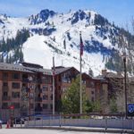
Mount Williamson

🏔️ Overview
Mount Williamson is one of the giants of California’s Sierra Nevada. Rising to approximately 14,379 feet (4,383 meters), it is the second-highest mountain in California, surpassed only by nearby Mount Whitney.
Despite its impressive height, Mount Williamson receives far fewer visitors than Whitney. Reaching the summit generally requires a long, strenuous wilderness approach followed by off-trail travel and scrambling. The mountain rises dramatically above the Owens Valley, producing an imposing eastern profile that is especially prominent from the vicinity of Manzanar.
Mount Williamson lies within the John Muir Wilderness of Inyo National Forest. Its proximity to Mount Whitney, Mount Tyndall, Shepherd Pass, and some of the wildest high country of the southern Sierra Nevada makes it an important summit for experienced Sierra mountaineers.
⚡ Fast Facts
| Fact | Details |
|---|---|
| Continent | North America |
| Country | United States |
| State/Province | California |
| County/Region | Inyo County |
| Mountain Range | Sierra Nevada |
| Parent Peak | Mount Whitney |
| Elevation | 14,379.4 feet / 4,382.9 meters |
| Prominence | 1,721.1 feet / 524.7 meters |
| Isolation | 5.4 miles / 8.7 kilometers |
| Nearest Higher Neighbor (NHN) | Mount Whitney |
| Coordinates | 36.65593° N, 118.31121° W |
| First Recorded Ascent | 1884 |
| First Recorded Climbers | William L. Hunter and C. Mulholland |
| Protected Area | John Muir Wilderness, Inyo National Forest |
| Common Approach | Shepherd Pass and Williamson Bowl |
📍 Location
Mount Williamson stands in eastern California, along the eastern side of the southern Sierra Nevada. The summit is approximately 6 miles north of Mount Whitney and about a mile east of the main Sierra Crest.
Unlike many major Sierra summits that lie directly along the crest, Williamson rises slightly east of it. This position places the entire summit within Inyo County and contributes to its extraordinary appearance from the Owens Valley.
The mountain towers above the region between Lone Pine and Independence. One of the most striking views is from Manzanar National Historic Site, where the National Park Service identifies Mount Williamson as the large mountain directly west of the historic site.
Shepherd Pass provides the principal trail access to the high country west of Williamson. The pass sits at approximately 12,000 feet and is reached by one of the Sierra Nevada’s more strenuous approach trails.
The mountain is relatively close to Mount Whitney geographically, but climbing the two peaks can feel very different. Whitney has an established trail reaching its summit, while a normal ascent of Williamson involves much more remote terrain, navigation and scrambling.
📏 Elevation & Prominence
Modern LiDAR-derived figures published by Peakbagger place the summit of Mount Williamson at approximately 14,379.4 feet (4,382.9 meters).
Older U.S. Geological Survey maps and publications commonly listed the elevation as 14,370 feet. Differences such as these are common among high mountains because survey methods, vertical datums and modern elevation datasets have changed over time.
At either measurement, Mount Williamson remains California’s second-highest mountain and one of the highest summits in the contiguous United States.
Peakbagger calculates its topographic prominence at approximately 1,721 feet (525 meters). Its key col is Vacation Pass.
The mountain has about 5.4 miles (8.7 kilometers) of topographic isolation. Peakbagger identifies Mount Whitney, located to the south, as its nearest higher neighbor.
These numbers make Mount Williamson a substantial independent mountain rather than simply a subsidiary point on the Sierra Crest.
🪨 Geology
Mount Williamson forms part of the vast Sierra Nevada batholith, the enormous complex of intrusive igneous rocks underlying much of the Sierra Nevada.
The batholith developed during the Mesozoic Era when large bodies of magma formed deep within Earth’s crust. Rather than erupting at the surface, much of this molten material cooled underground, forming granitic plutons.
Later uplift and erosion stripped away the overlying material and exposed the resistant granitic rocks that now characterize much of the High Sierra.
The dramatic relief seen today resulted from much younger tectonic uplift combined with erosion. The eastern Sierra Nevada rises abruptly beside the Owens Valley, producing one of the steepest mountain fronts in the western United States.
Glaciers also reshaped the high elevations during repeated cold periods. Around Mount Williamson, their influence can be seen in steep-walled basins, rugged cirques, polished rock and the alpine landscape of Williamson Bowl.
Mount Williamson is therefore not a volcano. Its rock formed deep underground as part of a much larger plutonic system and was exposed millions of years later.
🌿 Flora & Fauna
The enormous elevation difference between the Owens Valley and Mount Williamson’s summit creates a dramatic series of ecological zones.
The lower portions of the Shepherd Pass approach begin in the dry environment along the eastern base of the Sierra Nevada. Climbers gradually move through increasingly mountainous vegetation before eventually reaching the sparse alpine zone.
Near timberline, growing conditions become progressively harsher. Strong winds, intense sunlight, cold nighttime temperatures and a short growing season limit vegetation. Above roughly 12,000 feet, much of the landscape consists of exposed rock, talus and scattered alpine plants.
One of the most important animals associated with the area is the Sierra Nevada bighorn sheep. Mount Williamson lies within a region historically managed specifically for the protection of these rare mountain sheep.
Other wildlife of the High Sierra may include marmots, pikas, mule deer and numerous alpine and subalpine bird species, although wildlife distribution varies considerably with elevation and season.
Visitors should observe wildlife from a distance and avoid disturbing animals, particularly in sensitive alpine environments.

🥾 Hiking & Climbing Routes
Mount Williamson is not normally considered a conventional hiking summit. Even its standard route involves an exceptionally demanding approach followed by cross-country travel and scrambling.
Shepherd Pass and the West Side Route
The most commonly used route begins with the Shepherd Pass Trail.
The Forest Service describes Shepherd Pass Trail as long, steep and challenging. It climbs roughly 6,000 vertical feet from the Owens Valley to the approximately 12,000-foot pass.
From the high-country trailhead used by hikers, Shepherd Pass is roughly 12 miles away. A persistent snowfield below the pass can remain well into summer during some years.
After reaching Shepherd Pass, climbers leave the main trail system and travel through Williamson Bowl, a barren alpine basin between Mount Williamson and Mount Tyndall.
The route then crosses talus and boulders toward Williamson’s west face. The final ascent follows steep gullies and scrambling terrain to reach the broad summit area.
Sections of the standard west-side route are generally considered Class 3 scrambling, making this considerably more technical than a normal maintained hiking trail.
Route finding is important. Loose rock, exposure, lingering snow and changing conditions can substantially increase the difficulty.
George Creek and the Southeast Slopes
Another historic route approaches Mount Williamson through George Creek on its eastern side.
The upper climbing is technically easier in places than the standard west-side route, but the approach is substantially less straightforward. Bushwhacking, rough terrain and difficult route finding have traditionally made George Creek a serious wilderness undertaking.
The first recorded ascent of Mount Williamson in 1884 was made by William L. Hunter and C. Mulholland using the southeast side of the mountain.
Technical Routes
Mount Williamson also has numerous technical climbing routes on its steep faces and ribs. These are mountaineering objectives requiring skills beyond those needed for the standard route.
🏔️ Field Guide Tip: Do not judge Mount Williamson by its summit elevation alone. The combination of a very long approach, enormous elevation gain, off-trail navigation, scrambling and high altitude makes it one of California’s more demanding fourteeners.
Wilderness Permits
An Inyo National Forest wilderness permit is required for overnight travel in the John Muir Wilderness.
The Forest Service currently operates a trailhead quota system during the main permit season from May 1 through November 1. Permits are reserved through Recreation.gov.
Rules and conditions can change, so climbers should check current Inyo National Forest information before beginning a trip.
🌤️ Best Time to Visit
For most climbers using the standard route, summer through early autumn offers the most practical conditions.
July, August and September often provide the greatest likelihood of largely snow-free terrain, but conditions vary substantially from year to year. Heavy Sierra winters can leave steep snowfields well into summer.
Climbers should also consider the effects of altitude. The summit rises above 14,000 feet, where temperatures can fall rapidly and wind can make conditions much colder than in the Owens Valley below.
Afternoon thunderstorms are another summer concern in the Sierra Nevada. Lightning above timberline can be extremely dangerous because there is little shelter on exposed ridges and summit terrain.
Early starts are generally advisable for high Sierra objectives.
Spring ascents can involve serious snow climbing and may require an ice axe, crampons and avalanche knowledge. Winter ascents are major mountaineering undertakings.
🧭 Nearby Mountains & Attractions
Mount Whitney
Located about six miles south, Mount Whitney rises to approximately 14,505 feet and is the highest summit in California and the contiguous United States.
Mount Tyndall
Mount Tyndall rises immediately west of the Williamson area along the Sierra Crest. Its steep granite profile is a dominant feature above Williamson Bowl and Shepherd Pass.
Manzanar National Historic Site
Manzanar lies in the Owens Valley east of the Sierra Nevada. The mountain directly west of the historic site is Mount Williamson, making Manzanar one of the most accessible places from which to appreciate Williamson’s enormous eastern relief.
💡 Fun Facts
- Mount Williamson is the second-highest mountain in California, behind only Mount Whitney.
- It is commonly ranked as the sixth-highest summit in the contiguous United States.
- Despite its height, Williamson is substantially less visited than nearby Whitney because reaching it requires a much longer and more complicated wilderness journey.
- Its nearest higher neighbor is Mount Whitney, approximately 5.4 miles away.
- The mountain was named for Lt. Robert Stockton Williamson, an American military officer and surveyor associated with the Pacific Railroad Surveys.
- The first documented ascent occurred in 1884, although an earlier ascent may have taken place in 1881.
- Mount Williamson is the dominant mountain visible directly west of Manzanar National Historic Site.
- Its summit stands more than 8,000 vertical feet above the nearby eastern base of the Sierra Nevada over a remarkably short horizontal distance.

❓ Frequently Asked Questions
How high is Mount Williamson?
Modern LiDAR-based data place Mount Williamson at approximately 14,379.4 feet (4,382.9 meters). Older USGS sources commonly list an elevation of 14,370 feet.
Is Mount Williamson the second-highest mountain in California?
Yes. Only Mount Whitney is higher. Williamson is also higher than North Palisade, California’s third-highest major summit.
Where is Mount Williamson?
Mount Williamson is in Inyo County, California, within the John Muir Wilderness of Inyo National Forest. It rises on the eastern side of the Sierra Nevada north of Mount Whitney.
Can you hike to the summit of Mount Williamson?
There is no maintained hiking trail all the way to the summit. The standard approach follows Shepherd Pass Trail before leaving maintained trails for Williamson Bowl and the west face. The upper route requires off-trail navigation and Class 3 scrambling.
How difficult is Mount Williamson?
Mount Williamson is considered a strenuous mountaineering objective. The standard route combines a very long approach, more than 8,000 feet of overall elevation gain from the eastern Sierra foothills, high-altitude travel, talus, route finding and exposed scrambling.
What is the easiest route up Mount Williamson?
The southeast slopes from George Creek are sometimes described as technically easier, with mostly Class 2 terrain, but the approach involves substantial route finding and rough travel. The West Side Route via Shepherd Pass and Williamson Bowl is the more commonly used approach.
Do you need a permit to climb Mount Williamson?
An Inyo National Forest wilderness permit is required for overnight trips entering the John Muir Wilderness. Climbers should check current regulations before their trip because permit quotas, fire restrictions and wilderness rules can change.
What is Mount Williamson’s nearest higher mountain?
Peakbagger identifies Mount Whitney as Mount Williamson’s nearest higher neighbor. Whitney lies approximately 5.4 miles to the south.
Is Mount Williamson a volcano?
No. Mount Williamson is largely associated with the granitic rocks of the Sierra Nevada batholith. These rocks crystallized from magma deep underground and were later exposed through uplift and erosion.
🔗 Related Articles
- Mount Whitney
- North Palisade
- Mount Langley
- Mountain Ranges in the U.S.
- The World’s Top 100 Mountain Ranges
📚 Sources
- Peakbagger — Mount Williamson, California
- U.S. Forest Service — Shepherd Pass Trail
- U.S. Forest Service — Wilderness Permits
- U.S. Geological Survey — Sierra Nevada Batholith
- U.S. Geological Survey — Elevations of Named Summits Over 14,000 Feet
- National Park Service — Manzanar Frequently Asked Questions
- Wikipedia — Mount Williamson