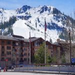
Rakaposhi (راکاپوشی)

🏔️ Overview
Rising dramatically above Pakistan’s Hunza and Nagar valleys, Rakaposhi is one of the most recognizable mountains in the Karakoram. Its summit reaches 7,788 meters (25,551 feet), but its extraordinary appearance comes from the immense vertical distance between its icy summit and the surrounding river valleys.
From the Hunza River, Rakaposhi rises approximately 5,900 meters (19,350 feet) over a horizontal distance of roughly 11 kilometers. This exceptional local relief gives the mountain a towering presence that rivals peaks higher in absolute elevation.
Rakaposhi belongs to the Rakaposhi–Haramosh Mountains, a subrange of the Karakoram. Its broad, glacier-covered massif dominates the landscape south of the Hunza River and is visible from numerous locations along the Karakoram Highway.
The mountain is also known as Dumani, commonly translated as “Mother of Mist” or “Mother of Clouds.” Its main name is often interpreted as “Shining Wall,” a fitting description of the enormous snow-covered slopes that gleam above the valleys on clear days.
Unlike many remote Karakoram giants, Rakaposhi can be admired from roads, villages, and established trekking routes. Reaching its summit, however, is an entirely different undertaking: the mountain remains a serious high-altitude climbing objective with steep terrain, significant avalanche exposure, and relatively few successful ascents.
⚡ Fast Facts
| Fact | Details |
|---|---|
| Continent | Asia |
| Country | Pakistan |
| State/Province | Gilgit-Baltistan |
| County/Region | Nagar District; Nagar, Hunza, and Bagrot valley region |
| Range | Rakaposhi–Haramosh Mountains, Karakoram |
| Parent Peak | K2 |
| Elevation | 7,788 meters (25,551 feet) |
| Prominence | 2,818 meters (9,245 feet) |
| Isolation | 40.89 kilometers (25.41 miles) |
| NHN | Batura Sar |
| Coordinates | 36.142428° N, 74.490038° E |
| Alternative Names | Dumani; Rakapushi |
| Mountain Classification | Ultra-prominent peak |
| World Elevation Ranking | Approximately 26th or 27th, depending on ranking criteria |
| First Recorded Ascent | June 25, 1958 |
| First Ascensionists | Mike Banks and Tom Patey |
| First Ascent Route | Southwest Spur/Ridge |
| Primary Trekking Gateway | Minapin village |
| Popular Viewpoint | Rakaposhi View Point near Ghulmet on the Karakoram Highway |
📍 Location
Rakaposhi stands in Gilgit-Baltistan, northern Pakistan, in the mountainous region surrounding the Nagar, Hunza, and Bagrot valleys.
Its northern slopes face the Hunza River corridor, while the broader massif extends toward valleys south and east of the main Karakoram Highway. The mountain’s location near this major transportation route makes it considerably more visible to travelers than many equally impressive Karakoram summits.
Minapin, a village in Nagar District, is the principal starting point for the popular Rakaposhi Base Camp trek. The settlement lies close to the Karakoram Highway and provides access to trails climbing through cultivated land, forested slopes, and alpine pastures toward the Minapin Glacier.
Another well-known viewing area is Rakaposhi View Point, often associated with Ghulmet and sometimes called Rakaposhi Zero Point. From this roadside location, visitors can see the mountain rising directly above glacier-fed streams and the surrounding valley.
Although Rakaposhi is closely associated with Hunza tourism, it is important to distinguish the mountain’s location from the broader destinations used to describe it. Rakaposhi stands prominently above the Nagar side of the valley, while viewpoints throughout both Nagar and Hunza offer different perspectives.

📏 Elevation & Prominence
Rakaposhi reaches 7,788 meters (25,551 feet) above sea level, placing it among the highest independent mountains on Earth.
Its exact position in global rankings varies according to which summits are included and how independence is defined. Peakbagger ranks Rakaposhi 26th among its listed mountains exceeding 7,200 meters, while other references commonly describe it as the world’s 27th-highest mountain.
The mountain has a topographic prominence of 2,818 meters (9,245 feet). Because this exceeds the 1,500-meter threshold for an ultra-prominent peak, Rakaposhi qualifies as an ultra.
Some mapping services report slightly different prominence measurements, reflecting differences in terrain models and the elevation assigned to the mountain’s key col. Peakbagger’s figure of 2,818 meters is used here.
Rakaposhi’s nearest higher neighbor is Batura Sar, which rises to approximately 7,795 meters (25,574 feet). Although Batura Sar is only about seven meters higher, it lies approximately 40.89 kilometers (25.41 miles) to the north.
Perhaps more impressive than any ranking is Rakaposhi’s local relief. The mountain rises almost 5,900 meters above the Hunza River valley over a comparatively short horizontal distance. This steep transition from valley floor to high summit creates one of the most dramatic mountain walls in the Karakoram.
🪨 Geology
Rakaposhi occupies a region shaped by the continuing convergence of the Indian and Eurasian tectonic plates.
The broader collision between these continental landmasses created the immense mountain systems of High Asia, including the Himalayas and the Karakoram. Over millions of years, compression, crustal thickening, faulting, uplift, and erosion produced the steep topography visible throughout Gilgit-Baltistan.
The Gilgit–Hispar region contains a complex mixture of igneous and metamorphic rocks, reflecting multiple stages of mountain building and geological transformation. These rocks were uplifted and exposed as rivers and glaciers cut deeply into the landscape.
Glaciation has played an equally important role in shaping Rakaposhi. Snow accumulating at high elevations feeds glaciers that move down the mountain’s flanks, carving valleys, transporting broken rock, and building extensive moraine deposits.
The Minapin Glacier occupies part of the landscape between Rakaposhi and nearby Diran. Its debris-covered ice, crevasses, and steep surrounding slopes provide a vivid example of how active glaciers continue to reshape the Karakoram.
The combination of ongoing uplift and powerful erosion helps explain why Rakaposhi rises so abruptly above neighboring valleys. Rivers cut downward while tectonic forces raise the surrounding mountains, producing exceptional vertical relief.

🌿 Flora & Fauna
Rakaposhi’s enormous elevation range creates several distinct environmental zones.
At lower elevations, villages in the Nagar and Hunza valleys support orchards, cultivated fields, and stands of trees maintained through carefully managed irrigation. Apricot trees are especially associated with the region, and spring blossoms add color to settlements beneath the snow-covered peaks.
As trekking routes climb away from the valley floor, vegetation transitions into shrubs, grasses, scattered trees, and seasonal alpine meadows. During the warmer months, these higher pastures support grazing livestock and a variety of flowering plants adapted to a short growing season.
Above the meadows, vegetation becomes increasingly sparse. Exposed rock, moraine, permanent snow, and glacial ice dominate the upper mountain, where only specialized organisms can survive.
The wider Karakoram region provides habitat for wildlife including ibex, foxes, marmots, birds of prey, and elusive snow leopards. The presence of particular species varies by elevation, season, and habitat, and sightings are never guaranteed.
Large birds such as eagles and vultures may be observed circling above the valleys, while smaller mountain birds inhabit rocky slopes and areas with more established vegetation.
Human communities are also central to the mountain’s ecological landscape. Farming, grazing, tourism, and glacier-fed water supplies all connect local livelihoods to the seasonal conditions of the surrounding mountains.
🥾 Hiking & Climbing Routes
Rakaposhi Base Camp Trek
The best-known way to experience Rakaposhi without attempting a technical ascent is the trek from Minapin village to Rakaposhi Base Camp.
The route climbs through cultivated land and wooded slopes before reaching mountain pastures and viewpoints overlooking the Minapin Glacier. The main base-camp area is commonly known as Taghafari, although its spelling varies.
Depending on the exact starting point and destination, the full out-and-back hike may cover approximately 18 kilometers (11 miles) and involve around 1,400 meters (4,600 feet) of elevation gain.
Some strong, acclimatized hikers complete the trip in one long day, but many visitors prefer spending two or three days on the route. An overnight itinerary allows more time to enjoy the scenery, manage the steep ascent, and experience the mountain in early morning or evening light.
A common intermediate stopping point is Hapakun, also spelled Hakapun. This meadow and camping area divides the climb into more manageable sections.
The route should not be mistaken for a casual walk simply because it is more accessible than major Karakoram expeditions. Steep grades, sun exposure, changing weather, and increasing altitude can make the hike demanding.
Diran Base Camp Extension
Some trekkers extend their trip toward Diran, a neighboring mountain that rises to approximately 7,266 meters (23,839 feet).
This extension may involve traveling near or across glaciated terrain. Glacier routes can contain hidden crevasses, unstable ice, loose moraine, and rapidly changing conditions.
Anyone considering a glacier crossing should obtain current local guidance and use an experienced guide when conditions or personal experience require it. Ordinary hiking ability does not substitute for glacier-travel knowledge.
Southwest Spur/Ridge
The Southwest Spur/Ridge was the route used during Rakaposhi’s first recorded ascent.
On June 25, 1958, Mike Banks and Tom Patey reached the summit as members of a British-Pakistani expedition. Banks later described the climb in the Himalayan Journal, documenting the expedition’s planning, difficult conditions, and successful summit push.
Although the southwest route is historically significant, it remains a serious mountaineering objective involving high altitude, snow and ice, steep terrain, and substantial objective hazards.
Northwest Ridge and North Spur
Subsequent expeditions established routes on the Northwest Ridge and North Spur, both of which involve long and difficult climbing through heavily glaciated terrain.
A Polish-Pakistani expedition completed an ascent by the Northwest Ridge in 1979, while a Japanese team climbed the North Spur during the same year. Later parties revisited these routes using different expedition styles and varying amounts of fixed equipment.
These routes are appropriate only for highly experienced mountaineers with advanced technical skills, expedition support, acclimatization, and the necessary permits.
South Face and Southeast Ridge
In 2019, Japanese climbers Kazuya Hiraide and Kenro Nakajima completed an outstanding ascent of Rakaposhi by the South Face and Southeast Ridge.
Their route involved approximately 4,000 meters of climbing from base camp and required a committing journey through steep snow, unstable weather, and high-altitude terrain.
The ascent received a 2020 Piolet d’Or, recognizing its exploratory character, difficulty, and climbing style.
🏔️ Field Guide Tip: For most visitors, the best Rakaposhi experience is an overnight trek from Minapin to the Taghafari meadows. Start early, allow time for the steep climb, and avoid entering glaciated terrain without the skills, equipment, and local guidance the conditions require.

🌤️ Best Time to Visit
The most practical season for visiting Rakaposhi’s viewpoints and trekking routes generally extends from late spring through early autumn.
May and June can bring green valleys, flowering vegetation, and comparatively fresh snow on the surrounding mountains. However, lingering snow may affect higher sections of the trail, especially early in the season.
July and August are popular trekking months because longer days and warmer temperatures make overnight trips more manageable. At the same time, heat, increased glacial melt, thunderstorms, landslides, and unstable mountain conditions can create additional hazards.
September and early October often provide comfortable daytime temperatures, clearer skies, and the beginning of autumn color in the Hunza and Nagar valleys. Conditions can change quickly as the season advances, particularly at higher elevations.
Winter brings colder temperatures, shorter days, snow-covered trails, and a higher likelihood of access difficulties. Roadside viewpoints may still be rewarding when conditions are clear, but trekking becomes more challenging and should be planned around current weather and local advice.
Regardless of season, visitors should check road conditions, forecasts, and local guidance before traveling. Mountain visibility can disappear quickly when clouds settle over the massif.
🧭 Nearby Mountains & Attractions
Diran
Diran stands near Rakaposhi in the same broader mountain group and rises to 7,266 meters (23,839 feet).
The two mountains share a dramatic glaciated landscape, and some trekking itineraries combine views of both peaks.
Batura Sar
Batura Sar rises to approximately 7,795 meters (25,574 feet) in the Batura Muztagh.
It is Rakaposhi’s nearest higher neighbor and lies roughly 41 kilometers to the north. Despite the small difference in elevation, the two mountains belong to different Karakoram subranges.
Ultar Sar
Ultar Sar rises sharply above the Hunza Valley and is closely associated with the scenery around Karimabad.
Its steep walls and proximity to major valley settlements make it another defining feature of the wider Hunza landscape.
Haramosh Peak
Haramosh Peak reaches approximately 7,409 meters (24,308 feet) and belongs to the same broader Rakaposhi–Haramosh mountain system.
Like Rakaposhi, it is known for dramatic relief, difficult climbing, and relatively limited summit traffic.
Distaghil Sar
Distaghil Sar rises to 7,885 meters (25,869 feet) in the Hispar Muztagh.
Although it occupies a different Karakoram subrange, it provides useful geographic context for understanding the concentration of exceptionally high mountains across northern Pakistan.
Hunza and Nagar Valleys
The Hunza and Nagar valleys offer mountain viewpoints, historic settlements, orchards, traditional architecture, and access to numerous trekking routes.
Karimabad, Minapin, and nearby villages serve as practical bases for exploring the region. Seasonal apricot blossoms, summer greenery, and autumn foliage create dramatically different experiences throughout the year.
Karakoram Highway
The Karakoram Highway follows the mountain corridor through northern Pakistan toward the Chinese border.
Several stretches of the road offer views of Rakaposhi, particularly around Ghulmet and the Nagar Valley. For travelers who cannot undertake the base-camp trek, the highway provides some of the most accessible perspectives on the mountain.

💡 Fun Facts
- Rakaposhi rises approximately 5,900 meters above the Hunza River valley, making its local relief exceptionally dramatic.
- Its nearest higher neighbor, Batura Sar, is only about seven meters taller.
- The alternative name Dumani is commonly translated as “Mother of Mist” or “Mother of Clouds.”
- Rakaposhi qualifies as an ultra-prominent peak because its prominence exceeds 1,500 meters.
- Mike Banks and Tom Patey reached the summit on June 25, 1958.
- The mountain is frequently ranked either 26th or 27th in the world, depending on the list and summit-selection criteria.
- Rakaposhi can be viewed directly from the Karakoram Highway, unlike many high Karakoram mountains that require lengthy expeditions to see.
- The 2019 ascent by Kazuya Hiraide and Kenro Nakajima received a 2020 Piolet d’Or.
- Nearby Diran identifies Rakaposhi as its nearest higher neighbor, while Rakaposhi’s own nearest higher neighbor is Batura Sar.
❓ FAQ

How high is Rakaposhi?
Rakaposhi is 7,788 meters (25,551 feet) above sea level.
Where is Rakaposhi located?
Rakaposhi is located in Gilgit-Baltistan, northern Pakistan, in the mountainous region surrounding the Nagar, Hunza, and Bagrot valleys.
Is Rakaposhi in the Himalayas?
No. Rakaposhi belongs to the Karakoram, which is a separate mountain range from the Himalayas.
What does Rakaposhi mean?
Rakaposhi is commonly interpreted as “Shining Wall.” Its alternative name, Dumani, is often translated as “Mother of Mist” or “Mother of Clouds.”
Is Rakaposhi the 26th- or 27th-highest mountain in the world?
Both rankings appear in published references. Peakbagger places Rakaposhi 26th on its list of major mountains exceeding 7,200 meters, while other sources commonly rank it 27th. The difference reflects how individual mountain lists define and count independent summits.
Who first climbed Rakaposhi?
Mike Banks and Tom Patey completed the first recorded ascent on June 25, 1958, as members of a British-Pakistani expedition.
What is the nearest higher mountain to Rakaposhi?
The nearest higher mountain is Batura Sar, located approximately 40.89 kilometers (25.41 miles) to the north.
Can you hike to Rakaposhi Base Camp?
Yes. The most popular route begins in Minapin village and climbs toward the meadows at Taghafari. Depending on the itinerary, the trek can take one long day or a more comfortable two to three days.
How difficult is the Rakaposhi Base Camp trek?
The trek is generally considered moderate to strenuous because of its steep ascent, elevation gain, and changing mountain conditions. It does not require a summit climb, but hikers should be physically prepared and equipped for mountain weather.
Can beginners climb Rakaposhi?
No. Rakaposhi is a technically demanding high-altitude mountain with significant avalanche, weather, and glacier hazards. The summit should be attempted only by experienced mountaineers with appropriate expedition support.
When is the best time to visit Rakaposhi?
Late spring through early autumn generally offers the best conditions for sightseeing and trekking. May, June, September, and early October can be particularly rewarding, although local weather and trail conditions should always be checked.
Can Rakaposhi be seen from the Karakoram Highway?
Yes. Rakaposhi is visible from multiple locations along the Karakoram Highway, including the popular viewing area near Ghulmet.
🔗 Related Articles
- Mountains in Pakistan: Highest Peaks, Major Ranges, and Trekking Guide
- Karakoram
- Batura Sar
- Diran
- Haramosh Peak
- Ultar Sar
- Distaghil Sar
- K2
- Hiking Gear: Essential Equipment for Every Trail
📚 Sources
- Rakaposhi — Peakbagger
- Rakaposhi Climbed — The Himalayan Club
- Rakaposhi, South Face and Southeast Ridge — Piolets d’Or
- Rakaposhi View Point — Gilgit-Baltistan Tourism Department
- Geology of the Gilgit-Hispar Area, Pakistan — U.S. Geological Survey
- Satellite Image Atlas of Glaciers of the World: Asia — U.S. Geological Survey