
Shishapangma (Xixabangma, Shisha Pangma, Gosainthan)

Rising to 8,027 meters (26,335 feet) in the Himalayas of Tibet, Shishapangma is the 14th-highest mountain on Earth and the lowest of the world’s fourteen recognized eight-thousanders. Although it stands only slightly above the 8,000-meter threshold, there is nothing modest about this enormous, heavily glaciated mountain.
Shishapangma is particularly unusual among the great Himalayan peaks because it lies entirely within the Tibet Autonomous Region of China. Unlike Mount Everest, Cho Oyu, Makalu, and several other eight-thousanders associated with Tibet, its summit does not sit on an international border.
Its relative isolation, distinctive summit ridge, enormous glaciers, and dramatic southwest face have given Shishapangma an important place in mountaineering history. It was also the last of the fourteen eight-thousanders to receive a recorded first ascent, when a Chinese-Tibetan expedition reached the summit in 1964.
🏔️ Overview
Shishapangma rises in Nyalam County in southern Tibet, a short distance north of the Nepalese border. It belongs to the central Himalayas and is generally associated with the Jugal Himal, which continues southward toward Nepal and is closely connected geographically with the Langtang Himal.
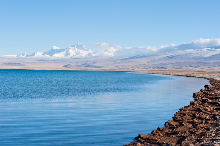
The mountain appears especially impressive from the Tibetan Plateau. Unlike peaks that rise from deep valleys on the southern side of the Himalayas, Shishapangma emerges above broad expanses of high grassland and glaciated terrain.
Its name has several spellings, including Shishapangma, Shisha Pangma, Shishasbangma, and Xixabangma. It has also historically been known as Gosainthan, a Sanskrit-derived name generally interpreted as meaning the “abode of God” or “place of the saint.”
One interpretation of the Tibetan name, associated with geologist Toni Hagen, translates it roughly as the “crest above the grassy plains.” The name is especially fitting when the great snow-covered mountain is viewed rising above the comparatively open Tibetan landscape.
⚡ Fast Facts
| Fact | Details |
|---|---|
| Continent | Asia |
| Country | China |
| State/Province | Tibet Autonomous Region |
| County/Region | Nyalam County, Shigatse |
| Range | Himalayas — Jugal Himal |
| Parent Peak | Annapurna I |
| Elevation | 8,027 m / 26,335 ft |
| Prominence | Approximately 2,906 m / 9,534 ft |
| Isolation | Approximately 91 km / 56.5 mi |
| NHN | Cho Oyu |
| Coordinates | 28.351962° N, 85.781102° E |
| World Elevation Rank | 14th |
| Classification | Eight-thousander; ultra-prominent peak |
| First Ascent | May 2, 1964 |
| First Winter Ascent | January 14, 2005 |
| Location | Entirely within Tibet, China |
📍 Location
Shishapangma stands in south-central Tibet, close to the border between China and Nepal. The summit itself, however, lies entirely on the Chinese side.
The mountain rises north of Nepal’s Langtang region and forms part of an exceptionally rugged section of the central Himalayas. Nearby ridges contain a number of substantial satellite mountains, including Porong Ri, Pungpa Ri, and Molamenqing, also known as Phola Gangchen.
To the east lies Cho Oyu, the sixth-highest mountain in the world and Shishapangma’s nearest higher neighbor. Farther east are Mount Everest, Lhotse, Makalu, and many of the other giants of the central Himalayas.
Shishapangma is also located within the wider Qomolangma National Nature Preserve, an immense protected landscape encompassing much of southern Tibet’s highest mountain country.
Unlike Everest, which rises amid a dense concentration of enormous neighboring summits, Shishapangma appears relatively solitary when seen from some northern viewpoints. This visual separation helps give the mountain its distinctive presence above the Tibetan Plateau.

📏 Elevation & Prominence
Shishapangma reaches an accepted elevation of 8,027 meters (26,335 feet), making it the 14th-highest mountain on Earth.
It is therefore the lowest of the traditional fourteen eight-thousanders, but only by a narrow margin. Gasherbrum II, the next mountain on the list, reaches approximately 8,035 meters—only about eight meters higher.
Peakbagger lists Shishapangma with approximately 2,906 meters (9,534 feet) of topographic prominence, making it an exceptionally independent summit and qualifying it easily as an ultra-prominent mountain.
Its topographic isolation is about 91 kilometers (56.5 miles).
The nearest higher mountain is Cho Oyu, located roughly east-southeast of Shishapangma.
The Main Summit and Central Summit
One of the most important details about Shishapangma is the distinction between its true main summit and its slightly lower Central Summit.
The Central Summit is commonly listed at roughly 8,008–8,013 meters, depending on the source and measurement used. Reaching it does not necessarily mean a climber has reached Shishapangma’s true 8,027-meter summit.
The two are separated by an exposed section of high-altitude ridge.
This distinction has played an important role in mountaineering records. Some historical expeditions believed to have climbed Shishapangma were later judged to have stopped at the Central Summit rather than continuing to the true highest point.
For climbers pursuing all fourteen eight-thousanders, accurately identifying the true summit has therefore become especially important.
🪨 Geology
Shishapangma is not simply another Himalayan summit built from a generic mixture of sedimentary and metamorphic rocks. The mountain has attracted considerable geological attention because much of the massif is composed of a large body of Himalayan leucogranite.
Scientific research describes the Shisha Pangma pluton as one of the major leucogranitic intrusions exposed along the Himalayan metamorphic core.
Leucogranite is a relatively light-colored granite rich in minerals such as quartz and feldspar. The Shishapangma intrusion also contains varying combinations of muscovite, tourmaline, garnet, and biotite.
Radiometric dating of different phases of the granite indicates major intrusive activity during the Miocene, roughly 20 to 17 million years ago.
The massif also lies near the South Tibetan Detachment system, an enormous network of faults that records some of the complex deformation accompanying the uplift and evolution of the Himalayas.
Shishapangma’s geology is therefore part of a much larger story. The collision of the Indian continental plate with Eurasia compressed, thickened, heated, uplifted, and deformed Earth’s crust, ultimately producing both the Tibetan Plateau and the Himalayan mountain belt.
Glaciers, freeze-thaw weathering, avalanches, rockfall, and continuing erosion have since sculpted the enormous ridges, faces, and valleys visible today.
🌿 Flora & Fauna
The summit and upper slopes of Shishapangma are far too high and cold to support plant life. Much of the mountain consists of exposed rock, snow, glaciers, and permanent ice.
Conditions change dramatically at lower elevations.
The Tibetan landscape surrounding the mountain includes alpine grasslands, cold steppe, rocky slopes, wetlands, and high-elevation shrub communities. During the short growing season, grasses, sedges, cushion plants, and other hardy alpine vegetation can survive in sheltered areas.
Shishapangma lies within the broader Qomolangma protected landscape, which supports a surprisingly diverse community of high-altitude wildlife.
Animals of the wider region include species adapted to extreme Himalayan and Tibetan environments, such as:
- Snow leopards
- Blue sheep
- Tibetan wild ass, or kiang
- Tibetan antelope
- Wolves
- Himalayan marmots
- Various high-altitude raptors and other mountain birds
These animals primarily inhabit the lower valleys, plateaus, cliffs, and alpine environments rather than Shishapangma’s permanently frozen upper slopes.
The enormous elevation difference across the protected region creates a series of ecological zones, progressing from relatively productive valleys and grasslands to alpine desert and finally permanent snow and ice.
🥾 Hiking & Climbing Routes
Shishapangma is sometimes described as one of the more straightforward eight-thousanders by its standard northern route. That description can be dangerously misleading.
At more than 8,000 meters, the mountain exposes climbers to extreme altitude, avalanche terrain, crevasses, severe cold, high winds, unstable snow, and prolonged time within the death zone. There is no easy eight-thousander.
Northern Route
The traditional approach comes from the Tibetan side and follows glacier terrain before climbing toward the mountain’s northern slopes and summit ridge.
The original 1964 Chinese expedition approached from the north via the Yebakongal Glacier system. Variations of the northern route eventually became the most commonly used approaches to Shishapangma.
The terrain leading toward the Central Summit is less technically difficult than many routes on other eight-thousanders. The final journey toward the true summit, however, can involve a significantly more serious and exposed ridge traverse.
This is one reason the Central Summit has occasionally been mistaken for a complete ascent.
Southwest Face
Shishapangma looks radically different from the south.
Its southwest face rises more than 2,000 meters above the glacier below, creating an enormous wall of snow, ice, and rock.
In 1982, British climbers Roger Baxter-Jones, Alex MacIntyre, and Doug Scott completed a major alpine-style ascent of the southwest face. Their climb became one of the landmark achievements in Shishapangma’s mountaineering history.
Numerous additional routes and variations have since been established across the massif.
Extreme High-Altitude Hazards
Regardless of route, climbers face hazards including:
- Acute mountain sickness and other altitude illnesses
- Avalanches
- Crevasses
- Serac collapse
- Cornices
- Hurricane-force winds
- Extreme cold
- Whiteout conditions
- Sudden storms
- Exhaustion and dehydration
- Difficult evacuation from remote terrain
The mountain’s upper slopes are especially exposed to winds associated with the jet stream.
🏔️ Field Guide Tip: Shishapangma’s reputation as one of the “easier” eight-thousanders refers only to comparative technical difficulty on certain routes. An 8,027-meter summit remains an extreme expedition requiring advanced mountaineering experience, acclimatization, specialized equipment, logistical support, and favorable conditions.

🧗 First Ascent of Shishapangma
Shishapangma was the last of the fourteen eight-thousanders to be climbed.
Although explorers and surveyors had observed the mountain decades earlier, access to Tibet was highly restricted during much of the early era of Himalayan mountaineering.
Chinese teams carried out reconnaissance expeditions in 1961 and 1963. During the 1963 expedition, climbers reached approximately 7,160 meters.
A much larger Chinese-Tibetan expedition returned in 1964.
Led by Xu Jing, the expedition established a series of camps on the northern side of the mountain. On May 2, 1964, ten members of the team reached the summit.
The achievement completed the first-ascent era of the world’s fourteen recognized 8,000-meter mountains. Annapurna I had been the first eight-thousander climbed in 1950; Shishapangma completed the group fourteen years later.
Foreign access remained extremely limited afterward, which helps explain why the second ascent did not occur until 1980.
❄️ First Winter Ascent
Shishapangma remained unclimbed in calendar winter for another four decades.
Italian climber Simone Moro and Polish mountaineer Piotr Morawski reached the 8,027-meter summit on January 14, 2005.
Their ascent followed a route on the southern side of the mountain and involved extraordinary cold, wind, snow, and technical climbing.
The American Alpine Journal records Moro’s account of the final summit push, during which the pair climbed from their high camp and reached the summit at approximately 1:13 p.m.
The ascent added Shishapangma to the relatively small group of eight-thousanders that had received successful winter ascents at that time.
🌤️ Best Time to Visit
For ordinary travelers viewing Shishapangma from the Tibetan Plateau, conditions vary greatly with elevation and season.
The spring and autumn months generally provide some of the clearest periods for seeing the high Himalayas, although weather at these elevations is never predictable.
Mountaineering expeditions traditionally concentrate on relatively limited seasonal weather windows, especially during spring and autumn.
Winter brings extreme cold and powerful winds, while summer is influenced by the broader Asian monsoon system. Shishapangma lies north of the main Himalayan crest and is consequently drier than many mountains on the Nepalese side, but heavy snow and storms remain possible.
Travel and climbing access in Tibet is regulated, and permit requirements can change. Anyone planning a trip should verify current access rules through appropriate authorities or licensed operators before making arrangements.
🧭 Nearby Mountains & Attractions
Shishapangma occupies a remarkable section of the Himalayas surrounded by high peaks, glaciers, plateau landscapes, and protected wilderness.
Cho Oyu
Cho Oyu rises to more than 8,180 meters east of Shishapangma. It is Shishapangma’s nearest higher neighbor and the sixth-highest mountain on Earth.
Gyachung Kang
Gyachung Kang rises between Cho Oyu and Everest. At roughly 7,952 meters, it is famous for being the world’s highest mountain that does not reach the 8,000-meter threshold.
Molamenqing
Molamenqing, also known as Phola Gangchen, rises immediately east of Shishapangma. From some angles it forms a dramatic sharp summit beside the much larger Shishapangma massif.
Langtang Himal
The mountains south of Shishapangma continue toward Nepal’s Langtang region, where deep valleys and glaciated peaks create one of the most beautiful mountain landscapes in the central Himalayas.
Qomolangma National Nature Preserve
The wider protected landscape of southern Tibet encompasses Shishapangma along with some of Earth’s highest mountains and most extensive high-altitude environments.

💡 Fun Facts
- Shishapangma is the 14th-highest mountain in the world.
- At 8,027 meters, it is the lowest of the fourteen recognized eight-thousanders.
- It is the only eight-thousander located entirely within Tibet and entirely within China.
- Shishapangma was the last eight-thousander to receive a recorded first ascent, in 1964.
- The mountain has both a true main summit and a slightly lower Central Summit, creating complications in historical climbing records.
- Its nearest higher neighbor is Cho Oyu, about 91 kilometers away.
- Shishapangma is an ultra-prominent mountain, with more than 2,900 meters of prominence.
- Much of the massif consists of leucogranite, making it especially interesting to geologists studying the formation of the Himalayas.
- The first successful winter ascent was completed by Simone Moro and Piotr Morawski in January 2005.
- The mountain’s southwest face has produced some of the most important technical climbs in Himalayan mountaineering history.
❓ FAQ
How high is Shishapangma?
Shishapangma rises 8,027 meters (26,335 feet) above sea level.
Where is Shishapangma?
Shishapangma is located in Nyalam County in the Tibet Autonomous Region of China, near the border with Nepal.
What rank is Shishapangma among the world’s highest mountains?
Shishapangma is the 14th-highest mountain in the world.
Is Shishapangma an eight-thousander?
Yes. Shishapangma is one of the fourteen generally recognized mountains exceeding 8,000 meters in elevation.
Is Shishapangma in Nepal or China?
The mountain lies entirely within China, in Tibet. Unlike several other major Himalayan peaks, its summit is not on an international border.
What is Shishapangma’s nearest higher neighbor?
Its nearest higher neighbor is Cho Oyu, located roughly 91 kilometers to the east-southeast.
Who first climbed Shishapangma?
A Chinese-Tibetan expedition led by Xu Jing achieved the first ascent on May 2, 1964.
Why was Shishapangma the last eight-thousander to be climbed?
Its location entirely within Tibet meant access was tightly restricted during much of the early era of Himalayan mountaineering. Chinese reconnaissance and climbing teams eventually made the first ascent in 1964.
Is Shishapangma easy to climb?
No. Some northern routes are comparatively less technical than routes on other eight-thousanders, but Shishapangma remains an extreme high-altitude mountaineering expedition with serious avalanche, glacier, weather, and altitude hazards.
What is the difference between Shishapangma’s Central Summit and main summit?
The Central Summit is slightly lower than the mountain’s 8,027-meter true summit. Climbers reaching the Central Summit must continue across exposed high-altitude terrain to reach the mountain’s highest point.
🔗 Related Articles
- Cho Oyu
- Gyachung Kang
- Siguang Ri
- Labuche Kang III
- Melungtse: The Highest Mountain of the Rolwaling Himal
- Highest Mountains
- Top 30 Tallest Mountain Peaks in the World
- Mountains in China: A Guide to the Country’s Highest Peaks and Major Ranges
📚 Sources
- Peakbagger — World 8,000-Meter Peaks — elevation and prominence data.
- PeakVisor — Shishapangma — coordinates, isolation, nearest higher neighbor, and geographic data.
- The Himalayan Club — Shishapangma — geography, early exploration, first ascent, routes, weather, and mountaineering history.
- The Journal of Geology — Shisha Pangma Leucogranite, South Tibetan Himalaya — geology of the Shishapangma massif and leucogranite pluton.
- American Alpine Journal — Shishapangma, First Winter Ascent — account of the 2005 winter ascent by Simone Moro and Piotr Morawski.
- ExplorersWeb — A Short History of Shisha Pangma and Its Climbing Routes — summit geography, early reconnaissance, first ascent, southwest face, and route history.
- Qomolangma National Nature Preserve — protected-area geography and biodiversity of the wider region.
- Shishapangma — Wikipedia — cross-check for elevation, location, names, first ascent, and summit history.




