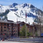
Mount Silverheels

Rising dramatically above South Park in central Colorado, Mount Silverheels is one of the most prominent and recognizable thirteeners in the Front Range. Modern LiDAR measurements place its summit at approximately 13,828 feet (4,215 meters), making it one of Colorado’s 100 highest ranked mountains.
Mount Silverheels is a Colorado Centennial Peak, currently ranking approximately #94 among the state’s highest ranked summits.
Elevation alone, however, does not explain why the mountain dominates the landscape.
Silverheels has roughly 2,300 feet of topographic prominence, making it one of Colorado’s most geographically independent high summits. Its broad slopes rise conspicuously above South Park and can be seen from Fairplay, Alma, Hoosier Pass, and many surrounding mountains.
Its Nearest Higher Neighbor and proximate parent is Mount Bross, while its prominence line parent is Mount Lincoln.
The mountain is also famous for something much less geological.
Local legend says Mount Silverheels was named for a mysterious nineteenth-century dance-hall performer known only as Silverheels, who reportedly remained in the mining camp of Buckskin Joe during a smallpox epidemic to care for sick residents.
Whether every detail of that story is historically verifiable is uncertain, but the legend has become one of the most enduring stories associated with Colorado’s mining era.
Today, Mount Silverheels provides a long but technically moderate alpine climb through forests, tundra, broad ridges, and off-trail terrain. There is currently no official maintained trail to the summit, making navigation and responsible cross-country travel important parts of the experience.
⚡ Fast Facts
| Feature | Details |
|---|---|
| Country | United States |
| State | Colorado |
| County | Park County |
| Nearest Towns | Alma and Fairplay |
| Mountain Range | Front Range |
| Greater Range | Rocky Mountains |
| Protected Land | Pike National Forest |
| Ranger District | South Park Ranger District |
| Elevation | 13,828 ft / 4,215 m |
| Older Map Elevation | Approx. 13,822–13,829 ft |
| Prominence | Approx. 2,284–2,297 ft / 696–700 m |
| Isolation | Approx. 5.3–5.5 mi / 8.5–8.8 km |
| Nearest Higher Neighbor (NHN) | Mount Bross |
| Proximate Parent | Mount Bross |
| Line Parent | Mount Lincoln |
| Key Col | Hoosier Pass, approx. 11,530–11,545 ft |
| Coordinates | 39.3394° N, 106.0053° W |
| Mountain Type | Eroded intrusive igneous mountain |
| Notable Geology | Mount Silverheels intrusive stock / porphyritic monzonitic rocks |
| Volcanic? | Ancient volcanic-intrusive center; modern mountain is not an active volcano |
| First Recorded Ascent | Unknown |
| Typical Summer Difficulty | Class 2 |
| Popular Route | North Spur from Hoosier Pass |
| Approx. Hoosier Pass Route | 9 mi round trip / ~3,500 ft gain |
| Colorado Rank | Approx. #94 |
| Prominence Rank | Around top 60 in Colorado |
| Notable Distinction | Colorado Centennial Peak |
🗺️ Where Is Mount Silverheels?
Mount Silverheels rises in Park County, Colorado, approximately five miles northeast of Alma and north of Fairplay.
The mountain stands east of the high Mosquito Range fourteeners, including:
- Mount Bross
- Mount Lincoln
- Mount Cameron
- Mount Democrat
To the north lies Hoosier Ridge and beyond it the mountains surrounding Breckenridge.
To the east spreads the enormous high-elevation basin of South Park.
Silverheels’ position on the edge of this broad basin makes it particularly visible.
From South Park, the mountain rises as a huge rounded mass rather than a sharp alpine pyramid.
Its summit may not look technically intimidating, but its size is deceptive.
The climb involves substantial distance, high elevation, and long periods above treeline.
🏔️ Front Range or Mosquito Range?
Mount Silverheels is generally classified within the Front Range rather than the neighboring Mosquito Range.
This can seem confusing because the mountain stands only a few miles east of major Mosquito Range peaks.
Hoosier Pass and the surrounding high ridges create a transition between several central Colorado mountain groups.
Modern peak databases place Silverheels within the:
Front Range → Central Front Range → Boreas-Georgia Passes area.
Immediately to the west, the mountains around Mount Lincoln and Mount Bross belong to the Mosquito Range.
This geographic position explains why the views from Silverheels include spectacular terrain from both ranges.
📏 Elevation
Modern LiDAR data gives Mount Silverheels an elevation of:
13,828 feet / 4,215 meters
Older sources commonly list:
- 13,822 feet
- 13,823 feet
- 13,829 feet
These minor differences reflect:
- Older contour mapping
- Survey methods
- Vertical datum conversions
- Modern LiDAR measurements
For current Mountain Field Guide purposes, 13,828 feet is the best figure to use.
🏆 Colorado Centennial Peak
Mount Silverheels belongs to the Colorado Centennial Peaks—the state’s 100 highest ranked summits.
Current LiDAR-based rankings place it around:
#94 in Colorado
That places Silverheels near the bottom of the Centennial list, but the distinction remains significant.
Completing Colorado’s Centennials is considerably more difficult than simply climbing the fourteeners.
Many Centennial thirteeners have:
- No maintained summit trail
- Long approaches
- Difficult route-finding
- Limited signage
- Few other hikers
Silverheels fits that pattern.
Its easiest terrain is moderate, but the lack of an official trail and considerable distance create a much more independent mountain experience than many popular fourteeners.
📐 Prominence
Mount Silverheels has approximately:
2,284–2,297 feet / roughly 700 meters
of topographic prominence.
Current high-resolution databases differ slightly in the exact saddle elevation, which explains the small range.
Either figure makes Silverheels one of Colorado’s more prominent mountains.
Lists of John currently places it around:
#60 in Colorado by prominence.
That is remarkable for a mountain ranked only around #94 by elevation.
Many higher peaks are much less geographically independent.
🧭 Key Col: Hoosier Pass
Mount Silverheels’ key saddle lies around Hoosier Pass.
Modern data places the relevant low point around:
11,530–11,545 feet
depending on the dataset.
The difference between this saddle and the 13,828-foot summit produces Silverheels’ roughly 2,300 feet of prominence.
Hoosier Pass crosses the mountains on Colorado Highway 9 between:
- Breckenridge
- Alma
The highway summit itself sits at roughly 11,540 feet.
It also serves as the starting point for one of the most popular routes on Mount Silverheels.
🧭 Nearest Higher Neighbor: Mount Bross
Mount Silverheels’ Nearest Higher Neighbor is Mount Bross.
Mount Bross rises west of Silverheels to approximately:
14,178 feet
using modern LiDAR measurements.
Bross is therefore roughly 350 feet higher.
It also serves as Silverheels’ proximate parent, meaning it is the most geographically immediate higher mountain associated with the summit.
🧭 Line Parent: Mount Lincoln
Prominence analysis identifies Mount Lincoln as Silverheels’ line parent.
Mount Lincoln rises to approximately:
14,293 feet
and is the highest peak of the Mosquito Range.
This creates an interesting relationship:
NHN / proximate parent: Mount Bross
Line parent: Mount Lincoln
The distinction results from how connecting ridges and key saddles lead toward progressively higher terrain.
📊 Mount Silverheels vs. Mount Bross
| Feature | Mount Silverheels | Mount Bross |
|---|---|---|
| Elevation | 13,828 ft | 14,178 ft |
| Prominence | ~2,284 ft | ~315 ft |
| Isolation | ~5.5 mi | ~1.1 mi |
| Colorado Rank | ~#94 | ~#22 |
| Fourteener? | No | Yes |
| Centennial? | Yes | Yes |
| Topographic Character | Highly independent | Subsidiary summit near Lincoln/Cameron |
| NHN Relationship | Bross is Silverheels’ NHN | Mount Cameron/Lincoln terrain higher nearby |
Mount Bross is about 350 feet higher.
Silverheels, however, has more than seven times as much prominence.
This is an excellent example of why mountain elevation and topographic independence are completely different measurements.
🗣️ The Legend of Silverheels
Mount Silverheels carries one of Colorado’s most memorable mountain names.
According to local legend, it honors a woman known as Silverheels who lived in the mining camp of Buckskin Joe during the early 1860s.
The settlement stood west of present-day Alma during the height of Colorado’s mining boom.
Silverheels was reportedly a dance-hall performer known for wearing distinctive silver-heeled shoes.
Her real name is uncertain.
Several versions of the story exist.
🦠 The Smallpox Epidemic
The central part of the legend concerns a smallpox outbreak around 1861.
According to the traditional story, many residents fled Buckskin Joe as the disease spread.
Silverheels remained.
She reportedly:
- Nursed sick miners
- Helped pay for medical care
- Tended the dying
- Eventually contracted smallpox herself
When the epidemic ended, surviving miners collected money to thank her.
But when they went to find Silverheels, she had disappeared.
👤 What Happened to Silverheels?
No reliable record explains what became of her.
The traditional legend says smallpox had badly scarred her face and that she withdrew from public life.
Some later versions claim that a mysterious veiled woman occasionally returned to place flowers on graves at Buckskin Joe.
Whether these stories describe a real individual or became embellished through decades of retelling cannot be determined with confidence.
Colorado Public Radio and South Park historical groups still present the story as one of the region’s enduring legends.
That distinction matters.
It should be described as legend, not as fully verified biography.
🏔️ Naming the Mountain
The final part of the story says the miners named the nearby mountain in gratitude for Silverheels’ compassion.
The name Mount Silverheels began appearing on Colorado maps by approximately the mid-1860s.
If so, that makes it one of the state’s unusual high summits named for a woman associated with Colorado’s mining frontier.
Whatever the precise historical details, the story has become inseparable from the mountain.
🏚️ Buckskin Joe
Buckskin Joe was one of the earliest major mining camps in the South Park region.
Gold discoveries attracted miners beginning around 1859–1860.
For a short period, the settlement became an important commercial and political center.
Like many mining camps, however, its fortunes changed rapidly.
Mining declined.
Residents moved away.
Buildings disappeared or were relocated.
Today, little remains of the original town.
The Silverheels story preserves one of Buckskin Joe’s most memorable cultural connections.
⛏️ Alma and Mining History
Nearby Alma became another important mining community.
The area surrounding Mount Silverheels, Mount Bross, Mount Lincoln, and Buckskin Gulch was heavily explored for:
- Gold
- Silver
- Lead
- Zinc
Old mining roads, prospects, claims, and mine structures remain scattered through the high country.
Some of the roads used by modern hikers originated as mining access routes.
Never enter abandoned mines.
Hazards include:
- Vertical shafts
- Collapse
- Toxic gases
- Unstable explosives
- Contaminated water
Historic mining structures should also be left undisturbed.
🪨 Geology of Mount Silverheels
Mount Silverheels has unusually interesting geology for a Front Range summit.
Much of the central Front Range consists of extremely ancient Precambrian rock.
Silverheels is different.
The mountain contains a much younger intrusive igneous complex known as the Mount Silverheels stock.
Modern geological mapping indicates that the Montgomery Gulch–Mount Silverheels area experienced substantial igneous intrusion roughly:
42–43 million years ago
during the Eocene.
This makes the rocks dramatically younger than the billion-year-old crystalline basement forming much of the surrounding Rockies.
🌋 Was Mount Silverheels a Volcano?
This question has a fascinating answer.
Mount Silverheels is not an intact volcanic cone today.
However, classic U.S. Geological Survey research interpreted the Mount Silverheels stock as lying within or near an ancient volcanic throat.
The idea comes partly from the unusual porphyritic rocks found on the mountain.
USGS geologists noted similarities between the Mount Silverheels porphyry and volcanic pebbles preserved in nearby sedimentary formations.
They suggested that the Silverheels intrusive body may represent magma solidified in the conduit beneath an ancient volcano.
If correct, today’s summit exposes the underground plumbing of a volcanic system whose original cone has long since disappeared.
🔥 What Is a Volcanic Throat?
A volcanic throat or neck forms when magma solidifies within a volcano’s main conduit.
After volcanic activity stops, erosion removes the surrounding:
- Lava
- Ash
- Loose volcanic debris
- Softer country rock
The harder intrusive material can remain.
Famous volcanic necks include features such as Shiprock in New Mexico.
Mount Silverheels is much broader and less dramatically shaped, but its geology may record a similar principle:
erosion exposing rock that once cooled beneath an ancient volcanic vent.
🪨 Mount Silverheels Porphyry
Historical geologists used the term Silverheels porphyry for some intrusive rocks in the district.
The rock is broadly described as quartz-poor monzonite porphyry.
It contains visible crystals including:
- Feldspar
- Hornblende
- Biotite
with accessory minerals such as:
- Magnetite
- Apatite
- Zircon
- Pyrite
The porphyritic texture indicates at least two stages of cooling.
Larger crystals began growing while magma cooled slowly underground.
The remaining melt later crystallized more quickly.
🧪 Monzonitic Intrusions
Modern mapping identifies a variety of intrusive rocks around Mount Silverheels ranging approximately from:
- Diorite
- Monzonite
- Quartz monzonite
These magmas intruded older rocks during repeated pulses of Tertiary igneous activity.
The same broad geological era produced extensive mineralization throughout central Colorado.
This helps connect Mount Silverheels geologically with the famous mining districts to the west around Alma, Leadville, and the Mosquito Range.
🌎 Building the Front Range
The broader Front Range rose mainly during the Laramide Orogeny, beginning roughly 70 million years ago.
Compression uplifted huge blocks of ancient crystalline rock.
As uplift continued, magma intruded portions of the crust.
The Mount Silverheels igneous center developed during the later part of this mountain-building history.
Erosion then removed enormous quantities of overlying material.
The mountain visible today is therefore the result of:
- Ancient crust formation
- Laramide uplift
- Eocene igneous intrusion
- Long-term erosion
- Pleistocene glacial modification
- Modern freeze-thaw weathering
🧊 Ice Age Effects
Mount Silverheels does not have the dramatic modern cirques found on some steeper Colorado peaks, but Pleistocene glaciers and periglacial processes affected the surrounding landscape.
The high basin around Hoosier Pass and nearby valleys contains evidence of past glaciation.
Cold-climate processes produced:
- Moraines
- Talus
- Rounded high ridges
- Glacial deposits
- Wet alpine basins
Even where true glacier ice did not occupy every slope, repeated freezing and thawing shattered rock.
That process continues today.
💧 Continental Divide Geography
Mount Silverheels lies immediately east of the Continental Divide.
Hoosier Pass crosses the divide west-northwest of the summit.
This creates an interesting watershed contrast.
Water falling west of the divide eventually reaches the:
Colorado River → Gulf of California / Pacific drainage
Water flowing east from Mount Silverheels enters systems associated with:
South Platte River → Platte River → Missouri River → Mississippi River → Gulf of Mexico
Silverheels itself lies primarily on the Atlantic-draining side.
The Continental Divide is only a short distance away.

🏞️ South Park
Mount Silverheels towers above South Park, one of Colorado’s great high mountain basins.
Despite the name, South Park is not a small recreational park.
It is a huge elevated valley surrounded by mountains.
Much of the basin lies around:
9,000–10,000 feet above sea level.
The Front Range rises to the east and north.
The Mosquito Range forms the western wall.
Silverheels stands prominently on the northwest edge.
This gives the mountain extraordinary views across an enormous portion of central Colorado.
🌊 Source-Water Importance
The Mount Silverheels roadless area also contains important water resources.
Beaver Creek supplies municipal water to Fairplay.
Streams and wetlands around the mountain contribute to the upper South Platte watershed.
That makes protection of:
- Alpine vegetation
- Wetlands
- Riparian corridors
- Water quality
important not merely for wildlife but for nearby communities.
🥾 Climbing Mount Silverheels
Mount Silverheels is generally a Class 2 mountain under dry summer conditions.
The technical difficulty is modest.
The physical effort is not.
Popular routes involve:
- Off-trail navigation
- Substantial elevation gain
- Long distances above 12,000 feet
- Tundra
- Scree
- Creek crossings
- Reascents after elevation losses
There is currently no official system trail leading to the summit.
Several informal routes are used.
🥾 Hoosier Pass North Spur Route
The most familiar approach begins at Hoosier Pass on Colorado Highway 9.
Current route descriptions give approximately:
9 miles round trip
with roughly:
3,500 feet of elevation gain.
The route is rated:
Class 2
The unusual part is that reaching Silverheels requires losing elevation after climbing Hoosier Ridge.
Hikers ascend from Hoosier Pass and then drop roughly 400 feet toward the north spur of Silverheels before climbing again.
That lost elevation must be regained on the return.
📊 Hoosier Pass Route
| Feature | Approximate Figure |
|---|---|
| Trailhead | Hoosier Pass |
| Trailhead Elevation | ~11,550 ft |
| Summit | 13,828 ft |
| Round Trip | ~9 miles |
| Elevation Gain | ~3,500 ft |
| Difficulty | Class 2 |
| Exposure | Moderate in places |
| Rockfall | Possible |
| Route-Finding | Moderate |
| Maintained Summit Trail | No |
Much of the route lies above treeline.
That makes weather particularly important.
🥾 Beaver Creek / West Ridge Route
Another route approaches from the west using the Beaver Creek drainage.
This route can use portions of Forest Road 659 before crossing Beaver Creek and climbing directly up Silverheels’ western slopes.
Terrain consists largely of:
- Grass
- Alpine tundra
- Scree
- Low rubble
The route is technically straightforward.
Access conditions and road quality can change, however.
Private property and mining claims also occur in parts of the broader area, so hikers should confirm legal access before choosing unconventional routes.
🥾 Tarryall Creek Approach
The Colorado Mountain Club also describes an eastern approach beginning near the Gold Dust Trailhead.
This route uses portions of:
- Gold Dust Trail
- Trout Creek Trail
before leaving maintained trail and climbing Silverheels’ northeast side.
Approximate statistics are:
9.4 miles round trip
with roughly:
3,800 feet of elevation gain.
This provides an alternative for hikers who prefer approaching from the South Park side.
🚫 No Official Summit Trail
The absence of an official trail is important.
U.S. Forest Service planning documents for the Silverheels Colorado Roadless Area specifically note that climbers reach the summit using:
- Non-system trails
- Cross-country routes
Common access has historically come from:
- Hoosier Pass
- Beaver Creek Road
- Crooked Creek Road
As of 2025–26, regional partners have been studying the possibility of creating a more sustainable formal summit route.
However, that project remains conceptual and requires additional design, environmental review, and approval.
Visitors should not assume a new official trail currently exists.
🐏 Bighorn Sheep and Trail Planning
One reason for the planning effort is wildlife protection.
The Silverheels bighorn sheep herd has experienced population concerns.
Increasing recreational use on:
- Ridgelines
- Drainages
- Alpine habitat
may contribute to stress during sensitive periods.
The goal of future trail planning is therefore not simply to make climbing easier.
It is to concentrate recreation in locations that reduce disturbance to wildlife and fragile tundra.
Until any official route is created, hikers should minimize unnecessary wandering and respect seasonal wildlife restrictions.
🌩️ Thunderstorms
Mount Silverheels is extremely exposed to summer weather.
Much of a Hoosier Pass climb occurs above:
12,000 feet.
Afternoon thunderstorms can develop rapidly.
Hazards include:
- Lightning
- Hail
- Heavy rain
- Strong wind
- Rapid cooling
Because the route is long and exposed, an early start is essential.
Do not plan merely to reach the summit before storms.
Allow enough time to descend from high ridges before thunderstorms arrive.
🌬️ Wind
Wind is another defining feature.
Mount Silverheels rises above open South Park with relatively few high barriers immediately to its east.
Strong winds are common during:
- Winter
- Spring
- Frontal weather changes
Even summer mornings can become extremely windy.
Wind chill can make temperatures feel dramatically colder than forecast conditions in Fairplay or Alma.
Carry wind-resistant layers regardless of valley weather.
❄️ Winter Climbing
Silverheels is also climbed during winter.
Its broad ridges make it a more approachable winter thirteener than many steep Colorado peaks.
The Hoosier Pass route is particularly popular.
That does not make winter climbing safe automatically.
Potential hazards include:
- Avalanche terrain
- Wind slabs
- Cornices
- Whiteouts
- Extreme cold
- Deep snow
- Wind-scoured ice
Some slopes and ski lines on the north side reach approximately 40 degrees.
Winter visitors need current avalanche information and appropriate skills.
📅 Best Time to Climb
For mostly snow-free hiking, the usual season is:
July through September
🌨️ June
Snow often remains across high ridges and drainages.
🌼 July
Routes generally become drier.
Wildflowers begin blooming.
Thunderstorms become frequent.
☀️ August
Often provides good dry hiking conditions.
Monsoon storms remain important.
🍂 September
Cool mornings and clearer weather can be excellent.
Early snow becomes possible later in the month.
❄️ October Through May
Winter or transitional conditions dominate.
Specialized snow and avalanche skills may be necessary.
🌿 Flora and Fauna
The Mount Silverheels landscape supports an unusually rich mixture of habitats.
The Forest Service’s Silverheels Colorado Roadless Area contains:
- Alpine tundra
- Spruce-fir forest
- Lodgepole pine forest
- Bristlecone pine
- Aspen
- Riparian wetlands
- Willow carrs
The range from approximately 10,500 feet to almost 13,830 feet creates several ecological zones within a relatively small area.
🌲 Engelmann Spruce and Subalpine Fir
Lower and middle slopes support forests containing:
- Engelmann spruce
- Subalpine fir
These species tolerate:
- Heavy snow
- Long winters
- Short summers
- Cold soils
As elevation increases, trees become shorter and more wind-shaped.
Eventually they give way to krummholz and then alpine tundra.
🌲 Lodgepole Pine
Lodgepole pine occurs on some lower slopes.
The species can colonize disturbed landscapes and tolerate relatively poor mountain soils.
Forests around the Silverheels roadless area have experienced a long history of:
- Fire
- Insect outbreaks
- Logging
- Mining disturbance
Modern lodgepole forests reflect both natural and human influences.
🌲 Bristlecone Pine
One of the most interesting trees in the region is the Rocky Mountain bristlecone pine.
Bristlecones can survive:
- Harsh winds
- Poor soils
- Intense cold
- Short growing seasons
Individual trees can live for extraordinary periods.
Their twisted forms reflect decades or centuries of exposure to severe mountain weather.
Forest Service descriptions specifically identify bristlecone pine within the Silverheels roadless landscape.
🌳 Aspen
Quaking aspen occurs at more moderate elevations.
Aspen groves are particularly conspicuous during autumn, when leaves turn bright:
- Yellow
- Gold
- Orange
Aspen also provides valuable wildlife habitat.
Groves often support richer understory vegetation than nearby conifer forests.
🌱 Alpine Tundra
The summit region is dominated by alpine tundra.
Colorado treeline occurs around:
11,500 feet, varying with exposure.
Silverheels rises more than 2,300 feet above that level.
Plants survive through adaptations including:
- Low growth
- Cushion forms
- Deep roots
- Hairy leaves
- Rapid flowering
Tundra can look durable but is extremely fragile.
Repeated footsteps can destroy vegetation that may require decades to recover.
🌺 Penland Eutrema
The Silverheels landscape supports a particularly important rare plant:
Penland eutrema (Eutrema penlandii)
The Forest Service identifies it as a federally protected species within the roadless area.
This small alpine plant occurs only in specialized high-elevation habitats in central Colorado.
Its presence makes careful recreational management especially important.
Hikers should never collect or deliberately disturb alpine plants.
🌾 Porter’s Feathergrass
Another sensitive plant in the area is Porter’s feathergrass (Ptilagrostis porteri).
This unusual grass is associated with wet high-elevation habitats and fen environments.
The Forest Service lists it as a sensitive species within the Silverheels area.
Such wetlands occupy only a small percentage of the alpine landscape but support disproportionately important biodiversity.
Avoid trampling wet meadows and willow areas whenever possible.
🐏 Bighorn Sheep
The Mount Silverheels area contains important Rocky Mountain bighorn sheep habitat.
The Forest Service identifies portions of the landscape as:
- Summer range
- Summer concentration areas
Bighorn sheep rely on open alpine terrain and steep escape slopes.
They can be particularly vulnerable to disturbance during sensitive seasonal periods.
Give sheep substantial space.
Do not alter your route to approach a herd for photographs.
🫎 Moose
Moose use summer habitat in portions of the Silverheels landscape.
They are most likely to occur in:
- Willow bottoms
- Riparian areas
- Wet meadows
Moose may appear slow and calm but can become aggressive when threatened.
Cows with calves require particularly generous space.
If a moose changes its behavior because of your presence, move away.
🐐 Mountain Goats
Mountain goats also occur in the broader alpine terrain.
Colorado’s mountain goat populations descend from animals introduced during the twentieth century.
They are superbly adapted to steep rocky landscapes.
Goats should never be:
- Fed
- Approached
- Encouraged to interact with hikers
Human salt can attract them unnaturally.
🦌 Elk and Mule Deer
The Silverheels roadless area provides habitat for both:
- Elk
- Mule deer
Elk use portions of the landscape during both summer and winter.
The eastern area includes elk calving habitat.
Mule deer use portions of the mountain as winter concentration and severe winter range.
Seasonal disturbances can therefore affect animals even when few hikers are present.
🐻 Black Bears and Mountain Lions
Lower forests support black bears and mountain lions.
Both usually avoid people.
Black bears feed opportunistically on:
- Plants
- Berries
- Insects
- Natural animal foods
Mountain lions rely heavily on deer and other prey.
Sightings near the exposed Silverheels summit are unlikely, but both species form part of the broader mountain ecosystem.
🐱 Canada Lynx
The Silverheels area contains habitat suitable for Canada lynx.
Lynx are rare and exceptionally difficult to see.
They are strongly associated with snowy forests supporting snowshoe hares, their primary prey.
The Forest Service identifies the roadless area as containing:
- Winter habitat
- Denning habitat
- Movement habitat
for lynx.
Maintaining connected forest landscapes is essential for the species.
🐦 White-Tailed Ptarmigan
The high tundra supports white-tailed ptarmigan.
These birds remain in alpine environments throughout the year.
Their plumage changes with the seasons.
During summer, they are mottled brown and gray.
During winter, they become almost completely white.
Ptarmigan are particularly vulnerable to recreation because they rely on tundra habitats directly crossed by hikers.
Watch carefully where you step.
🐿️ American Pika
Although not specifically highlighted in every Forest Service species list for Silverheels, the mountain’s abundant talus provides classic habitat for American pika.
Pikas live among boulder fields near and above treeline.
They do not hibernate.
Instead, they collect grasses and flowers during summer and store them in hay piles for winter.
Their sharp alarm calls are one of the characteristic sounds of Colorado alpine terrain.
🌎 Climate Change and Alpine Wildlife
Colorado contains roughly one-quarter of the alpine habitat remaining in the contiguous United States.
Species particularly dependent on this environment include:
- American pika
- White-tailed ptarmigan
- Brown-capped rosy-finch
Warming temperatures can gradually shift vegetation zones higher.
Alpine species face a simple problem:
Eventually there is no higher mountain left to move onto.
Protecting large alpine landscapes such as Mount Silverheels therefore has increasing conservation importance.
🌄 Summit Views
Mount Silverheels’ isolation gives it exceptional summit views.
To the west rise the Mosquito Range giants:
- Mount Bross
- Mount Lincoln
- Mount Cameron
- Mount Democrat
To the north are:
- Hoosier Ridge
- North Star Mountain
- Quandary Peak
- Tenmile Range
Far below spreads South Park.
On clear days, distant mountain groups can appear across a huge portion of central Colorado.
⛰️ Nearby Mountains
Mount Bross
Mount Bross rises west of Silverheels and is its Nearest Higher Neighbor and proximate parent.
Its modern elevation is approximately 14,178 feet.
Mount Lincoln
Mount Lincoln reaches approximately 14,293 feet and is Silverheels’ line parent.
It is also the highest mountain in the Mosquito Range.
Mount Cameron
Mount Cameron rises between Mount Lincoln and Mount Bross.
Although higher than Bross, it lacks enough prominence to qualify as an independently ranked fourteener under the traditional 300-foot rule.
Mount Democrat
Mount Democrat is another major fourteener in the Mosquito Range west of Silverheels.
It forms part of the well-known DeCaLiBron group.
Hoosier Ridge
Hoosier Ridge rises north of Silverheels to approximately 13,362 feet.
Interestingly, Silverheels is Hoosier Ridge’s nearest higher neighbor and parent mountain.
Bald Mountain
Bald Mountain rises farther north near Breckenridge to approximately 13,703 feet.
Despite being only about 125 feet lower than Silverheels, it is significantly farther from higher terrain in its own section of the Front Range.

📊 Mount Silverheels vs. Mount Lincoln
| Feature | Mount Silverheels | Mount Lincoln |
|---|---|---|
| Elevation | 13,828 ft | ~14,293 ft |
| Prominence | ~2,284 ft | ~3,860 ft |
| Colorado Rank | ~#94 | ~#8 |
| Fourteener? | No | Yes |
| Centennial? | Yes | Yes |
| Range | Front Range | Mosquito Range |
| Relationship | Lincoln is line parent | Higher parent terrain far beyond |
| Common Summer Difficulty | Class 2 | Class 2 |
Lincoln is more than 460 feet higher.
Both are highly prominent mountains, although Lincoln is significantly more dominant.
❓ Frequently Asked Questions
How high is Mount Silverheels?
Modern LiDAR data places the summit at approximately 13,828 feet (4,215 meters).
Where is Mount Silverheels?
It is in Park County, Colorado, northeast of Alma and north of Fairplay.
What mountain range is Mount Silverheels in?
It is generally classified in the Front Range, close to the boundary with the Mosquito Range.
Is Mount Silverheels a fourteener?
No.
It is a high thirteener.
Is Mount Silverheels a Colorado Centennial Peak?
Yes.
Current rankings place it approximately #94 among Colorado’s 100 highest ranked summits.
What is Mount Silverheels’ Nearest Higher Neighbor?
What is Mount Silverheels’ line parent?
How prominent is Mount Silverheels?
Approximately 2,300 feet, with current LiDAR datasets producing figures around 2,284–2,297 feet.
How isolated is Mount Silverheels?
Approximately 5.3–5.5 miles.
What is its key col?
The key saddle is associated with Hoosier Pass, around 11,530–11,545 feet.
Who was Silverheels?
Local legend describes Silverheels as a dance-hall performer who cared for sick miners during an 1861 smallpox epidemic at Buckskin Joe.
Her real identity and many details of the story remain uncertain.
Is the Silverheels story definitely true?
The broad story has been repeated for generations and the mountain name appeared on maps by the mid-1860s.
However, many biographical details cannot be independently verified.
It is best treated as an important South Park legend rather than a fully documented biography.
Who first climbed Mount Silverheels?
A definitive first-ascent record is not known.
Mining and surveying activity occurred throughout the area during the nineteenth century, making an early undocumented ascent very likely.
How difficult is Mount Silverheels?
The standard routes are generally Class 2 in dry summer conditions.
The challenge comes primarily from altitude, distance, off-trail navigation, weather, and elevation gain.
How long is the Hoosier Pass route?
Approximately 9 miles round trip with roughly 3,500 feet of elevation gain.
Is there an official trail to the summit?
No.
The summit is currently reached using informal non-system and cross-country routes.
A future sustainable trail has been discussed, but as of 2026 the project remains in the planning and environmental-review stages.
What is the best time to climb?
Generally July through September for mostly snow-free conditions.
Can Mount Silverheels be climbed in winter?
Yes, and the Hoosier Pass route is used by winter climbers.
However, avalanche terrain, wind, snow, cold, and whiteout conditions require winter mountain skills.
What wildlife lives around Mount Silverheels?
The broader landscape supports species including:
- Bighorn sheep
- Moose
- Elk
- Mule deer
- Mountain goats
- Black bears
- Mountain lions
- Canada lynx
- White-tailed ptarmigan
- American pika
Are there rare plants?
Yes.
The Forest Service identifies rare or sensitive species including Penland eutrema and Porter’s feathergrass in the Silverheels roadless area.
⭐ Why Mount Silverheels Is Special
Mount Silverheels is a mountain whose importance becomes clearer the more closely you examine it.
At first glance, it is simply another high Colorado thirteener.
It does not reach 14,000 feet.
Its summit is broad rather than jagged.
Its easiest climbing terrain is not technical.
But those simple impressions miss almost everything interesting about it.
Silverheels is one of Colorado’s 100 highest ranked mountains.
It rises roughly 2,300 feet above its key saddle, placing it among the state’s more prominent peaks.
Higher terrain does not appear for more than five miles.
From South Park, that independence gives the mountain an enormous visual presence.
Then there is the geology.
Silverheels contains a roughly 42–43-million-year-old intrusive center that USGS geologists have interpreted as potentially representing the throat or plumbing of an ancient volcano.
The original volcanic landscape disappeared long ago.
Erosion stripped it away and exposed rock that once cooled underground.
The human story is equally unusual.
According to South Park legend, the mountain commemorates a mysterious woman known as Silverheels who remained in Buckskin Joe during a deadly smallpox epidemic to care for sick miners.
Her real identity has disappeared into history, and the story accumulated details through generations of retelling.
Yet the name endured.
By the mid-nineteenth century, maps were already calling the mountain Mount Silverheels.
Today, another story is unfolding.
Recreation is increasing on the mountain even though no official summit trail exists.
At the same time, the surrounding landscape provides habitat for a vulnerable bighorn sheep herd, Canada lynx, ptarmigan, rare alpine plants, and fragile tundra.
Future trail planning must therefore balance access with conservation.
That combination makes Silverheels far more than an elevation statistic.
It is a 13,828-foot Centennial Peak, a major South Park landmark, an ancient igneous center, the mountain of one of Colorado’s most enduring frontier legends, and an important high-altitude ecosystem whose future depends on careful recreation and conservation.
🔗 Related Articles
- Mount Bross
- Mount Lincoln
- Front Range
- Mosquito Range
- The Rocky Mountains
- The 10 Highest Peaks in Colorado
- What Is Mountain Prominence?
📚 Sources
- Peakbagger — Mount Silverheels
- Lists of John — Mount Silverheels
- 14ers.com — Mount Silverheels North Spur from Hoosier Pass
- Colorado Mountain Club — Mount Silverheels
- Climb13ers — Mount Silverheels
- U.S. Forest Service — Silverheels Colorado Roadless Area Profile
- U.S. Geological Survey — Geology and Ore Deposits of the Front Range
- U.S. Geological Survey — Geology and Ore Deposits of the Front Range, Professional Paper 223
- Colorado Parks and Wildlife — Alpine Habitats
- Colorado Parks and Wildlife — American Pika
- National Park Service — South Park National Heritage Area
- Colorado Public Radio — Mt. Silverheels
- Outside 285 — Mount Silverheels Recreation Planning