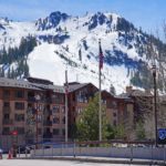
Mount Wilson

Mount Wilson rises to approximately 14,255 feet (4,345 meters) in southwestern Colorado’s spectacular San Miguel Mountains, a rugged subgroup of the San Juan Mountains. Its sharp summit, steep faces, loose gullies, and remote alpine basins make it one of Colorado’s most serious fourteeners, while its exceptional topographic prominence establishes it as one of the most geographically important mountains in the state.
The mountain is the highest summit of the San Miguel Mountains and the highest point in Dolores County. Modern LiDAR measurements place Mount Wilson at approximately 14,254.8 feet, normally rounded to 14,255 feet. The summit has roughly 4,020 feet of topographic prominence and an impressive 33.01 miles of isolation.
Its nearest higher neighbor and line parent is Uncompahgre Peak, the highest mountain in the broader San Juan Mountains.
Mount Wilson should not be confused with nearby Wilson Peak, another famous fourteener in the same mountain group. Mount Wilson is both higher and substantially more prominent.
The standard ascent follows the Southwest Slopes from Kilpacker Basin, a Class 3 route that replaced the historically popular North Slopes as the preferred standard because it generally offers more stable terrain. Even so, the climb involves significant exposure, loose rock, difficult route finding, a long wilderness approach, and a demanding final summit pitch.
⚡ Fast Facts
| Fact | Details |
|---|---|
| Mountain | Mount Wilson |
| Country | United States |
| State | Colorado |
| County | Dolores County |
| Mountain Range | San Miguel Mountains |
| Parent Range | San Juan Mountains |
| Mountain System | Rocky Mountains |
| Elevation | Approximately 14,255 ft / 4,345 m |
| LiDAR Elevation | 14,254.8 ft NAVD88 |
| Older Published Elevation | Approximately 14,246–14,252 ft |
| Prominence | Approximately 4,020 ft / 1,225 m |
| Isolation | Approximately 33.01 mi / 53.13 km |
| Nearest Higher Neighbor (NHN) | Uncompahgre Peak |
| Line Parent | Uncompahgre Peak |
| Key Col | Lizard Head Pass |
| Key Col Elevation | Approximately 10,235 ft |
| Colorado Fourteener | Yes |
| Colorado Elevation Rank | Approximately #16 |
| San Miguel Mountains High Point | Yes |
| Dolores County High Point | Yes |
| Current Standard Route | Southwest Slopes |
| Standard Difficulty | Class 3 |
| Standard Round Trip | About 12.5 mi |
| Standard Elevation Gain | About 4,400 ft |
| Standard Trailhead | Kilpacker |
| Trailhead Elevation | About 10,100 ft |
| Former Standard Route | North Slopes |
| North Slopes Difficulty | Class 4 |
| Nearby Fourteener | El Diente Peak |
| Wilderness | Lizard Head Wilderness |
| National Forest | San Juan National Forest |
| First Recorded Ascent | September 13, 1874 |
| First Recorded Climbers | A. D. Wilson, Franklin Rhoda and party |
| Namesake | A. D. Wilson |
Mount Wilson’s nearest higher neighbor is Uncompahgre Peak, located approximately 33 miles to the east-northeast. Uncompahgre also serves as Mount Wilson’s line parent.
📍 Where Is Mount Wilson?
Mount Wilson is located in Dolores County in southwestern Colorado, roughly north of Rico and southwest of Telluride.
The mountain forms the dominant summit of the San Miguel Mountains, one of the western subranges of the San Juan Mountains.
Nearby mountains include:
- El Diente Peak
- Wilson Peak
- Gladstone Peak
- Lizard Head
- Dolores Peak
- Sunshine Mountain
The mountain’s dramatic profile is especially visible from portions of Colorado Highway 145, Lizard Head Pass, Telluride-area viewpoints, and the surrounding San Miguel high country.
Mount Wilson lies within the Lizard Head Wilderness, an especially rugged protected landscape characterized by steep peaks, glacial basins, forests, alpine tundra, and comparatively remote trails.

🏔️ Highest Mountain in the San Miguel Mountains
Mount Wilson is the highest summit of the San Miguel Mountains.
The group contains several of southwestern Colorado’s most recognizable peaks, including three famous fourteeners:
- Mount Wilson
- Wilson Peak
- El Diente Peak
Mount Wilson is easily the most topographically dominant of the three.
Approximate modern elevations include:
| Mountain | Approximate Elevation |
|---|---|
| Mount Wilson | 14,255 ft |
| Wilson Peak | ~14,023 ft |
| El Diente Peak | ~14,159 ft |
| Gladstone Peak | ~13,919 ft |
| Lizard Head | ~13,119 ft |
El Diente actually rises substantially higher than Wilson Peak, but its low connecting saddle with Mount Wilson means it has relatively little independent prominence.
Mount Wilson, by contrast, rises more than 4,000 feet above its key saddle at Lizard Head Pass.
📏 How High Is Mount Wilson?
Peakbagger’s LiDAR-refined data places Mount Wilson at 14,254.8 feet using the NAVD88 vertical datum.
That figure is normally rounded to 14,255 feet.
Current climbing resources may use approximately 14,256 feet, while older maps and guidebooks commonly give lower numbers such as:
- 14,246 feet
- 14,250 feet
- 14,252 feet
These discrepancies primarily reflect changes in survey methods and vertical datums.
For a modern Mountain Field Guide profile, approximately 14,255 feet is the most useful figure.
Under current Colorado peak rankings, Mount Wilson sits around 16th among Colorado’s recognized fourteeners.
📈 Mount Wilson’s Exceptional Prominence
Mount Wilson has approximately 4,020 feet of topographic prominence.
This is unusually large for a Colorado fourteener.
Its key saddle is Lizard Head Pass, at approximately 10,235 feet.
To travel from Mount Wilson toward any higher mountain while remaining on connected terrain, a climber would have to descend more than 4,000 vertical feet before climbing again.
That qualifies Mount Wilson as one of Colorado’s major prominent summits.
Its topographic isolation is equally impressive at approximately 33.01 miles.
The nearest higher mountain is Uncompahgre Peak.
🏞️ Dolores County High Point
Mount Wilson is also the highest point in Dolores County.
This makes it important not only to fourteener climbers but also to people pursuing Colorado county high points.
Dolores County extends across a large portion of southwestern Colorado, from high San Juan Mountain terrain toward lower mesas and canyon country farther west.
Mount Wilson’s 14,000-foot summit stands at the extreme alpine end of that geographical range.
It is one of the more difficult Colorado county high points to reach because no hiking-only trail leads to its summit.
🥾 Climbing Mount Wilson
Mount Wilson should be considered a serious alpine scramble, not a straightforward high-altitude hike.
The current standard route is the Southwest Slopes from Kilpacker Basin.
Current approximate figures are:
| Route Detail | Measurement |
|---|---|
| Trailhead | Kilpacker |
| Trailhead Elevation | About 10,100 ft |
| Summit Elevation | About 14,255 ft |
| Round-trip Distance | About 12.5 mi |
| Elevation Gain | About 4,400 ft |
| Difficulty | Class 3 |
| Exposure | High |
| Rockfall Potential | Considerable |
| Route Finding | Considerable |
| Commitment | Considerable |
The Class 3 rating means climbers should expect frequent use of their hands and terrain where a fall could have serious consequences.
Loose rock creates an additional hazard throughout the upper mountain.
🆕 Southwest Slopes: The Current Standard Route
For many years, the North Slopes from Navajo Basin were commonly treated as Mount Wilson’s standard ascent.
That has changed.
The current standard is the Southwest Slopes from Kilpacker Basin, which 14ers.com identifies as easier and more stable than the North Slopes.
This is an important update because older guidebooks and trip reports may still direct climbers toward Navajo Basin.
The Southwest Slopes remain difficult Class 3 terrain, but they generally avoid some of the particularly unstable gullies and Class 4 climbing encountered on the North Slopes.
🚗 Kilpacker Trailhead
The Kilpacker Trailhead is reached from Colorado Highway 145 south of Telluride.
Drivers cross Lizard Head Pass and continue south before turning onto Forest Road 535.
The road continues roughly five miles to the signed Kilpacker trailhead.
Under normal dry conditions, the road is generally considered a 2WD dirt road, although rough spots and seasonal deterioration are always possible.
The trailhead sits at approximately 10,100 feet.
Because access occurs within a remote mountain setting, climbers should verify current road and trail conditions immediately before traveling.
🌲 Kilpacker Basin Approach
The first portion of the climb follows the Kilpacker approach through forest and increasingly open high-country terrain.
The route gradually enters a broad basin beneath Mount Wilson and El Diente Peak.
As elevation increases, climbers leave the trees behind and enter alpine tundra and talus.
Near approximately 12,600 feet, the route reaches the general area where climbers heading for El Diente’s South Slopes separate from those continuing toward Mount Wilson.
From here, the Mount Wilson route becomes substantially less trail-like.
Small cairns may help identify the way, but climbers should not expect the obvious constructed trail found on easier fourteeners.
🪨 Crossing the Upper Basin
Beyond the junction, climbers move east along the northern side of the basin.
The terrain becomes progressively rockier.
Cairns lead toward a drainage that rises northeast toward Mount Wilson.
The route climbs this drainage toward approximately 13,200 feet.
From here, much of the remaining upper route becomes visible.
Climbers work toward a major talus pile and then move left toward rock beneath the connecting ridge between Mount Wilson and El Diente.
Route finding matters considerably.
Wandering into the wrong gully can expose climbers to significantly looser and harder terrain.
🧗 Entering the Upper Gullies
Around 13,800 feet, the route traverses loose material beneath cliffs before entering an upper gully.
This is where the standard route becomes more technical.
Climbers ascend partway through the first gully before locating the correct crossover onto a rock rib.
A few Class 3 moves lead across the rib and into another gully.
Remembering this crossover is crucial for descent.
From above, the correct exit can be much harder to identify.
Photographs, GPS tracks, and visual landmarks can help, but climbers should actively study the terrain during ascent rather than relying completely on electronics.
🧗 The South Ridge Notch
The upper gully climbs toward a notch in Mount Wilson’s South Ridge near approximately 14,200 feet.
Reaching this notch places climbers only a short vertical distance beneath the summit.
The remaining roughly 150-foot pitch is among the most difficult portions of the standard route.
Careful line selection keeps the climbing within Class 3.
The terrain is steep, exposed, and rocky.
Loose material can become especially dangerous when several parties occupy the upper mountain at once.
A helmet is strongly recommended.
🌄 The Summit
Mount Wilson’s summit is relatively compact and dramatically exposed.
Unlike broad, walkable fourteeners such as Grays Peak or Mount Sherman, the top feels unmistakably alpine.
The summit provides commanding views toward:
- El Diente Peak
- Wilson Peak
- Gladstone Peak
- Lizard Head
- Telluride-area mountains
- Dolores Peak
- San Juan high country
- distant ranges of southwestern Colorado
The enormous topographic prominence is easy to appreciate from the summit.
Mountains stretch in every direction, yet there is no higher terrain nearby.

⬇️ The Descent
The descent deserves at least as much attention as the climb.
Class 3 terrain that feels manageable while ascending may feel substantially more exposed when downclimbing.
Footholds are harder to see from above.
Loose rocks can also be dislodged toward climbers lower on the route.
The gully crossover around the upper mountain is particularly important to locate correctly.
Climbers who miss it can wander into more difficult terrain.
Fatigue, storms, fading daylight, and route-finding mistakes all make the descent potentially more hazardous than the ascent.
Reaching the summit is only the halfway point.
🥾 The Former Standard: North Slopes
Mount Wilson’s North Slopes remain an established route but are no longer considered the preferred standard.
The route approaches through Navajo Basin.
Current ratings classify it as Class 4 with:
- High exposure
- High rockfall potential
- High route-finding difficulty
- Considerable commitment
Approximate distances depend on the starting point.
| Starting Point | Approx. Round Trip | Approx. Gain |
|---|---|---|
| Navajo Lake | 6.5 mi | 3,200 ft |
| Rock of Ages Trailhead | 11.5 mi | 5,300 ft |
| Navajo Basin Trailhead | 16 mi | 5,100 ft |
The upper route traverses multiple gullies and rock ribs before reaching the northeast ridge.
Several Class 4 moves are required near the summit.
For most climbers seeking the least difficult established ascent, the Southwest Slopes are now the better choice.
⛺ 2026 Navajo Lake Camping Changes
An important change took effect in 2026 for climbers using Navajo Basin.
The U.S. Forest Service moved the Navajo Lake Basin to a designated dispersed camping model.
Established campsites have been created around the lake area, and visitors are asked to use those sites rather than creating new camps elsewhere.
Because campsite capacity is limited, backpackers should:
- Avoid the busiest weekends when possible.
- Arrive with a backup plan.
- Avoid creating new campsites.
- Follow current fire and wilderness regulations.
An alternative camping area lies near the Kilpacker Trail junction approximately 2.3 miles south of Navajo Lake.
These measures are intended to protect vegetation, water quality, and wilderness character in a heavily used alpine basin.
🔗 Mount Wilson and El Diente Peak
Mount Wilson and El Diente Peak are connected by one of Colorado’s most famous alpine ridges.
The two summits are close geographically but separated by rugged terrain.
El Diente rises above 14,000 feet but has relatively little independent prominence because its saddle with Mount Wilson remains high.
For Colorado fourteener climbers, however, El Diente is traditionally counted as a separate named summit.
The ridge connecting the mountains creates one of the state’s classic advanced fourteener traverses.
🧗 Mount Wilson–El Diente Traverse
The El Diente–Mount Wilson Traverse is substantially more serious than the standard Southwest Slopes.
It includes sustained exposed scrambling across a jagged ridge.
Depending on the exact line, climbers may encounter:
- Difficult Class 3
- Class 4 terrain
- Loose rock
- Knife-edge sections
- Significant route finding
- High fall consequences
The traverse should not be attempted simply because the mountains appear close together.
Climbers should already possess considerable scrambling experience and be comfortable moving efficiently through exposed terrain.
Weather is especially important because escape options from portions of the ridge are limited.
🏔️ Mount Wilson vs. Wilson Peak
Mount Wilson is frequently confused with Wilson Peak.
They are separate mountains.
| Feature | Mount Wilson | Wilson Peak |
|---|---|---|
| Elevation | ~14,255 ft | ~14,023 ft |
| Prominence | ~4,020 ft | Much lower |
| San Miguel Mountains High Point | Yes | No |
| Dolores County High Point | Yes | No |
| Standard Difficulty | Class 3 | Class 3 |
| Named for | A. D. Wilson | A. D. Wilson |
Wilson Peak is famous for its particularly photogenic pyramid shape and appearance in countless images of the Telluride region.
Mount Wilson is more than 200 feet higher and far more topographically prominent.
Both were named for the same nineteenth-century surveyor.
🧑 Surveyor A. D. Wilson
Mount Wilson honors Allen David Wilson, usually identified as A. D. Wilson.
Wilson was one of the most important topographers associated with Ferdinand V. Hayden’s surveys of the American West.
His work required far more than ordinary mapmaking.
Survey crews climbed difficult mountains, measured angles, established reference points, and mapped vast areas of rugged country at a time when roads and modern climbing equipment were virtually nonexistent.
Wilson became an accomplished mountaineer in the process.
His Colorado summit record included first documented ascents of several major fourteeners.
🥾 First Recorded Ascent
The first documented ascent of Mount Wilson occurred on September 13, 1874.
The party included:
- A. D. Wilson
- Franklin Rhoda
- Other members of the Hayden Survey
The climbers approached by a difficult southern route.
Wilson and Rhoda were participating in systematic surveys of southwestern Colorado, where accurate summit positions were essential for mapping the surrounding country.
Their climb was therefore both a mountaineering achievement and part of a major scientific mapping effort.
As with other western mountains, “first recorded ascent” refers to the surviving Euro-American mountaineering record rather than the entire human history of the landscape.
🪶 Indigenous Connections
The San Juan Mountains formed part of Indigenous cultural landscapes long before nineteenth-century surveyors entered the region.
The mountains and valleys of southwestern Colorado are especially associated with the Ute peoples, whose traditional homelands extended across large portions of western Colorado.
High mountain landscapes provided:
- Travel routes
- Hunting territory
- Plant resources
- Seasonal camps
- Spiritual and cultural places
Modern recreational climbing represents only a very recent period in the human relationship with these mountains.
🪨 Geology of Mount Wilson
Mount Wilson’s geology differs from the broad volcanic plateaus that characterize some portions of the San Juan Mountains.
The mountain belongs to the Wilson Peak intrusive complex, historically described by the U.S. Geological Survey as the Wilson Peak stock.
A stock is a body of intrusive igneous rock that formed when magma cooled beneath Earth’s surface.
The Wilson Peak stock includes rocks such as:
- Granodiorite
- Quartz-poor pyroxene granodiorite
- Porphyritic intrusive rocks
- Related igneous phases
Erosion later exposed these once deeply buried rocks.
Their strength helps create the sharp, resistant mountains of the Wilson group.
🌋 Is Mount Wilson a Volcano?
No.
Mount Wilson is associated with igneous activity, but it is not a volcanic cone.
The rocks formed primarily from magma that crystallized underground.
That distinction is important in the San Juan Mountains because the broader range contains enormous volcanic deposits, calderas, lava flows, ash-flow tuffs, and intrusive bodies produced by a long period of Oligocene volcanic activity.
Mount Wilson represents part of the intrusive side of that geological story.
🌎 The Wilson Peak Stock
U.S. Geological Survey mapping shows that the Wilson Peak stock is an irregular intrusive complex.
Granodiorite is one of its important rock types.
Granodiorite resembles granite but contains a somewhat different balance of feldspar minerals and typically more dark minerals.
The stock intruded older surrounding rocks.
Later erosion exposed the intrusive core.
Differences in rock composition and resistance helped shape the steep ridges, walls, basins, and pinnacles visible today.
The geological complexity also played a major role in concentrating valuable mineral deposits around the mountain.
⛏️ Mineralization and Mining
The Mount Wilson region experienced extensive mining exploration during the late nineteenth and early twentieth centuries.
The combination of igneous intrusion, fractures, heat, and hydrothermal fluids created favorable conditions for mineralization.
Metals found in the wider district included:
- Silver
- Gold
- Lead
- Zinc
- Copper
Veins and replacement deposits developed where mineral-rich fluids moved through fractured rock.
Prospectors followed these mineralized zones into remarkably difficult terrain.
⛏️ Silver Pick Basin
Silver Pick Basin, north of Mount Wilson, preserves the name of one of the region’s historic mining sites.
Mining claims and workings developed across this high country during Colorado’s silver era.
Historic features may include:
- Prospect pits
- Mine tunnels
- Waste-rock piles
- Old roads
- Ruins
Modern climbers should treat abandoned workings cautiously.
Old mines can contain unstable timbers, hidden shafts, collapsing tunnels, hazardous gases, and contaminated water.
Historic remains should also be left undisturbed.
❄️ Ice Age Glaciation
Pleistocene glaciers played a major role in sculpting the San Miguel Mountains.
Ice accumulated in high basins surrounding Mount Wilson and neighboring peaks.
Glaciers carved and deepened terrain including:
- Navajo Basin
- Kilpacker Basin
- High cirques
- U-shaped valleys
- Steep headwalls
Moving ice also transported enormous quantities of rock downslope.
After the glaciers disappeared, freeze-thaw weathering continued breaking apart exposed rock.
This ongoing weathering contributes to the loose talus and unstable gullies that make Mount Wilson challenging today.
🏔️ Rock Glaciers and Persistent Snow
The high San Miguel Mountains contain abundant rock-glacier landforms and persistent snowfields.
Rock glaciers are masses of rock debris containing or moving over buried ice or ice-rich material.
They can resemble ordinary talus fields but show slow downslope movement over long periods.
These features preserve evidence of the cold alpine climate and glacial history of the Wilson group.
Snowfields may also linger into summer within shaded gullies.
Their condition can dramatically affect the climbing difficulty.
Firm consolidated snow can sometimes provide easier travel than loose rock, while hard ice or poorly supported melting snow may create severe hazards.
🌲 Flora and Fauna
Mount Wilson’s approaches pass through several ecological zones before reaching the bare alpine summit.
Lower elevations support forests that may include:
- Engelmann spruce
- Subalpine fir
- Aspen
- Lodgepole pine in suitable locations
As hikers approach treeline, forests become shorter and increasingly fragmented.
Wind, cold, heavy snow, and short summers prevent normal tree growth at the highest elevations.
Beyond treeline, alpine tundra and rock dominate.
🌼 Alpine Tundra
Plants living above treeline face one of Colorado’s harshest environments.
They must tolerate:
- Intense wind
- Freezing nights
- Deep snow
- High ultraviolet radiation
- Thin soil
- A very short growing season
Rather than growing tall, alpine species remain close to the ground.
Plant communities may contain:
- Alpine grasses
- Sedges
- Cushion plants
- Mosses
- Lichens
- Small wildflowers
Wet areas around streams and snowmelt can support richer vegetation.
These communities recover very slowly from trampling.

🌱 Protecting Lizard Head Wilderness
Mount Wilson lies within the Lizard Head Wilderness, designated by Congress in 1980.
The wilderness encompasses roughly 41,600 acres across portions of the San Juan and Uncompahgre National Forests.
The landscape includes:
- Mount Wilson
- El Diente Peak
- Wilson Peak
- Lizard Head
- Dolores Peak
- Alpine lakes
- Forest
- Tundra
- High mountain basins
Motorized and mechanized equipment is generally prohibited within designated wilderness.
Group-size and camping rules also apply.
Visitors should check current Forest Service regulations before backpacking.
🏕️ Leave No Trace
Mount Wilson’s remote appearance does not mean its alpine basins are immune to recreation impacts.
Popular camping areas around Navajo Lake and other approach basins can experience:
- Soil compaction
- Damaged vegetation
- Improper fire rings
- Human-waste problems
- Social trails
- Water contamination
Using designated sites where required and choosing durable surfaces elsewhere helps protect the wilderness.
Campers should also store food securely and keep camps an appropriate distance from lakes and streams under current regulations.
🐿️ American Pikas
American pikas inhabit rocky talus throughout the San Juan Mountains.
These small relatives of rabbits are extremely well adapted to cool alpine environments.
Pikas spend summer collecting grasses and wildflowers.
Rather than hibernating, they store vegetation beneath rocks in haypiles and use it as winter food.
Their distinctive calls are frequently heard from boulder fields surrounding high mountain basins.
Rocky areas around Mount Wilson provide excellent pika habitat.
🐾 Yellow-Bellied Marmots
Yellow-bellied marmots also occupy alpine and subalpine rocky terrain.
Unlike pikas, marmots spend much of winter hibernating.
They feed heavily during summer to build enough fat reserves for months underground.
Marmots may become habituated around frequently used camps.
Visitors should never feed them.
Human food changes natural behavior and can make wildlife unusually aggressive or dependent.
🐐 Mountain Goats
Mountain goats can occur throughout the San Juan Mountains.
They are especially adapted to steep, rocky high-altitude terrain.
Their specialized hooves provide grip on cliffs and ledges that appear nearly impossible to traverse.
Although strongly associated with Colorado today, modern mountain-goat populations were introduced to the state.
Visitors should maintain substantial distance.
Mountain goats sometimes seek salts from human urine, backpacks, or sweaty clothing and can become aggressive when habituated.
🐏 Bighorn Sheep
Rocky Mountain bighorn sheep also inhabit western San Juan mountain landscapes.
Unlike mountain goats, bighorn sheep are native to Colorado.
They can be distinguished by their:
- Brownish coats
- White rump patches
- Large curled horns on adult rams
Bighorns use steep rocky terrain to evade predators.
The western San Juans contain recognized bighorn sheep management populations.
Wildlife should always be given plenty of space, particularly during lambing or winter stress periods.
🦌 Forest Wildlife
Lower-elevation forests surrounding Mount Wilson support a much wider variety of mammals.
Possible species include:
- Elk
- Mule deer
- Black bears
- Mountain lions
- Coyotes
- Snowshoe hares
- Pine martens
Elk are especially common across portions of southwestern Colorado.
Autumn visitors may hear bulls bugling in valleys below the high peaks.
Black bears generally remain much lower than the summit but reinforce the importance of proper food storage for backpackers.
🐦 Alpine Birds
Birds in the Mount Wilson area may include:
- White-tailed ptarmigan
- Ravens
- Clark’s nutcrackers
- Brown-capped rosy-finches
- Golden eagles
White-tailed ptarmigan are especially adapted to alpine life.
They remain at high elevation throughout the year and change plumage color seasonally.
Ravens are frequently seen riding mountain winds above ridges and basins.
Golden eagles may patrol the larger landscape in search of small mammals.
🌦️ Best Time to Climb Mount Wilson
For climbers seeking mostly dry scrambling conditions, the normal season is approximately July through September.
Snow commonly remains in gullies into early summer.
Depending on the route and conditions, some experienced mountaineers prefer consolidated early-season snow because it can cover unstable talus.
However, snow introduces its own hazards.
Appropriate early-season equipment may include:
- Ice axe
- Crampons
- Helmet
- Avalanche gear when conditions warrant
Later summer generally provides drier rock but also increases exposure to loose talus.
🌩️ Thunderstorms
Colorado’s summer monsoon presents a major hazard on Mount Wilson.
The climb is long, remote, and technically slow.
A climber near the summit cannot simply run down a trail when thunder begins.
Descending involves:
- Class 3 downclimbing
- Loose gullies
- Route finding
- Miles of exposed alpine terrain
Climbers should begin very early and make conservative weather decisions.
If storms begin developing sooner than expected, turning around before reaching the summit is often the safest decision.
🪨 Rockfall
Rockfall is one of the defining hazards on Mount Wilson.
Loose talus and gullies create numerous opportunities for climbers to dislodge rocks.
A helmet is strongly recommended.
Parties should avoid traveling directly above one another where practical.
Rockfall risk can increase:
- During freeze-thaw conditions
- After heavy rain
- During snowmelt
- When many climbers occupy the same gully
A seemingly small rock can become extremely dangerous after accelerating down a steep slope.
❄️ Snow and Ice
Snow can remain on Mount Wilson long after lower mountains appear dry.
Steep gullies hold snow especially well.
Firm snow may require crampons and an ice axe.
A short uncontrolled slide can have severe consequences on steep terrain.
Later in the day, warming snow may become soft and unstable.
Climbers should evaluate the actual conditions they encounter rather than assuming summer means snow-free climbing.
🌡️ Altitude
Mount Wilson reaches more than 14,250 feet.
Altitude illness can affect even highly fit climbers.
Symptoms may include:
- Headache
- Nausea
- Dizziness
- Fatigue
- Shortness of breath
- Poor coordination
The long Kilpacker approach gives the body somewhat more time to adjust than a drive-up trailhead, but the mountain remains physiologically demanding.
Worsening symptoms require descent.
Technical terrain is a particularly dangerous place to experience impaired balance or judgment.
⚠️ Mount Wilson Safety
Mount Wilson should be attempted by climbers who already have substantial Class 3 scrambling experience.
Important precautions include:
- Study the route before departure.
- Use the current Southwest Slopes description rather than assuming older North Slopes information is still standard.
- Start extremely early.
- Carry a helmet.
- Carry reliable navigation.
- Remember key route-finding landmarks for descent.
- Avoid climbing directly below other parties.
- Bring waterproof and insulating layers.
- Carry sufficient food and water.
- Check current weather.
- Understand snow conditions.
- Watch for altitude illness.
- Follow Lizard Head Wilderness rules.
- Turn around if conditions deteriorate.
The mountain has serious consequences for mistakes.
It should never be selected solely because someone wants another fourteener summit.

🏔️ Mount Wilson vs. El Diente Peak
Mount Wilson and El Diente are closely connected geographically.
| Feature | Mount Wilson | El Diente Peak |
|---|---|---|
| Elevation | ~14,255 ft | ~14,159 ft |
| Prominence | ~4,020 ft | Less than 300 ft |
| Ranked 14er? | Yes | Traditionally counted but unranked |
| Standard Difficulty | Class 3 | Class 3 |
| Connecting Ridge | El Diente–Wilson Traverse | El Diente–Wilson Traverse |
Mount Wilson is almost 100 feet higher and far more topographically independent.
El Diente’s summit remains an important traditional fourteener objective despite lacking the approximately 300 feet of prominence commonly used for Colorado ranked peaks.
🏔️ Mount Wilson vs. Mount Sneffels
Mount Sneffels is another famous western San Juan fourteener.
| Feature | Mount Wilson | Mount Sneffels |
|---|---|---|
| Elevation | ~14,255 ft | ~14,150 ft |
| Prominence | ~4,020 ft | ~3,050 ft |
| Standard Difficulty | Class 3 | Class 2+ |
| Setting | San Miguel Mountains | Sneffels Range |
| Character | Long, loose, technical | Steep couloir and scrambling |
Mount Wilson is higher, more prominent, and generally more difficult by its current standard route.
Sneffels is also serious, but its standard climb is shorter and less technically demanding under dry summer conditions.
🏔️ Mount Wilson vs. Uncompahgre Peak
Uncompahgre Peak is Mount Wilson’s nearest higher neighbor and line parent.
| Feature | Mount Wilson | Uncompahgre Peak |
|---|---|---|
| Elevation | ~14,255 ft | ~14,315–14,318 ft |
| Prominence | ~4,020 ft | ~4,246 ft |
| Isolation | ~33 mi | ~85 mi |
| Standard Difficulty | Class 3 | Class 2 |
| Relationship | Child summit | NHN and line parent |
Uncompahgre rises only about 60 feet higher but stands more than 30 miles away.
The two mountains are among the most topographically significant summits of the San Juan Mountains.
Their climbing characters could hardly be more different.
Uncompahgre has a broad summit and relatively straightforward standard route, while Mount Wilson is sharp, loose, remote, and technically demanding.
🌄 Views from the Summit
Mount Wilson’s summit provides one of the finest high-alpine panoramas in southwestern Colorado.
El Diente Peak dominates the nearby ridge to the west.
Wilson Peak and Gladstone Peak rise to the north.
Lizard Head’s extraordinary tower stands farther east.
The larger San Juan Mountains stretch across much of the horizon.
On clear days, climbers can see toward:
- Telluride
- Sneffels Range
- Lizard Head Pass
- Dolores River country
- distant San Juan fourteeners
- high plateaus of southwestern Colorado
The combination of 4,000 feet of prominence and 33 miles of isolation creates an unusually expansive summit perspective.
🌄 Why Mount Wilson Is Special
Mount Wilson stands apart even among Colorado’s famous fourteeners.
At approximately 14,255 feet, it is the highest summit of the San Miguel Mountains and the highest point in Dolores County.
Its 4,020 feet of prominence and 33 miles of isolation make it one of Colorado’s genuinely major independent peaks.
But numbers only begin to explain its character.
Mount Wilson occupies a landscape of enormous alpine basins, jagged ridges, intrusive igneous rock, abandoned mining districts, glacial landforms, tundra, forests, and wilderness.
Its history is intertwined with the nineteenth-century Hayden Survey and topographer A. D. Wilson, whose difficult summit ascents helped map some of the wildest terrain in Colorado.
For modern climbers, Mount Wilson remains equally serious.
The standard route has changed over time as climbers have learned more about the hazards of its unstable terrain. The Southwest Slopes from Kilpacker Basin are now preferred over the historically standard North Slopes, but the mountain remains a Class 3 climb with significant route finding, exposure, rockfall, and commitment.
Nearby El Diente adds one of Colorado’s classic ridge traverses, while Wilson Peak, Gladstone Peak, and Lizard Head create one of the most dramatic skylines in the Rocky Mountains.
For hikers moving beyond Colorado’s easier fourteeners, Mount Wilson represents a major step into true alpine scrambling.
It rewards careful preparation, experience, conservative judgment, and respect for a mountain whose difficulty is every bit as impressive as its scenery.
❓ Frequently Asked Questions
How high is Mount Wilson in Colorado?
Modern LiDAR measurements place Mount Wilson at approximately 14,254.8 feet, normally rounded to 14,255 feet.
Is Mount Wilson a Colorado fourteener?
Yes. Mount Wilson is a ranked Colorado fourteener and currently ranks approximately 16th among the state’s recognized fourteeners.
What is Mount Wilson’s nearest higher neighbor?
The nearest higher neighbor is Uncompahgre Peak, approximately 33 miles away.
What is Mount Wilson’s line parent?
Mount Wilson’s line parent is also Uncompahgre Peak.
How prominent is Mount Wilson?
Mount Wilson has approximately 4,020 feet of topographic prominence.
How isolated is Mount Wilson?
Its topographic isolation is approximately 33.01 miles.
What mountain range is Mount Wilson in?
Mount Wilson is the highest summit of the San Miguel Mountains, part of the larger San Juan Mountains and Rocky Mountains.
Is Mount Wilson the highest mountain in Dolores County?
Yes. Mount Wilson is the Dolores County high point.
What is the standard route on Mount Wilson?
The current standard route is the Southwest Slopes from Kilpacker Basin.
How difficult is Mount Wilson?
The Southwest Slopes are rated Class 3, with high exposure and considerable rockfall, route-finding, and commitment ratings.
How long is the standard Mount Wilson climb?
The Southwest Slopes route is approximately 12.5 miles round trip with about 4,400 feet of elevation gain.
Is the North Slopes route still the standard?
No. The North Slopes were historically considered the standard route, but the Southwest Slopes are now preferred because they are generally easier and more stable.
How difficult are the North Slopes?
The current North Slopes route is rated Class 4 with high exposure, rockfall, and route-finding difficulty.
Can Mount Wilson and El Diente be climbed together?
Yes, experienced climbers can connect them using the El Diente–Mount Wilson Traverse, but it is a highly exposed advanced scrambling route and substantially more serious than either standard route alone.
Is Mount Wilson the same as Wilson Peak?
No. Mount Wilson and Wilson Peak are separate mountains. Mount Wilson is higher and substantially more prominent.
Who was Mount Wilson named after?
The mountain honors A. D. Wilson, an important topographer and mountaineer associated with the Hayden Survey.
Who made the first recorded ascent?
A. D. Wilson, Franklin Rhoda, and other members of the Hayden Survey made the first documented ascent on September 13, 1874.
Do you need a permit to climb Mount Wilson?
A special climbing permit is not normally required for ordinary day use, but the route enters designated wilderness where group-size, camping, fire, mechanized-use, and other regulations apply.
What changed at Navajo Lake in 2026?
The Forest Service changed Navajo Lake Basin to a designated dispersed camping model, meaning backpackers should use established campsites around the lake rather than creating new camps.
Is Mount Wilson suitable for a first Class 3 mountain?
Generally, no. Its long approach, loose terrain, significant route finding, rockfall, exposure, and difficult descent make Mount Wilson better suited to climbers who already have experience on other Class 3 peaks.
🔗 Related Articles
- San Juan Mountains
- Uncompahgre Peak
- Mount Sneffels
- Gladstone Peak
- The 10 Highest Peaks in Colorado
- The Rocky Mountains
📚 Sources
- Peakbagger — Mount Wilson
- 14ers.com — Mount Wilson Southwest Slopes
- 14ers.com — Mount Wilson North Slopes
- 14ers.com — Mount Wilson Name History
- Colorado Fourteeners Initiative — Mount Wilson
- U.S. Geological Survey — Geology of the Mount Wilson Quadrangle
- U.S. Geological Survey — Geology of the Wilson Peak Stock
- U.S. Forest Service — Lizard Head Wilderness Regulations
- U.S. Forest Service — San Juan Wilderness Guide
- Colorado Parks and Wildlife — Mountain Goat
- Colorado Parks and Wildlife — Rocky Mountain Bighorn Sheep