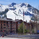
Mont Blanc (mɔ̃ blɑ̃, Monte Bianco)

Mont Blanc is the highest mountain in the Alps and the highest summit in Western Europe, rising above the Chamonix Valley of France and the Aosta Valley of Italy in one of the most famous mountain landscapes on Earth. Its broad snow-and-ice summit crowns the Mont Blanc massif, an extraordinary concentration of glaciers, granite aiguilles, immense rock faces, and more than two dozen Alpine 4,000-meter summits.
Unlike mountains whose highest point is bare rock, Mont Blanc is capped by a thick and constantly changing dome of snow and ice. A Franco-Italian scientific campaign conducted in 2025 measured the summit surface at approximately 4,807.3 meters (15,772 feet). The previous widely publicized French survey in 2023 measured 4,805.59 meters. These changing figures do not mean the underlying mountain is rapidly rising and falling. Wind, snowfall, compaction, melting, and the shape of the summit ice cap continually alter the elevation and location of the highest point.
Mont Blanc is equally extraordinary topographically. Its prominence is approximately 4,694 meters (15,400 feet), making it one of the most prominent mountains on Earth, while its isolation is roughly 2,812 kilometers (1,747 miles). The nearest higher terrain lies not elsewhere in the Alps but on the Elbrus massif in the Caucasus.
Its importance to mountaineering is difficult to overstate. Jacques Balmat and Michel-Gabriel Paccard reached the summit on August 8, 1786, an ascent widely regarded as one of the events marking the birth of modern alpinism. Today thousands of mountaineers continue to dream of Mont Blanc, although even its easiest routes remain serious glacier climbs requiring acclimatization, technical skills, good judgment, and suitable conditions.
⚡ Fast Facts
| Feature | Details |
|---|---|
| Mountain | Mont Blanc |
| Italian name | Monte Bianco |
| Meaning | White Mountain |
| Countries | France / Italy — precise summit boundary remains disputed |
| French region | Auvergne-Rhône-Alpes |
| French department | Haute-Savoie |
| Italian region | Aosta Valley |
| Nearest major towns | Chamonix-Mont-Blanc, France; Courmayeur, Italy |
| Mountain massif | Mont Blanc massif |
| Greater range | The Alps |
| Latest published summit-surface measurement | Approx. 4,807.3 m / 15,772 ft (2025) |
| 2023 measurement | 4,805.59 m / 15,766 ft |
| Traditional map elevation | Historically around 4,807–4,810 m |
| Prominence | Approx. 4,694 m / 15,400 ft |
| Isolation | Approx. 2,812 km / 1,747 mi |
| Key col | Volga–Baltic watershed/canal region |
| Key-col elevation | Approx. 113 m / 371 ft |
| Nearest Higher Neighbor (NHN) | Kukurtlu Dome, Elbrus massif |
| Broader higher mountain | Mount Elbrus |
| Coordinates | Approx. 45.8326° N, 6.8652° E |
| Alps elevation rank | 1st |
| Western Europe elevation rank | 1st |
| Europe rank | Lower than Mount Elbrus if the Caucasus is included in Europe |
| Prominence classification | Ultra-prominent mountain |
| Main rock | Granite and associated crystalline rocks |
| Granite age | Roughly 300–315 million years |
| Summit covering | Permanent snow and ice cap |
| Major French glacier | Glacier des Bossons |
| Major Italian glaciers | Miage and Brenva glacier systems |
| First ascent | August 8, 1786 |
| First ascenders | Jacques Balmat and Michel-Gabriel Paccard |
| De Saussure ascent | August 1787 |
| First woman to summit | Marie Paradis, 1808 |
| Major French normal route | Goûter Route |
| Goûter Hut elevation | Approx. 3,815 m |
| Tête Rousse Hut elevation | Approx. 3,165 m |
| Goûter summit-day round trip | Approx. 6–7 hours from the hut for strong acclimatized parties |
| Major hazard on Goûter approach | Grand Couloir rockfall |
| Second major French route | Trois Monts / Three Mont Blancs |
| Italian normal route | Gonella / Aiguilles Grises route |
| Gonella Hut elevation | 3,071 m |
| Italian summit-day elevation gain | Approx. 1,739 m |
| Italian route grade | Approx. PD / PD+ |
| Major subsidiary summit | Monte Bianco di Courmayeur |
| Nearby summit | Aiguille du Midi |
| Nearby major peak | Aiguille Verte |
| Nearby climbing landmark | Aiguille du Dru |
| Nearby 4,000er | Dent du Géant |
| Major nearby massif summit | Grandes Jorasses |
| Historic climbing needle | Aiguille du Grépon |
| Known for | Highest Alps summit, birthplace of alpinism, enormous glaciers, exceptional prominence |
📍 Where Is Mont Blanc?
Mont Blanc rises in the western Alps between Chamonix in France and Courmayeur in Italy.
The French side falls toward the Chamonix and Saint-Gervais valleys. The Italian side descends toward Val Veny and the Aosta Valley.
The wider Mont Blanc massif extends across France, Italy, and Switzerland, although Switzerland does not reach the summit of Mont Blanc itself.
The mountain is surrounded by an extraordinary collection of high summits.
Immediately southeast lies Monte Bianco di Courmayeur, the mountain’s closely connected subsidiary summit.
Farther northeast are Mont Maudit, Mont Blanc du Tacul, Aiguille du Midi, Dent du Géant, and the Grandes Jorasses.
To the north rise the famous granite needles of Chamonix, including Aiguille du Grépon, Aiguille du Dru, and Aiguille Verte.

🌍 Is Mont Blanc in France or Italy?
The simplest answer is that Mont Blanc rises on the France–Italy frontier, but the precise location of the international boundary across the summit remains disputed.
Italian maps traditionally follow the watershed, placing the international boundary across the summit area.
French official maps instead show the boundary bending south of the highest point, placing the summit entirely within France.
The disagreement ultimately traces back to interpretations of the 1860 Treaty of Turin, when Savoy passed from the Kingdom of Sardinia to France, and subsequent nineteenth-century maps.
The issue remains unresolved.
For general geographic purposes, describing Mont Blanc as a France–Italy border mountain with a disputed summit delineation is the most neutral and accurate approach.

📏 How High Is Mont Blanc?
Unlike the rocky summit of Aiguille du Grépon or the fixed limestone summit of a Dolomite mountain, Mont Blanc’s highest point is made of snow and ice.
Its elevation therefore changes.
A major Franco-Italian scientific survey in 2025 measured the summit surface at:
4,807.3 meters / approximately 15,772 feet
The French survey published in 2023 found:
4,805.59 meters
In 2021, another campaign measured approximately:
4,807.81 meters
Historically, values above 4,810 meters have also been recorded.
None of these measurements is necessarily “wrong.” They describe the summit cap at different moments.
🧊 Why Does Mont Blanc’s Height Change?
Mont Blanc’s summit is covered by a thick cap of snow and glacier ice.
The highest point can move vertically and horizontally as that cap changes.
Important influences include:
- Winter snowfall
- Summer melting
- Wind redistribution
- Snow compaction
- Ice flow
- Temperature
- Seasonal weather patterns
The 2025 research campaign measured roughly 20–25 meters of ice beneath portions of the summit area.
Older precision studies found that the highest underlying rock is substantially lower and offset from the highest snow-covered point.
Mont Blanc therefore does not have one permanently fixed surface elevation in the same way as a bare-rock summit.

📊 Extraordinary Topographic Prominence
Mont Blanc has approximately:
4,694 meters / 15,400 feet of topographic prominence
That figure is enormous.
Prominence measures how far a mountain rises above the lowest saddle connecting it to higher terrain.
For ordinary mountain groups, the controlling saddle is usually a nearby pass.
Mont Blanc is different.
Because it is the highest mountain in the entire Alps, the topographic connection toward higher terrain must travel enormous distances across Europe before descending to its key col.
The resulting prominence places Mont Blanc among the world’s great independent mountains.
🌎 A Key Col Far From the Alps
Peakbagger’s global prominence calculation places Mont Blanc’s key col around the Volga–Baltic lowland/canal system, at only about 113 meters above sea level.
That sounds astonishingly distant from Chamonix, but it illustrates how continental-scale prominence works.
To reach higher terrain without descending below that point, the topographic chain ultimately has to extend toward the Caucasus and beyond.
Mont Blanc is therefore not merely dominant within the Alps.
Its prominence reflects a huge section of the European landscape.
📐 Isolation
Mont Blanc’s true topographic isolation is approximately:
2,812 kilometers / 1,747 miles
Within that enormous radius, nothing is higher.
The nearest higher land lies on Kukurtlu Dome, a high subsidiary feature of the Mount Elbrus massif in the Caucasus.
That means a traveler could move from Mont Blanc across the Alps, much of central and eastern Europe, and toward the Caucasus before finally reaching terrain exceeding Mont Blanc’s summit elevation.
Few mountains combine such enormous prominence and isolation.
🏔️ Is Mont Blanc the Highest Mountain in Europe?
That depends on how the boundary of Europe is defined.
Mont Blanc is unquestionably:
The highest mountain in the Alps
and
The highest mountain in Western Europe
If the Caucasus Mountains are considered part of Europe, Mount Elbrus in Russia, at 5,642 meters, is higher.
This is why some older books and promotional materials call Mont Blanc the highest mountain in Europe while modern geographic references more often use highest in Western Europe.
Both statements arise from different definitions of Europe’s eastern geographic boundary.

👑 Highest Mountain in the Alps
Within the Alps, there is no ambiguity.
Mont Blanc ranks first.
Some of the highest neighboring Alpine summits include:
| Mountain | Approx. Elevation |
|---|---|
| Mont Blanc | 4,807.3 m, variable ice summit |
| Monte Bianco di Courmayeur | ~4,748 m |
| Dufourspitze | 4,634 m |
| Nordend | 4,609 m |
| Zumsteinspitze | 4,563 m |
| Signalkuppe / Punta Gnifetti | 4,554 m |
| Dom | 4,545 m |
| Lyskamm | 4,527 m |
Mont Blanc is therefore substantially higher than the great summits of the Monte Rosa and Mischabel groups.
🪨 Geology of Mont Blanc
Mont Blanc is built primarily from granite and other ancient crystalline rocks.
The granite of the massif formed roughly 300–315 million years ago during the Variscan, or Hercynian, mountain-building cycle.
At that time, magma intruded deep into older metamorphic rocks.
The magma cooled slowly underground.
Large interlocking mineral crystals developed, creating the tough granite that now forms many of the famous Chamonix aiguilles.
The rock is therefore hundreds of millions of years older than the modern Alps themselves.
🌋 Granite Formed Deep Underground
The Mont Blanc granite contains minerals including:
- Quartz
- Feldspar
- Mica
The magma solidified kilometers below the ancient land surface.
For much of its history, the rock remained completely hidden.
Later erosion stripped away the overlying crust.
Still later, Alpine tectonic forces helped lift the crystalline massif toward the surface.
Today the rock that once crystallized deep underground forms some of Europe’s highest mountain walls.
🌎 Formation of the Alps
The modern Alps developed much later than the Mont Blanc granite.
Africa and associated continental fragments converged toward Europe.
The intervening ocean closed.
Sediments and pieces of continental crust became compressed.
Large rock masses were folded, faulted, buried, and uplifted.
Ancient crystalline basement—including the Mont Blanc granite—was pushed upward.
Erosion then removed overlying rock fast enough to expose the deeply buried granite core.
The result is one of the major external crystalline massifs of the western Alps.
⛰️ Why the Mont Blanc Massif Is So Jagged
Mont Blanc itself is broad and snowy, but much of the surrounding massif consists of incredibly sharp granite towers.
The reason lies in a combination of rock strength, fracture systems, and glacial erosion.
Granite resists erosion.
However, it contains joints and faults.
Water freezes inside these cracks and widens them.
Blocks detach.
Glaciers then remove the debris.
Where resistant slabs remain between fractures, they form aiguilles and buttresses.
This process produced the famous skyline containing Aiguille du Dru, Aiguille du Grépon, and dozens of other granite needles.
🧊 A Mountain Surrounded by Glaciers
Mont Blanc sits at the heart of one of the most heavily glaciated landscapes in the Alps.
Major glaciers associated with the massif include:
- Glacier des Bossons
- Glacier de Taconnaz
- Mer de Glace system
- Glacier du Miage
- Glacier de la Brenva
- Glacier du Dôme
- Glacier du Géant
- Glacier de Bionnassay
These glaciers have sculpted almost every major valley around the mountain.
They continue to influence climbing routes, water systems, erosion, rockfall, tourism, and scientific research.

🧊 Glacier des Bossons
The Glacier des Bossons descends almost directly from the Mont Blanc summit toward the Chamonix Valley.
Official Chamonix information describes it as one of the great icefalls of the Alps.
The glacier historically descended to remarkably low elevations.
Its upper ice travels through huge fields of seracs before narrowing into a tongue above Les Bossons.
The difference between the 4,800-meter summit and the glacier’s lower tongue creates extraordinary vertical relief.
Few glaciers anywhere descend so continuously from such a high summit toward a populated valley.
❄️ Glacier de Taconnaz
West of Bossons lies the Glacier de Taconnaz.
The two glacier systems drain large portions of the northern Mont Blanc slopes.
Avalanches and ice movement have long made Taconnaz an important natural hazard.
Protective structures have been constructed above inhabited areas to reduce avalanche risk.
The glacier and neighboring slopes illustrate the direct relationship between a high Alpine massif and communities living thousands of meters below.
🧊 Miage Glacier
On the Italian side lies the enormous Miage Glacier.
Its lower section is heavily covered with rock debris.
From a distance, parts can look more like a moraine or rocky valley than a glacier.
The ice extends from the high western and southern sectors of the massif down Val Veny.
The Italian normal route toward Mont Blanc begins by traveling through this remarkable glacial landscape before climbing toward Rifugio Gonella.
🧊 Brenva Glacier
The Brenva Glacier descends beneath the huge southeast face of Mont Blanc.
Above it rise some of the most famous technical climbing routes in the Alps.
The setting includes seracs, steep snowfields, granite buttresses, and immense mixed faces.
The Brenva side has historically attracted elite mountaineers rather than ordinary summit aspirants.
It remains one of the wildest sectors of the massif.
📉 Retreating Glaciers
The glaciers around Mont Blanc are retreating rapidly.
Official Chamonix information notes that glaciers of the French Alps have lost roughly a quarter of their surface area since the late 1960s.
The Mer de Glace front has retreated more than 2.5 kilometers since the eighteenth century, with significant acceleration in recent decades.
The consequences extend beyond scenery.
Glacier retreat changes approaches, exposes unstable moraine, alters crevasse patterns, affects water storage, and can increase rockfall by removing ice and permafrost that previously helped stabilize fractured slopes.
🔥 A Changing High-Mountain Environment
The summer of 2026 provided another striking example of changing conditions.
Extreme warmth destabilized ice and rock throughout the massif. In August, the three principal normal-route systems to Mont Blanc became temporarily impractical or inaccessible because of hazards including rockfall and deteriorating glacier conditions.
The Goûter and Tête Rousse huts were temporarily closed.
Improved conditions allowed their official reopening on August 26, 2026, but the French Alpine Club explicitly warned that reopening the huts did not mean the route had become free of danger.
That distinction is important.
Administrative access and safe mountaineering conditions are not the same thing.
📜 The Search for a Route to the Summit
For centuries, the glaciers above Chamonix were viewed with fear.
Local traditions associated high icy mountains with danger and supernatural forces.
The development of scientific interest gradually changed that attitude.
In 1760, Swiss scientist Horace-Bénédict de Saussure offered a reward to anyone who could find a route to the summit.
Attempts followed over the next quarter-century.
Climbers gradually explored the Bossons Glacier, Montagne de la Côte, Aiguille du Goûter, and other approaches.
The mountain was proving difficult not because of technical rock climbing, but because of glaciers, altitude, route finding, cold, and the unknown effects of prolonged exposure at extreme height.
🏆 First Ascent: August 8, 1786
The breakthrough came on August 8, 1786.
The summit was reached by:
Jacques Balmat
and
Michel-Gabriel Paccard
Paccard was a physician and experienced local climber.
Balmat was a Chamonix crystal hunter and mountaineer.
Their route climbed through the Bossons side and high snowfields.
The ascent and descent were extraordinary undertakings for the period.
There were no crampons resembling modern models, no lightweight waterproof clothing, no formal glacier-rescue systems, no accurate weather forecasts, and little reliable knowledge of altitude physiology.
Their success transformed the history of mountaineering.
🩺 Michel-Gabriel Paccard
Paccard’s role was sometimes overshadowed in later popular accounts by Balmat.
Modern historical scholarship has restored his importance.
As a physician and scientist, Paccard had a particular interest in reaching the summit and making observations.
He had participated in earlier attempts and possessed extensive local knowledge.
During the successful climb, he carried scientific equipment and made observations from the summit.
The ascent was therefore both an athletic and scientific achievement.
🧗 Jacques Balmat
Balmat became one of the legendary figures of Alpine history.
His experience as a crystal hunter meant he was comfortable moving through rough mountain terrain where few people traveled.
After the successful ascent, he played an important role in the mountain’s growing fame.
The story of Balmat and Paccard became part of Chamonix’s identity.
Their statues and names remain prominent throughout the valley.
🔬 Horace-Bénédict de Saussure Reaches the Summit
The man whose reward helped encourage the search reached the summit himself in August 1787.
Horace-Bénédict de Saussure climbed with a large party of guides and assistants.
He carried scientific instruments and conducted experiments at altitude.
His expedition helped establish the connection between high mountains and scientific research.
That tradition continues around Mont Blanc today through glacier monitoring, climate research, geology, atmospheric studies, and biological observation.
🏔️ The Birth of Alpinism
August 8, 1786 is frequently treated as a symbolic birth date for modern alpinism.
People had climbed mountains before Mont Blanc.
What changed was the cultural meaning.
High mountains increasingly became places worth reaching for:
- Exploration
- Science
- Adventure
- Personal challenge
- Sport
- Aesthetic experience
The successful climb also triggered international interest in Chamonix.
Within decades, the valley became one of the great centers of European mountaineering.
👩 Marie Paradis
In 1808, local woman Marie Paradis became the first woman known to reach Mont Blanc’s summit.
Her climb came only 22 years after Balmat and Paccard.
Accounts suggest the ascent was extremely difficult for her physically, and she received considerable help from companions near the top.
That does not diminish the historical importance of the achievement.
At a time when women had very few opportunities to participate in mountaineering, Paradis reached the highest summit in the Alps.
👩 Henriette d’Angeville
In 1838, Henriette d’Angeville became the second woman known to summit Mont Blanc.
Her ascent became particularly famous because she organized and prepared seriously for the expedition and was determined to complete the climb through her own effort.
She became known as one of the early pioneers of women’s mountaineering.
Her achievement helped challenge the idea that serious Alpine climbing was an exclusively male activity.
🥾 The Goûter Route
Today, the Goûter Route is the most frequently used route to the summit.
The journey generally begins through the Saint-Gervais and Les Houches side.
Mountaineers use the Bellevue lift and Tramway du Mont-Blanc to reach the high approach toward Nid d’Aigle.
From there, the route climbs toward:
Refuge de Tête Rousse — approximately 3,165 m
then
Aiguille du Goûter and Refuge du Goûter — approximately 3,815 m
before crossing high snow and glacier terrain toward:
Dôme du Goûter
Col du Dôme
Vallot shelter
Bosses Ridge
and finally:
Mont Blanc summit
🏠 Refuge de Tête Rousse
Tête Rousse provides the first major high refuge on the normal route.
It allows climbers to divide the ascent more gradually.
Some itineraries sleep at Tête Rousse before climbing to the Goûter hut the next day.
This approach can help reduce fatigue and provide additional time at altitude.
The refuge also sits close to one of the most notorious hazards on the entire mountain:
the Grand Couloir.
⚠️ The Grand Couloir
The Grand Couloir—sometimes called the Goûter Couloir—crosses the approach to Aiguille du Goûter.
Rockfall is the major danger.
Stones released from high on the slope can accelerate through the couloir and cross the route used by climbers.
Warm conditions often increase activity.
The danger varies by season, time of day, snow cover, freeze-thaw cycles, and weather.
Crossing quickly does not eliminate the hazard.
The couloir is one of the main reasons the Goûter Route should never be described as an easy climb merely because its technical grade is moderate.
🧗 Aiguille du Goûter
Above the couloir, climbers ascend the rocky Aiguille du Goûter.
Portions are protected with cables.
The terrain is physically tiring and can be loose.
The route eventually reaches the high Goûter refuge.
By this point, climbers have already gained substantial elevation.
Many summit attempts fail not because of one technical obstacle but because the combined effects of altitude, fatigue, cold, and difficult terrain accumulate throughout the climb.
🏠 Refuge du Goûter
The modern Refuge du Goûter stands at approximately 3,815 meters.
Its extraordinary position places it high above most Alpine refuges.
The hut is the principal overnight base for the normal summit attempt.
For the 2026 season, the official FFCAM reservation system lists a staffed opening period from late May into early October, although operational dates and route access can change rapidly because of weather and safety conditions.
Reservations are regulated.
Climbers using the normal route must carry the required proof of their hut booking and identification.
🌌 Summit Day From the Goûter Hut
Summit parties usually leave in darkness.
The route crosses glacial terrain toward the shoulder of the Dôme du Goûter, around 4,300 meters.
From there, climbers descend slightly toward the broad Col du Dôme before rising again to the Vallot shelter.
The final section follows the Bosses Ridge.
The altitude becomes increasingly significant.
From the Goûter hut, the summit round trip typically takes strong acclimatized parties around six to seven hours, although actual times vary substantially.
🛖 Vallot Shelter
The Vallot shelter, approximately 4,362 meters high, is an emergency structure rather than an ordinary mountain refuge.
It sits close to the final summit ridge.
The shelter is intended for emergencies and should not be planned as regular accommodation.
Its presence has saved lives, but reaching Vallot does not mean the climb is nearly finished in terms of effort.
The final ridge still climbs several hundred vertical meters at extreme altitude.
🏔️ The Bosses Ridge
Above Vallot, the route passes the Grande Bosse and Petite Bosse.
The ridge narrows and becomes more exposed.
Wind can be intense.
In poor visibility, the terrain can become disorienting.
Cornices may develop along the crest.
The final climb past the Tournette leads toward the summit dome.
Despite technically moderate terrain, this is serious mountaineering because of the altitude and exposure.
🌄 The Summit
Mont Blanc’s summit is usually a narrow elongated snow ridge rather than a broad rocky plateau.
Its exact shape changes with wind and snow.
On clear days, the panorama can extend across enormous sections of the Alps.
Major ranges and distant landscapes may be visible far beyond the Mont Blanc massif.
Nearby peaks appear dramatically lower despite themselves exceeding 4,000 meters.
The view toward Monte Bianco di Courmayeur is particularly striking because the neighboring summit lies only a short distance away across Col Major.
🏔️ The Trois Monts Route
The second famous French ascent is the Trois Monts, or Three Mont Blancs, route.
It begins from the high Aiguille du Midi area, usually with an overnight stay at Refuge des Cosmiques.
The route crosses:
Mont Blanc du Tacul
then
Mont Maudit
before climbing to:
Mont Blanc
The route is more technically complex than the Goûter normal route and travels through heavily glaciated terrain beneath significant serac and avalanche hazards.

🧊 Mont Blanc du Tacul
From Refuge des Cosmiques, climbers descend onto the Col du Midi before climbing the glaciated slopes of Mont Blanc du Tacul.
Crevasses and seracs are major concerns.
The precise line changes as the glacier evolves.
The route generally passes below the true Tacul summit rather than climbing over its highest point.
From there, parties descend toward Col Maudit before beginning the next major climb.
🧊 Mont Maudit
Mont Maudit forms the most technically demanding section of many Trois Monts ascents.
The route climbs steep snow or ice terrain toward Col du Mont Maudit.
Depending on conditions, the slope can require careful front-pointing, belaying, or fixed-rope use.
Avalanche and serac danger can be substantial.
After crossing the col, climbers traverse toward Col de la Brenva and then begin the long final ascent to Mont Blanc.
The entire route takes place in a spectacular but very serious glacial environment.
🇮🇹 The Italian Normal Route
The principal Italian ascent uses Rifugio Gonella.
It is often called the Italian normal route, Aiguilles Grises route, or sometimes the Pope’s Route because Achille Ratti—later Pope Pius XI—traveled through this terrain in 1890.
The route begins from Val Veny.
Climbers travel up the long Miage Glacier before reaching Rifugio Gonella at:
3,071 meters
The summit day is substantially longer than the normal French route.
🏠 Rifugio Gonella
Rifugio Gonella sits near the Dôme Glacier in a dramatic position above the Miage.
The approach itself is already a significant mountain journey.
From the refuge, the summit route involves approximately:
1,739 meters of elevation gain
and around:
6½–8½ hours of ascent, depending on conditions and party speed.
The route is commonly graded around:
PD / PD+
It requires glacier travel, crevasse navigation, high-altitude endurance, and competence on exposed snow ridges.

🧗 Piton des Italiens
The Italian route climbs the Dôme Glacier before reaching the Aiguilles Grises ridge.
Higher up, parties reach:
Piton des Italiens — approximately 4,003 m
From there, an exposed snow ridge leads toward the Dôme du Goûter.
Eventually, the Italian route joins the French Goûter line near Col du Dôme.
The final climb past Vallot and the Bosses Ridge is therefore shared.
This creates the possibility of international traverses across the mountain.
🏔️ Historic Grands Mulets Route
The Grands Mulets Route follows terrain related to the early exploration of Mont Blanc.
It climbs from Chamonix through the Bossons Glacier system.
The route was historically important and remains used, particularly in spring ski mountaineering conditions.
Modern summer glacier deterioration has made portions more complex.
Crevasses and seracs can create significant objective danger.
The route’s historical significance is enormous because Balmat and Paccard’s successful 1786 ascent emerged from exploration of this side of the mountain.
🎿 Ski Mountaineering
Mont Blanc is also a legendary ski-mountaineering objective.
Spring conditions may allow experienced ski mountaineers to ascend and descend large portions of the mountain.
The Grands Mulets side is particularly associated with ski ascents.
Skiing Mont Blanc is not simply a more convenient version of the summer climb.
Glacier hazards, avalanche conditions, crevasses, weather, altitude, and technical transitions create an expert-level objective.
🧗 Brenva and Peuterey Routes
The Italian side contains some of the greatest technical routes in Alpine mountaineering.
The Brenva Face offers numerous snow, ice, and mixed lines.
Farther south, the Peuterey Ridge creates one of the longest and most magnificent high-Alpine ridge routes in Europe.
These climbs pass through or near summits such as Aiguille Noire de Peuterey and Aiguille Blanche de Peuterey before eventually reaching the Mont Blanc summit system.
They are entirely different objectives from the normal routes and belong to serious advanced alpinism.
🏔️ Monte Bianco di Courmayeur
Monte Bianco di Courmayeur rises immediately southeast of the main summit.
Its traditional elevation is approximately 4,748 meters.
The two summits are connected through Col Major, around 4,730 meters.
Because the saddle is so high, Monte Bianco di Courmayeur has only a small amount of independent prominence despite being one of the highest named summits in the Alps.
From Italy, however, it is an enormous and visually important mountain.
🧠 Altitude Is One of the Main Difficulties
The summit lies close to 4,800 meters.
At that elevation, atmospheric pressure is dramatically lower than at sea level.
The body receives substantially less oxygen with every breath.
Possible altitude symptoms include:
- Headache
- Nausea
- Loss of appetite
- Poor coordination
- Unusual fatigue
- Dizziness
- Sleep disturbance
Severe altitude illness can be life-threatening.
Acclimatization is therefore essential even for climbers who are extremely fit.
🏃 Fitness Is Not Enough
Mont Blanc attracts strong runners, hikers, and athletes who sometimes assume cardiovascular fitness alone will be sufficient.
It is not.
A successful ascent also requires:
- Acclimatization
- Crampon technique
- Ice-axe use
- Rope travel
- Crevasse awareness
- Movement on exposed rock
- Weather judgment
- Ability to function while tired and cold
Professional Chamonix guides typically incorporate acclimatization climbs before attempting Mont Blanc.
The mountain is a mountaineering objective, not simply a very long hike.

🌩️ Weather
Weather on Mont Blanc can become severe at any time of year.
Conditions may include:
- Hurricane-force winds
- Whiteout
- Snowfall
- Extreme cold
- Thunderstorms
- Rapid cloud formation
- Wind chill
- Freezing fog
A clear day in Chamonix does not guarantee good conditions on the summit.
The vertical difference between the valley and summit exceeds 3,700 meters.
The two environments can effectively experience different weather.
❄️ Cold
Even midsummer summit temperatures can be far below freezing.
Wind dramatically increases heat loss.
Frostbite is possible.
Hands and feet are particularly vulnerable because climbers may be moving slowly at altitude.
Appropriate gloves, layered insulation, windproof clothing, and suitable boots are essential.
An ascent often begins in darkness during the coldest part of the night.
☀️ Sun and Ultraviolet Radiation
High altitude also produces intense ultraviolet exposure.
Snow reflects sunlight upward.
This means climbers receive radiation from both sky and snow surface.
Glacier glasses or appropriate sunglasses are essential.
Skin burns quickly without protection.
Cloud does not eliminate ultraviolet risk.
Snow blindness can become a serious medical problem if the eyes are inadequately protected.
⚠️ Objective Hazards
Major hazards on Mont Blanc include:
- Rockfall
- Crevasses
- Serac collapse
- Avalanches
- Icefall
- Cornices
- Lightning
- Extreme cold
- High winds
- Whiteout
- Altitude illness
- Exhaustion
Different routes expose climbers to different combinations.
The Goûter Route has the notorious rockfall problem of the Grand Couloir.
The Trois Monts route has greater exposure to seracs and avalanche terrain.
The Italian route combines a very long glacier ascent with complex crevasse navigation.
📅 2026 Goûter Route Rules
The normal French route has formal accommodation regulations.
For the 2026 season, reservations at the Tête Rousse and Goûter huts require named participants.
Climbers must carry confirmation documents and identification.
The regulation was introduced partly to reduce overcrowding, illegal bivouacking, and unsafe summit attempts.
The rules should always be checked before departure because hut operations, transport schedules, and temporary safety closures can change.
🔥 The August 2026 Closure
The summer of 2026 was unusually difficult in the Mont Blanc massif.
Prolonged high temperatures weakened both ice and rock.
By mid-August, conditions had deteriorated enough that the major normal routes were effectively suspended or considered inaccessible.
The Tête Rousse and Goûter huts closed temporarily.
Improving conditions led authorities to schedule their reopening for August 26, 2026.
The FFCAM nevertheless stressed that the reopening was administrative and did not certify safe climbing conditions.
This is an excellent example of why Mont Blanc plans must remain flexible.

🌿 Flora and Fauna
Mont Blanc’s actual summit is an extreme snow-and-ice environment with almost no conventional vegetation.
The ecological story becomes much richer lower on the massif.
The enormous vertical range from valley floor to summit produces multiple zones:
- Montane forest
- Subalpine forest
- Alpine meadow
- Rock and scree
- Nival zone
- Permanent glacier and snow
Spruce, larch, and other trees dominate lower elevations.
Alpine flowers occupy meadows.
Only specialized lichens and microorganisms survive on the highest exposed rocks.

🐐 Chamois
Chamois inhabit steep mountain terrain throughout the Mont Blanc region.
They commonly use rocky slopes, meadows, and forest edges at much lower elevations than the summit.
Their specialized hooves provide exceptional traction.
Seasonal movement allows them to respond to snow conditions and food availability.
Quiet hikers on peripheral trails are far more likely to encounter chamois than climbers traveling through the heavily glaciated summit zone.
🐐 Alpine Ibex
Alpine ibex also inhabit parts of the wider massif.
Their enormous curved horns make adult males unmistakable.
Ibex are remarkably comfortable on steep rock.
The species nearly disappeared from the Alps before conservation efforts allowed populations to recover.
Like all wildlife, they should be observed from a distance and never fed.

🐿️ Marmots
Marmots occupy alpine meadows below the permanent snow line.
Their whistle is a familiar sound on summer hikes around the massif.
They spend the short warm season feeding intensively.
Winter is passed in deep hibernation underground.
Their presence creates a dramatic ecological contrast with the sterile summit environment only a few vertical kilometers above.
🦅 Golden Eagles and Bearded Vultures
Large Alpine raptors occur in the broader western Alpine landscape.
Golden eagles use mountain cliffs and open hunting territory.
Bearded vultures have returned to parts of the Alps through successful conservation programs.
Alpine choughs are much more likely to be encountered around high huts and climbing areas.
They can fly at remarkable elevations and often appear almost completely unbothered by harsh mountain conditions.
🏔️ Mont Blanc and Monte Bianco di Courmayeur
Monte Bianco di Courmayeur is Mont Blanc’s closest major named companion.
At approximately 4,748 meters, it is among the highest summits in the Alps.
Yet its prominence is only about 18 meters because Col Major barely separates it from Mont Blanc.
The relationship provides an excellent demonstration of the difference between elevation and topographic independence.
Monte Bianco di Courmayeur is enormously high.
Mont Blanc is enormously high and enormously prominent.
🏔️ Mont Blanc and Aiguille du Midi
Aiguille du Midi reaches approximately 3,842 meters north-northeast of the summit.
Its cable car makes it one of the most accessible extreme-altitude viewpoints in the world.
Aiguille du Midi also serves as the starting point for the Trois Monts route.
The contrast is remarkable.
Tourists can reach Aiguille du Midi in ordinary clothing.
Step beyond the protected station onto the snow ridge and the environment immediately becomes serious glaciated mountaineering terrain.

🏔️ Mont Blanc and Grandes Jorasses
Grandes Jorasses reaches approximately 4,208 meters along the France–Italy frontier.
Its Pointe Walker is far lower than Mont Blanc but possesses one of the most famous north faces in the Alps.
Mont Blanc represents the altitude crown of the massif.
Grandes Jorasses represents extreme technical wall climbing.
Together they helped make Chamonix and Courmayeur global centers of alpinism.
🏔️ Mont Blanc and Aiguille Verte
Aiguille Verte rises to 4,122 meters north of the main summit.
Its elegant snowy summit and steep mixed faces make it one of the most respected mountains in the Chamonix Valley.
Mont Blanc’s normal route is more accessible technically.
Aiguille Verte often demands steeper and more sustained alpinism.
This is an important reminder that the highest mountain is not necessarily the technically hardest.
🏔️ Mont Blanc and Aiguille du Dru
Aiguille du Dru reaches approximately 3,754 meters.
The Dru is more than a kilometer lower than Mont Blanc, yet its near-vertical granite faces have produced some of the most famous climbing routes in history.
Walter Bonatti’s solo climb on the Dru became legendary.
Massive rockfalls later erased portions of those historic walls.
The Dru and Mont Blanc represent two different dimensions of Alpine greatness: technical vertical climbing and extreme high-altitude mountaineering.
🏔️ Mont Blanc and Aiguille du Grépon
Aiguille du Grépon rises to approximately 3,482 meters among the Aiguilles de Chamonix.
Its first ascent in 1881 helped shift alpinism toward climbing difficult routes for their own sake.
Mont Blanc’s 1786 first ascent helped establish the concept of modern mountaineering.
Grépon’s ascent nearly a century later helped establish difficulty-driven technical climbing.
The two mountains therefore mark different turning points in Alpine history.
🏔️ Mont Blanc and Dent du Géant
Dent du Géant rises to approximately 4,013 meters east of the main Mont Blanc summit.
Its granite tower presented a very different challenge to nineteenth-century climbers.
Technical slabs resisted normal free-climbing techniques of the period.
Fixed ropes eventually played a major role in the first successful ascent.
From the high Mont Blanc routes, the mountain’s tooth-like shape is unmistakable.
❓ Frequently Asked Questions

How high is Mont Blanc?
The latest published 2025 scientific campaign measured the snow-and-ice summit at approximately 4,807.3 meters (15,772 feet).
The exact elevation changes because the highest point is an ice and snow dome.
Why do some sources say 4,805 meters or 4,810 meters?
Those figures come from measurements made at different times.
Mont Blanc’s summit snow and ice changes with weather, wind, snowfall, melting, and compaction.
What is Mont Blanc’s prominence?
Approximately 4,694 meters (15,400 feet).
What is its isolation?
Approximately 2,812 kilometers (1,747 miles).
What is the Nearest Higher Neighbor?
The nearest higher terrain is around Kukurtlu Dome on the Mount Elbrus massif in the Caucasus.
Is Mont Blanc the highest mountain in Europe?
It is the highest in the Alps and Western Europe.
If the Caucasus is included within Europe, Mount Elbrus is higher.
Is Mont Blanc in France or Italy?
The mountain lies in the France–Italy frontier region.
The exact international boundary around the summit remains disputed: French and Italian official mapping use different summit-area lines.
Who first climbed Mont Blanc?
Jacques Balmat and Michel-Gabriel Paccard reached the summit on August 8, 1786.
Who was the first woman to climb Mont Blanc?
Marie Paradis reached the summit in 1808.
What is the easiest route?
The Goûter Route is generally considered the standard and technically least difficult route under favorable conditions.
It is still a serious mountaineering climb.
Can you hike Mont Blanc without climbing experience?
No.
The summit routes cross glaciers and require crampon use, rope travel, altitude experience, and mountaineering judgment.
How long does it take to climb Mont Blanc?
Most guided normal-route programs take several days when acclimatization is included.
The actual summit section from the Goûter hut and back commonly takes around 6–7 hours for strong acclimatized parties.
Do you need a hut reservation?
On the regulated Goûter normal route, climbers using the huts need confirmed named reservations and must carry the required documentation.
What is the main danger on the Goûter Route?
The Grand Couloir is notorious for rockfall.
Altitude, glacier hazards, weather, cold, and exhaustion remain important throughout the rest of the route.

🌄 Why Mont Blanc Stands Out
Mont Blanc is not famous simply because it is the highest mountain in the Alps.
Its roughly 4,694 meters of prominence and 2,812 kilometers of isolation place it among Earth’s great topographic landmarks. Higher terrain does not appear again until the Caucasus.
Its physical structure is equally unusual. Hundreds of millions of years ago, magma crystallized deep underground to form the granite core of the massif. Alpine tectonic collision later lifted those ancient rocks toward the surface. Glaciers then carved them into the aiguilles, ridges, cirques, and valleys that define the modern Mont Blanc landscape.
The mountain remains intensely glaciated. Bossons, Miage, Brenva, Taconnaz, and other glaciers descend from its slopes and surrounding massif. Those glaciers are retreating rapidly, altering climbing routes and revealing how quickly high mountain environments can change.
Even Mont Blanc’s height is dynamic.
The latest 2025 research measured the summit at approximately 4,807.3 meters, but the number is only a snapshot of a moving cap of ice and snow. Wind can relocate the highest point. Snowfall can add height. Melting and compaction can remove it.
Human history transformed the mountain just as dramatically.
When Jacques Balmat and Michel-Gabriel Paccard stood on the summit on August 8, 1786, they accomplished more than a first ascent. Their climb helped change the way Europeans understood mountains. Peaks previously regarded largely as dangerous obstacles became places for scientific investigation, exploration, sport, and personal challenge.
Chamonix grew into a global mountaineering capital.
Courmayeur developed its own equally rich guiding tradition on the Italian side.
Marie Paradis became the first woman to summit in 1808. Henriette d’Angeville followed in 1838. Generations of guides, climbers, scientists, skiers, photographers, and explorers have continued adding to the mountain’s story ever since.
Modern infrastructure has made the massif easier to approach, but it has not made Mont Blanc safe.
The Goûter Route still crosses a notorious rockfall couloir. The Trois Monts route passes through serac and avalanche terrain. The Italian Gonella route demands a huge summit day through complicated glaciated terrain. Extreme heat in 2026 temporarily rendered the principal normal routes unusable, demonstrating how quickly conditions can deteriorate.
Mont Blanc therefore remains what it has been since 1786: a mountain that appears approachable from the valleys yet becomes increasingly serious with every meter gained.
For anyone exploring the mountains of France, Italy, or the wider Alps, Mont Blanc is the defining summit—a mountain where continental-scale topography, ancient granite, immense glaciers, the birth of alpinism, changing climate, international geography, and one of the world’s most enduring mountaineering dreams all meet on a shifting ridge of snow above Western Europe.

🔗 Related Articles
- Monte Bianco di Courmayeur
- Aiguille du Midi
- Aiguille du Grépon
- Aiguille du Dru
- Aiguille Verte
- Grandes Jorasses
- Dent du Géant
- The Alps
- Mountains in France
- Mountains in Italy
📚 Sources
- Peakbagger — Mont Blanc
- Regione Autonoma Valle d’Aosta — 2025 Mont Blanc Summit Measurements
- Chamonix-Mont-Blanc — Mont Blanc
- Chamonix-Mont-Blanc — History of the Valley and First Ascent
- Compagnie des Guides de Chamonix — Mont Blanc Ascent
- Compagnie des Guides de Chamonix — Mont Blanc Since 1786
- FFCAM — Mont Blanc Normal Route
- FFCAM — Refuge du Goûter
- Courmayeur Mountain Guides — Mont Blanc Routes
- Rifugio Gonella — Italian Normal Route
- Courmayeur Mountain Guides — Rifugio Gonella
- Chamonix-Mont-Blanc — Glacier des Bossons
- Chamonix-Mont-Blanc — Glaciers of the Chamonix Valley
- BRGM — Crystalline Geology and Formation of the Alps
- Italian Ministry of Foreign Affairs — Mont Blanc Border Note
- Leica Geosystems — Measuring the Mont Blanc Summit Ice Cap