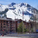
Kawagebo | Kawa Garbo | Khawa Karpo | Kawadgarbo | Nyainqênkawagarbo

🏔️ Overview
Kawagebo, also widely spelled Kawagarbo, Kawa Karpo, or Khawakarpo, is a spectacular 6,740-meter (22,113-foot) mountain rising along the border of Yunnan Province and the Tibet Autonomous Region in China. It is the highest mountain in Yunnan and the loftiest summit of the Meili Snow Mountains, a dramatic section of the Hengduan Mountains.
Kawagebo is remarkable for more than its height. The mountain is one of the most sacred peaks in Tibetan Buddhism, revered by communities throughout the region and visited by pilgrims who travel traditional circumambulation routes around the massif.
Despite its prominence and mountaineering significance, Kawagebo has never been climbed. A devastating avalanche killed all 17 members of a Chinese-Japanese expedition in 1991, and organized climbing was later prohibited out of respect for the mountain’s religious importance and local opposition to summit attempts.
With enormous vertical relief, glaciers, deep river valleys, rich forests, alpine ecosystems, and an unmistakable pyramid-shaped skyline, Kawagebo is one of the most extraordinary mountains in China.
⚡ Fast Facts
| Fact | Details |
|---|---|
| Continent | Asia |
| Country | China |
| Province / Region | Yunnan Province / Tibet Autonomous Region |
| Local Region | Dêqên County, Yunnan; near Zogang and Zayü counties in Tibet |
| Mountain Range | Meili Snow Mountains / Kawagebo Range |
| Major Mountain System | Hengduan Mountains |
| Elevation | 6,740 m (22,113 ft) |
| Prominence | 2,232 m (7,323 ft) |
| Isolation | Approximately 207.8 km (129.1 mi) |
| Nearest Higher Neighbor (NHN) | Bairiga, approximately 207.8 km WNW |
| Parent Peak | Depends on the topographic hierarchy used; PeakVisor’s island-parent hierarchy ultimately connects Kawagebo with Mount Everest |
| Coordinates | Approximately 28.4383° N, 98.6833° E |
| Highest Point In | Yunnan Province |
| First Ascent | Unclimbed |
| Climbing Status | Summit climbing prohibited |
| Sacred Tradition | Tibetan Buddhism |
📍 Location & Geography
Kawagebo stands in a remote and exceptionally rugged part of northwestern Yunnan, directly along the boundary with the Tibet Autonomous Region.
The mountain is roughly 20 kilometers west of Dêqên, one of the principal settlements on the Yunnan side of the massif. Its position places it within the famous Three Parallel Rivers region, where three of Asia’s great rivers flow through remarkably close but deeply separated valleys.
Kawagebo rises near the watershed separating the:
- Mekong River, known in China as the Lancang Jiang
- Salween River, known in China as the Nu Jiang
Farther east lies the upper Yangtze system.
This geography creates extraordinary relief. Deep river valleys can lie several vertical kilometers below snow-covered peaks only a short horizontal distance away. Around Kawagebo, elevations rise from below roughly 2,000 meters in the Mekong Valley to 6,740 meters at the summit.
The result is one of the most visually dramatic mountain landscapes in the Mountains of Tibet and southwestern China.
Is Kawagebo the Same as Meili Snow Mountain?
The terminology can be confusing.
Kawagebo is a specific summit—the highest peak in the massif. Meili Snow Mountains, or Meili Xueshan, is commonly used for the broader group of snow-covered peaks surrounding it.
Some historical and geographical sources use several overlapping names for the range, and Tibetan and Chinese naming traditions do not always divide the landscape in exactly the same way.
For most modern geographical purposes, it is reasonable to describe Kawagebo as the highest summit of the Meili Snow Mountains, which form part of the larger Hengduan mountain system.
📏 Elevation & Prominence
Kawagebo reaches approximately 6,740 meters (22,113 feet) above sea level. Some datasets give the more precise figure of about 6,740.1 meters, but 6,740 meters is the commonly cited elevation.
That makes Kawagebo:
- The highest mountain in Yunnan Province
- One of the major 6,000-meter summits of the Hengduan Mountains
- One of China’s most topographically prominent mountains
- One of the world’s notable unclimbed high peaks
Prominence
Kawagebo has approximately 2,232 meters (7,323 feet) of topographic prominence.
Because any mountain with at least 1,500 meters of prominence qualifies as an ultra-prominent peak, Kawagebo comfortably meets the definition of an Ultra.
Its enormous prominence reflects how distinctly the mountain rises above the surrounding terrain rather than simply being a minor high point along a higher ridge.
Isolation & Nearest Higher Neighbor
Kawagebo’s topographic isolation is approximately 207.8 kilometers (129.1 miles).
Its Nearest Higher Neighbor (NHN) is Bairiga, a roughly 6,882-meter mountain located to the west-northwest.
In practical terms, a climber or imaginary contour line would have to travel more than 200 kilometers from Kawagebo before reaching terrain higher than its summit.
Different databases can assign different “parent peaks” because parentage depends on the particular topographic hierarchy being used. PeakVisor’s island-parent system ultimately associates Kawagebo with Mount Everest, while Bairiga is the geographically closest higher summit.
🪨 Geology & Formation
Kawagebo occupies one of Earth’s most geologically complex mountain regions.
The Hengduan Mountains developed as part of the enormous tectonic deformation caused by the continuing collision of the Indian and Eurasian continental plates. Beginning tens of millions of years ago, this collision uplifted the Himalayas and Tibetan Plateau while also deforming the crust throughout southwestern China.
Rather than forming one simple east-west mountain chain, the Hengduan region consists of a series of steep, mostly north-south-trending ranges separated by enormously deep river valleys.
The wider Three Parallel Rivers landscape contains a complicated mixture of:
- Metamorphic rocks
- Sedimentary formations
- Igneous rocks
- Limestone
- Sandstone
- Conglomerates
- Heavily faulted and folded terrain
Uplift continues to interact with erosion, glaciation, monsoon rainfall, landslides, and powerful rivers.
Around Kawagebo, these forces have created steep rock walls, deeply cut valleys, sharp ridges, and extensive high-elevation glacial terrain.
Mingyong Glacier
One of Kawagebo’s most famous physical features is Mingyong Glacier, which descends from the high mountain environment on the eastern side of the massif.
UNESCO has highlighted Mingyong as particularly notable because it historically descended to unusually low elevations for a glacier at this latitude—around 2,700 meters.
The glacier’s dramatic descent from the vicinity of a 6,740-meter mountain toward forested valleys illustrates the enormous vertical range found around Kawagebo.
Like glaciers throughout many mountain regions, however, the exact position and extent of Mingyong Glacier can change over time.
🌿 Flora & Fauna
The extreme elevation difference between Kawagebo’s valleys and summit produces an equally impressive range of ecosystems.
A journey upward through the region can pass through several ecological zones, including:
- Warm valley vegetation and subtropical scrub
- Broadleaf forests
- Oak and mixed forests
- Conifer forests
- Subalpine vegetation
- Alpine meadows
- Rock and scree
- Permanent snow and ice
The broader Hengduan and Three Parallel Rivers region is considered one of the great centers of temperate biodiversity in the world.
Researchers have documented thousands of plant species across the region, including exceptionally diverse rhododendrons and numerous endemic plants found nowhere else.
Wildlife within the broader protected landscape includes species adapted to everything from forested valleys to high alpine environments. Depending on habitat and location, the region supports animals such as:
- Takin
- Musk deer
- Red panda
- Asiatic black bear
- Numerous pheasants and other mountain birds
- A wide variety of smaller alpine and forest mammals
These species should be understood as inhabitants of the wider Hengduan and Three Parallel Rivers ecosystem, rather than animals necessarily encountered on Kawagebo itself.
Part of this landscape is protected within the Three Parallel Rivers of Yunnan Protected Areas, which became a UNESCO World Heritage Site in 2003.
🙏 A Sacred Mountain
Kawagebo’s cultural importance is just as significant as its geography.
The mountain is deeply sacred in Tibetan Buddhism and is traditionally associated with a powerful warrior deity. Pilgrims have traveled around the massif for centuries, and circumambulating the sacred mountain remains a major religious act.
Kawagebo therefore should not be viewed simply as another 6,000-meter peak awaiting an ascent.
For many local Tibetan communities, the summit is considered a place that should remain untouched.
This distinction became central to debates over mountaineering on Kawagebo during the late 20th century.
Those interested in China’s spiritual mountain traditions may also enjoy the guides to the Sacred Mountains of China and Mount Kailash.
🥾 Hiking, Pilgrimage & Climbing
Can Kawagebo Be Climbed?
No. Kawagebo is not currently a legal recreational climbing objective, and the summit has never been reached.
Several expeditions attempted the mountain during the 20th century, but none succeeded.
The most infamous occurred in 1991, when an avalanche struck a joint Chinese-Japanese expedition. All 17 members of the team were killed, making the disaster one of the deadliest incidents in modern Himalayan and Chinese mountaineering history.
Opposition to further climbing attempts grew among local Tibetans, religious communities, conservationists, and others who argued that climbing violated the sacred nature of Kawagebo.
In 2001, authorities prohibited future climbing of the mountain.
Visitors should therefore approach Kawagebo as a sacred landscape to observe, hike around, and experience—not as a summit objective.
Yubeng Village
One of the best-known hiking destinations near Kawagebo is Yubeng Village, located beneath the great peaks of the Meili Snow Mountains.
The village has long been associated with pilgrimage routes and now also serves as a base for hikers exploring the lower valleys.
Popular destinations in the Yubeng area include routes toward:
- Sacred waterfalls
- Glacial valleys
- Alpine lakes
- Forests
- Mountain viewpoints
These are hikes around and beneath the massif, not routes to Kawagebo’s summit.
Inner Kora
Pilgrims undertake an inner circumambulation, or kora, through sacred sites around the mountain. Areas near Yubeng, waterfalls, temples, forests, and glacial landscapes form part of the religious geography surrounding Kawagebo.
Travelers should remember that these routes are not simply recreational trails. They remain places of active religious significance.
Outer Kora
A much longer traditional outer kora circles the wider Kawagebo massif.
Accounts of the route describe a journey of roughly 150 kilometers, crossing several major mountain passes and traveling between the Mekong and Salween drainage systems.
Some portions enter the Tibet Autonomous Region, making the journey substantially more complicated than an ordinary hiking trip. Access regulations, permits, trail conditions, transportation arrangements, and local restrictions can change, so anyone considering a long-distance pilgrimage route should verify current requirements locally before departure.
Mingyong Glacier
The Mingyong Glacier area provides another way to experience the landscape beneath Kawagebo without attempting the mountain itself.
The glacier and surrounding valley offer impressive views of the enormous vertical transition from forests toward snow and ice.
Feilai Temple Viewpoint
The area around Feilai Temple near Dêqên is famous for panoramic views across the valley toward Kawagebo and the Meili Snow Mountains.
When skies are clear, this is one of the classic locations for seeing Kawagebo’s snow-covered summit illuminated by early morning light.
🏔️ Field Guide Tip: Kawagebo is a high-altitude, sacred mountain environment rather than a conventional climbing destination. Visitors should plan for rapidly changing mountain weather, respect pilgrimage traditions and restricted areas, allow time for altitude adjustment, and carry basic hiking safety equipment even on lower trails. Review The Ten Essentials for Hiking before heading into remote terrain.
🌤️ Best Time to Visit Kawagebo
The best time to see Kawagebo depends largely on cloud cover, rainfall, snow, and the purpose of the visit.
October–November
Autumn is generally one of the best periods for mountain views.
After the summer monsoon, conditions are often drier and skies can be clearer. Temperatures are cooler, especially at night and at higher elevations.
December–February
Winter can produce crisp views of the snow-covered mountains, but visitors should expect:
- Cold temperatures
- Snow and ice at higher elevations
- Possible travel disruption
- Shorter daylight hours
March–April
Spring can provide another attractive window for visiting, with relatively cool conditions and improving vegetation at lower elevations.
May–September
Summer overlaps with the regional monsoon.
Expect:
- Greater cloud cover
- Frequent rain
- Lower odds of uninterrupted summit views
- Muddy trails
- Increased landslide risk
- Rapidly changing weather
Even during traditionally favorable months, Kawagebo can disappear behind clouds for days at a time.
🧭 Nearby Mountains & Attractions
Meili Snow Mountains
Kawagebo is surrounded by a dramatic cluster of glaciated summits collectively known as the Meili Snow Mountains.
Many of these peaks remain technically difficult, poorly documented, or culturally sensitive.
Mianzimu
Mianzimu, approximately 6,054 meters high, is another striking mountain in the massif. Its steep triangular form makes it one of the most recognizable neighboring summits when viewed from the east.
Mingyong Glacier
Descending from the Kawagebo massif, Mingyong Glacier is one of the region’s signature natural features and provides a dramatic example of the interaction between extreme relief, high mountains, and monsoon-influenced glaciation.
Yubeng
The remote mountain settlement of Yubeng offers access to forests, waterfalls, glacial landscapes, pilgrimage destinations, and superb views of the surrounding peaks.
Three Parallel Rivers of Yunnan Protected Areas
The wider Kawagebo landscape forms part of one of China’s most remarkable protected regions.
The UNESCO-listed Three Parallel Rivers of Yunnan Protected Areas encompasses approximately 1.7 million hectares of mountains, deep gorges, forests, rivers, glaciers, and exceptional biodiversity.
⭐ Fun Facts About Kawagebo
- Kawagebo is the highest mountain in Yunnan Province.
- Its summit reaches approximately 6,740 meters (22,113 feet).
- The peak has more than 2,200 meters of prominence, qualifying it as an ultra-prominent mountain.
- Kawagebo has never been successfully climbed.
- The mountain is one of the most sacred peaks in Tibetan Buddhism.
- Its nearest higher mountain is Bairiga, roughly 208 kilometers to the west-northwest.
- Kawagebo helps form the divide between the Mekong and Salween river systems.
- The 1991 avalanche disaster killed an entire 17-member Chinese-Japanese expedition.
- Climbing was prohibited in 2001 following years of religious, cultural, and environmental opposition.
- Mingyong Glacier has historically descended to unusually low elevations for a glacier at this latitude.
- Traditional pilgrims circle the mountain rather than attempting to stand on its summit.
- The broader landscape is part of the UNESCO-listed Three Parallel Rivers of Yunnan Protected Areas.
- The spellings Kawagebo, Kawagarbo, Kawa Karpo, and Khawakarpo can all refer to the same sacred mountain.
❓ Frequently Asked Questions
How high is Kawagebo?
Kawagebo is approximately 6,740 meters (22,113 feet) above sea level.
Where is Kawagebo?
Kawagebo lies on the border between Yunnan Province and the Tibet Autonomous Region in southwestern China, within the Meili Snow Mountains of the Hengduan mountain system.
Is Kawagebo the highest mountain in Yunnan?
Yes. Kawagebo is the highest point in Yunnan Province.
What is Kawagebo’s prominence?
Kawagebo has approximately 2,232 meters (7,323 feet) of topographic prominence, making it an ultra-prominent mountain.
What is Kawagebo’s nearest higher neighbor?
The nearest mountain higher than Kawagebo is Bairiga, approximately 207.8 kilometers (129.1 miles) west-northwest of Kawagebo.
Has anyone ever climbed Kawagebo?
No. Kawagebo remains unclimbed.
Several expeditions attempted the summit during the 20th century, but none reached the top.
Why is climbing Kawagebo prohibited?
Kawagebo is deeply sacred to Tibetan Buddhists, and many local communities opposed attempts to climb its summit. Following decades of expeditions, including the deadly 1991 avalanche, authorities prohibited further climbing in 2001.
What happened on Kawagebo in 1991?
On January 3, 1991, a massive avalanche struck a joint Chinese-Japanese expedition camp. All 17 climbers were killed.
Is Kawagebo the same mountain as Meili Snow Mountain?
Not exactly. Kawagebo is the highest individual summit, while Meili Snow Mountains usually refers to the broader mountain group surrounding it. Naming conventions in the region can vary between Tibetan, Chinese, and Western sources.
Is Kawagebo part of the Himalayas?
Kawagebo lies east of the principal Himalayan chain and is normally classified as part of the Meili Snow Mountains and Hengduan Mountains, rather than the Himalayas proper.
Can you hike near Kawagebo?
Yes. Visitors can hike in areas around Yubeng, Mingyong Glacier, sacred waterfalls, alpine lakes, forests, and pilgrimage routes. These routes do not provide legal access to the summit.
Why is Kawagebo sacred?
Kawagebo has centuries of religious significance within Tibetan Buddhism and is associated with a powerful protective warrior deity. Circumambulating the mountain is an important pilgrimage practice.
🔗 Related Articles
Continue exploring the mountains of China and the Tibetan Plateau:
- Hengduan Mountains
- Mountains in China: A Guide to the Country’s Highest Peaks and Major Ranges
- Highest Mountains in China
- Mountains of Tibet
- Sacred Mountains of China: Buddhist, Taoist and Imperial Peaks
- Mount Kailash
- Gongga Shan (Minya Konka)
- The World’s Top 100 Mountain Ranges
🔗 Related Hiking and Safety Guides
📚 Sources
- Peakbagger — Ultras of the Tibetan Plateau and Central China — elevation and prominence data.
- PeakVisor — Kawagarbo — elevation, isolation, coordinates, key col, and nearest higher neighbor data.
- UNESCO World Heritage Centre — Three Parallel Rivers of Yunnan Protected Areas — regional geology, biodiversity, protected status, river systems, and Mingyong Glacier.
- American Alpine Club — Kawagebo Range: Success on Cogar Lakpa — Kawagebo Range geography, mountaineering history, sacred status, and unclimbed status.
- University of Colorado Boulder Tibet Himalaya Initiative — Circumambulating Khawakarpo — pilgrimage traditions, climbing history, sacred landscape, biodiversity, and kora routes.